Blog Article
Weekend Winter Storm Alert: Ice & Snow for South and East
A major winter storm targets the South this weekend. Freezing rain and snow expected from Texas to the Carolinas. Get the latest forecast.
The South is on Thin Ice: Major Winter Storm Targeting Texas to the Carolinas
Alright folks, grab your coffee and pull up a chair. We have got a lot to talk about. The last 24 hours have been absolutely bonkers. We had the Northern Lights showing up in Alabama, a massive pileup in Michigan due to snow squalls, and wind chills that would make a polar bear shiver. But as much as I would love to just stare at those aurora photos, we have to turn our attention to a very serious situation developing for the weekend.
Here is the thing. The atmosphere is reloading. That deep Arctic air that has been punishing the Northern Plains isn't going anywhere. In fact, it is getting a reinforcing shot. And starting Friday, we are going to see a system slide underneath that cold air, bringing a messy mix of snow, sleet, and freezing rain to places that really don't need it.
First Up: The Midwest Clipper
Before we get to the main event in the South, I want to give a quick heads-up to my friends in the Midwest. We have a fast-moving "Clipper" system diving through the Great Lakes today and Wednesday.
If you are in Iowa, southern Wisconsin, northern Illinois, or heading over toward Detroit, expect a quick burst of snow. We are generally talking 1 to 3 inches, maybe up to 6 inches if you catch some lake enhancement near Lake Michigan. It is going to be cold and blustery, so watch out for slick spots on the commute. If you are catching the Miami Hurricanes at Indiana Hoosiers game, bundle up, because it is going to be a chilly one.
The Weekend Threat: The "Southern Slider"
Now, let's talk about the big story. The data is becoming clearer, and I am getting concerned about a significant icing event stretching from Texas all the way to the Mid-Atlantic.
Here is the timeline:
- Friday: The party starts in the Southern Plains. We are looking at snow for Oklahoma and parts of North Texas. But as you get into Central Texas, we are seeing signs of a "warm nose" aloft. That means snow melts into rain, falls into sub-freezing air at the surface, and freezes on contact. That is freezing rain, folks, and it is dangerous.
- Saturday: The mess moves east into Arkansas, Tennessee, and the Deep South. We could see a stripe of heavy snow to the north (think Tennessee Valley), but a dangerous corridor of ice across the mid-section.
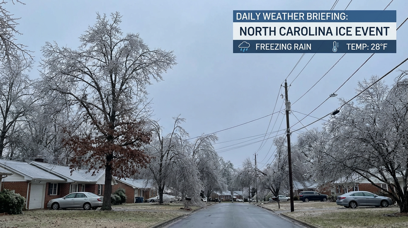
- Sunday: The system targets the Carolinas and the Mid-Atlantic. I am looking specifically at the Big Southern Classic Battle of the Bands in Charlotte on Saturday. If the timing holds, travel could be treacherous getting in or out of that event.
Why I am worried about Ice:
The Weather Prediction Center is explicitly mentioning "significant freezing rain" from Central Texas into portions of South Carolina and North Carolina. Unlike snow, which you can shovel, ice weighs down trees and power lines. A quarter-inch of ice is enough to start snapping branches and causing power outages. If you live in this corridor, you need to be prepared for the power to flicker or go out.
The Deep Freeze Continues
Behind this storm, the cold air just keeps coming. We are talking about wind chills dropping to -50 degrees in the Dakotas by late week. That is life-threatening cold.
Even down in Florida, you aren't safe from the chill. We are likely going to see more freeze warnings for the Sunshine State this weekend. If you are planning on hitting the Boca Raton Beer Wine and Spirits Fest on Saturday, leave the flip-flops at home. It is going to be jacket weather even down there.
Bottom Line
- Midwest: Watch for a quick 1-3 inches of snow through Wednesday. Roads will be slick.
- Texas & Oklahoma: Prepare for winter driving conditions starting Friday. The ice threat in Central Texas is real.
- The Southeast: Saturday and Sunday look messy. If you have travel plans along I-40 or I-85, keep a very close eye on the forecast.
- Power Outages: With the risk of freezing rain increasing, make sure you have flashlights, batteries, and a way to stay warm if the grid takes a hit.
We will be watching the models like a hawk over the next couple of days to pinpoint exactly where that rain-snow-ice line sets up. Stay safe out there, y'all!