Blog Article
Severe Weather Shifts East: Weekend Forecast & Impacts
The massive severe weather system shifts east toward the Ohio Valley and Texas. Plus, critical fire danger in the Plains and a new atmospheric river incoming.
The Storm Shifts East (And What's Next For Your Weekend)
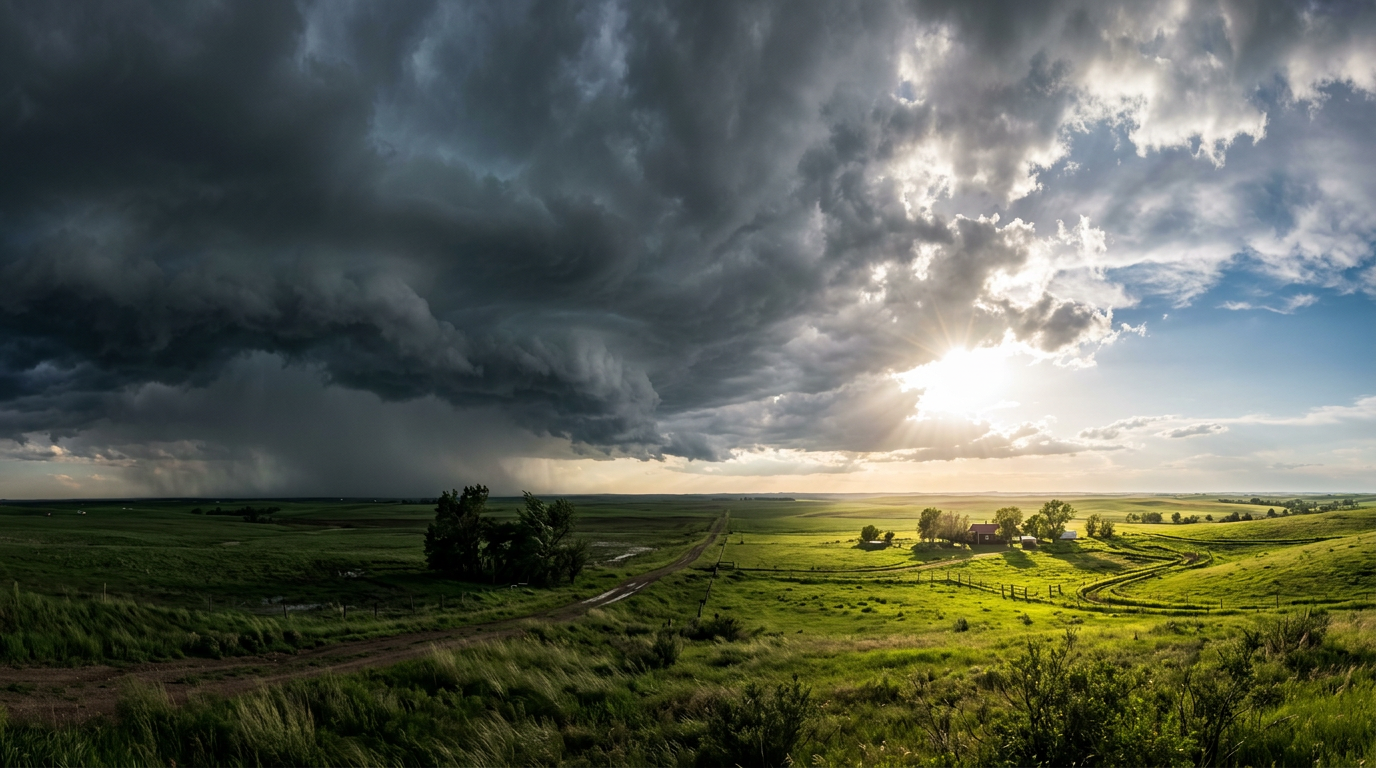
Alright folks, let's take a deep breath. Yesterday was an absolutely wild day of weather. As we talked about in our last update, that massive storm system was locked and loaded, and it unfortunately delivered exactly what we feared. From those devastating tornadoes in Michigan and Oklahoma to the massive snowstorm that gridlocked the Colorado Front Range, it was a day for the record books.
But here is the thing. The weather does not stop moving, and neither do we. That massive system is now sliding east, and it is bringing a whole new set of impacts for your weekend activities.
The Severe Threat Slides East
Get this. We still have a Slight Risk (that is a Level 2 out of 5) for severe weather today. The cold front is slicing right through the eastern half of the country. We are watching two main areas today: the Upper Ohio Valley stretching into western New York and Pennsylvania, and a big chunk of Texas right down into the Lower Mississippi Valley.
If you are in Houston, Dallas, or Columbus, you need to keep your weather radio handy today. We are looking at a risk for damaging winds and a few isolated tornadoes. The heavy rain could also cause some flash flooding along the Texas and Louisiana coast. If you are heading out to the Holi Festival in Washington DC today, you should be fine during the day, but keep an eye on the sky as we head into the evening hours.
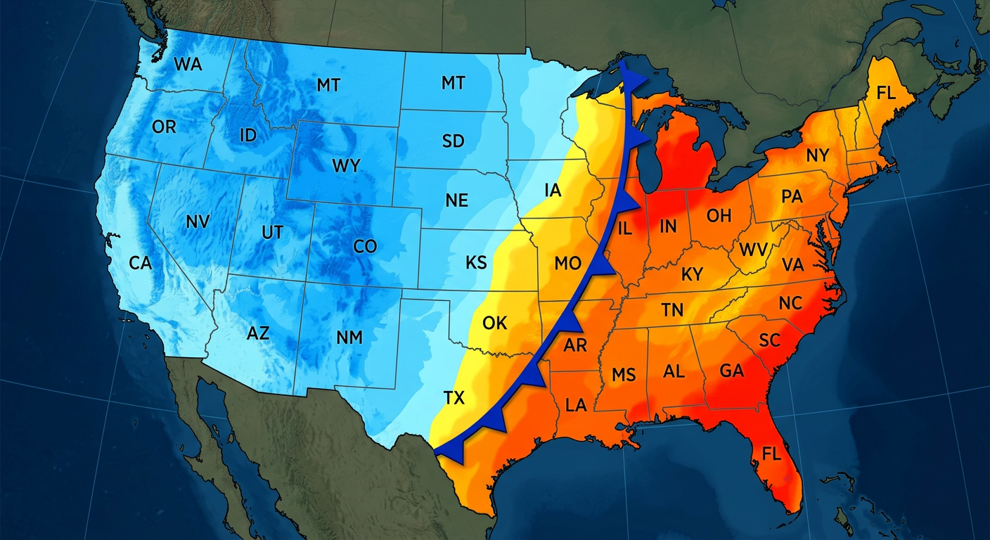
By Sunday, this whole system pushes toward the East Coast. The severe threat drops down to a Marginal Risk (Level 1 of 5) for the Carolinas and southeast Virginia. So if you are out in Florida for the Gate River Run or catching the Mets and Marlins down in Jupiter, you are going to miss the worst of this system completely.
A Tale of Two Extremes: Ice and Fire
Up in northern New England, folks are waking up to a messy situation. We have got warm air riding up over trapped cold air at the surface. That is a classic setup for freezing rain. Places like northern Maine and Vermont are seeing ice accretions up to a tenth of an inch this morning before temperatures finally rise above freezing and switch everything over to plain rain. Please take it slow on your morning commute today.
Now, let us flip the script and look at the Plains. The Northern Plains are about to experience a massive warmup. We are talking temperatures soaring 25 to 30 degrees above average. Is it a false spring? Maybe. But you will definitely be shedding those winter coats.
Down south in the High Plains of New Mexico and the Texas and Oklahoma Panhandles, this dry air is causing a serious problem. We have got gusty southwest winds pushing 15 to 25 mph, incredibly low humidity, and very dry brush. That is a recipe for critical fire weather. A Fire Weather Watch is in effect, so please, no outdoor burning this weekend.
The Next Big Thing: Pacific Northwest
Alright, let us look down the road a bit. The Pacific Northwest is about to get active again.
By Tuesday and Wednesday of next week, we are tracking a potent Atmospheric River taking aim at Washington and Oregon. This is going to funnel a ton of deep Pacific moisture right into the coast.
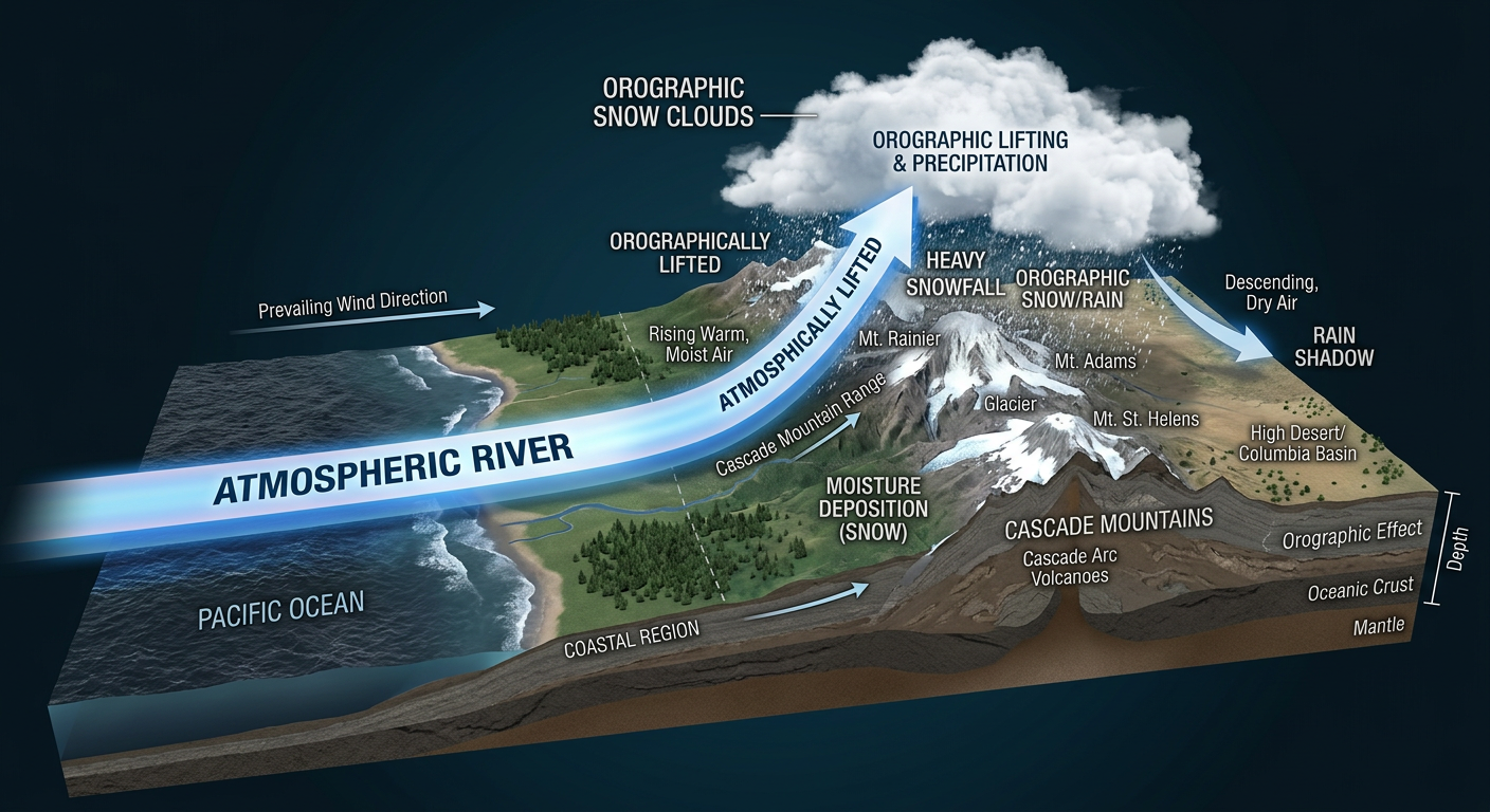
If you live near the Cascades or the Northern Rockies, get ready for heavy mountain snow. The data is showing a 50 to 90 percent chance of seeing over 6 inches of accumulation in the higher elevations. If you have travel plans through the mountain passes next week, you might want to start looking at alternative routes or adjusting your schedule early.
The Bottom Line
- Texas to Ohio Valley: Stay weather aware today. Have a way to get warnings for damaging winds and isolated tornadoes.
- New England: Watch out for icy spots this morning before temperatures warm up.
- Southern High Plains: Critical fire danger today and Sunday. Absolutely no outdoor burning.
- Pacific Northwest: Enjoy the weekend, because a heavy dose of rain and mountain snow is arriving by Tuesday.
Stay safe, y'all, and keep an eye on the sky!
https://ryanhallyall.com/blog/the-storm-shifts-east-and-whats-next-for-your-weekend