Blog Article
Major Severe Weather Outbreak and Snow Storm Hits the US
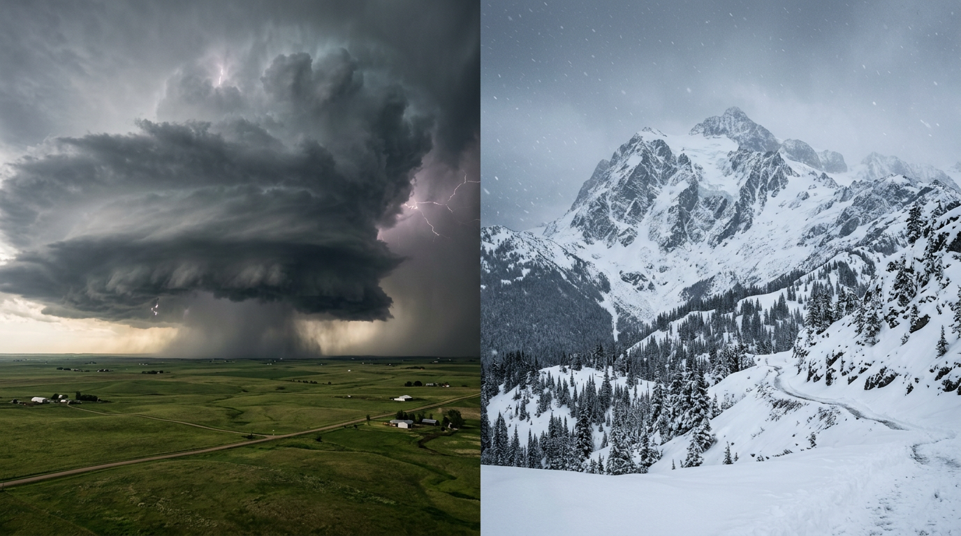
A massive storm system is bringing an Enhanced Risk of severe weather to the Plains, critical fire danger to the Southwest, and heavy snow to the Rockies.
The Storm That Flooded Texas Is Just Getting Started
Alright folks, let's get right into it. As we talked about yesterday, the Storm Prediction Center rolled out some massive updates to their forecasting right as this multi-day setup kicked off. Well y'all, the system has officially arrived and it is not messing around.
If you saw the news out of Dallas last night, you know things got out of hand quickly with that Flash Flood Emergency. We saw water rescues, submerged cars, and incredible rainfall rates. Now, this massive storm system is on the move. It is bringing a little bit of everything to the table over the next 48 hours, from tornadoes to blizzards.
The Severe Threat Shifts East
Today, we have an Enhanced Risk of severe weather for the eastern Texas Panhandle right into western Oklahoma. Places like Woodward, Elk City, and Clinton need to be on high alert this evening. We are talking about a very real potential for massive hail and a few tornadoes as a dryline punches into all that rich Gulf moisture.
Here is the thing, Friday is when this setup really flexes its muscles. The Enhanced Risk shifts eastward tomorrow to cover a huge chunk of real estate from Oklahoma City up through Kansas City, Wichita, and Tulsa. The mid-level jet stream is absolutely screaming overhead. That means a legitimate threat for strong tornadoes, damaging winds, and hail up to three inches in diameter. If you live in this corridor, Friday is not the day to be caught off guard.
A Tale of Two Extremes: Fire and Ice
Behind that dryline sparking the severe storms, the air is bone dry. The SPC has highlighted a Critical Fire Weather area for eastern New Mexico, southeast Colorado, and the Texas and Oklahoma panhandles for both today and tomorrow. Wind gusts could hit 50 mph out there. If a spark catches in those dry grasses, that fire is going to run fast. Please hold off on any outdoor burning.
On the complete opposite end of the spectrum, the Rockies are getting hammered with winter weather. The Colorado mountains are looking at 6 to 12 inches of heavy snow. The Denver and Boulder metro areas could see a quick 3 to 6 inches by Friday morning as the winds shift and push moisture right up against the foothills. That means your Friday morning commute on I-25 is going to be a slick, slushy mess. Leave early and take it slow.
Oh, and my friends in interior New England, you are not left out of the icy side of things. Freezing rain and sleet are moving into places like the Berkshires and eastern New York tonight. We could see a quarter-inch of ice glaze, which is plenty to bring down some tree branches and make backroads treacherous.
What This Means For Your Weekend
What does all this mean for your actual life? If you are heading to Schell's Bockfest up in New Ulm, Minnesota on Saturday, you might just dodge the worst of the severe stuff. You will definitely need a heavy jacket though, as much colder air wraps around the backside of this system.
Down south, the Dallas area is finally getting a break from the severe storms. That is great news for folks navigating the road closures and cleanup from Wednesday night's flooding. However, if you are traveling anywhere along the I-35 corridor from Texas up to Missouri on Friday, you need to pay close attention to the radar. You do not want to be driving through a tornado warning or a blinding rainstorm.
The Bottom Line
This is a highly dynamic, multi-hazard storm. Whether you are dealing with critical fire danger in New Mexico, heavy snow in Colorado, or life-threatening severe storms in Oklahoma and Missouri, you need a plan.
- For the Plains: Have multiple ways to get warnings that will wake you up at night.
- For the Southwest: Avoid any activities that could cause a spark.
- For the Rockies and Northeast: Prepare for a messy, slow commute on Friday morning.
Make sure your phones are charged, keep your weather radios on, and check on your neighbors. We will keep tracking this and bring you the latest right here.
https://ryanhallyall.com/blog/the-storm-that-flooded-texas-is-just-getting-started