Blog Article
Weekend Weather Reality Check: Snow in Northeast, Storms in South
The massive storm system moves East. We track severe risks in the Southeast, snow potential for New England, and ongoing fire danger in the Plains.
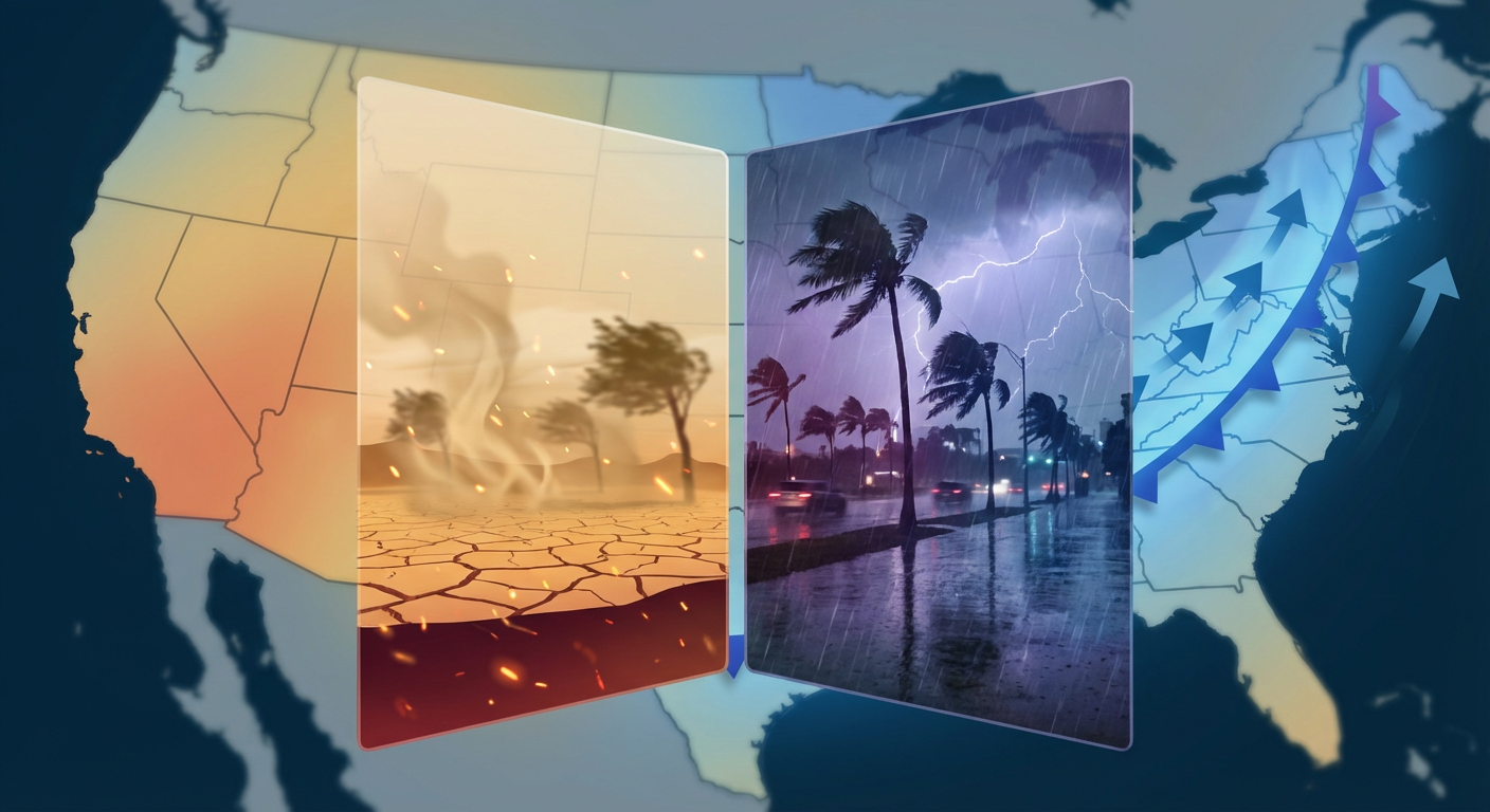
The Storm That Won't Quit: Weekend Plans, Snow Risks & The "Morning After"
Alright folks, let's take a deep breath.
We are waking up to some tough images out of Illinois and Indiana this morning. As we talked about in the last update, that PDS (Particularly Dangerous Situation) tornado outbreak last night was the real deal. If you are in those communities helping with the cleanup, our hearts are with you. That system has finally moved out of the Ohio Valley, but here is the thing: it is not done yet.
Energy like this doesn't just disappear. It transfers. And today, that energy is dragging a cold front right across the Southeast while setting up a messy weekend for the Northeast. Let's break down what this means for your Friday and your weekend plans.
Southeast: Keep an Eye to the Sky
The Storm Prediction Center has issued a Marginal Risk (that is a Level 1 out of 5) for severe storms today. This covers a slice of the country from southeast Alabama, through the Florida Panhandle, and up into Georgia and the South Carolina coast.
We are talking about cities like Columbus, Savannah, and Charleston.
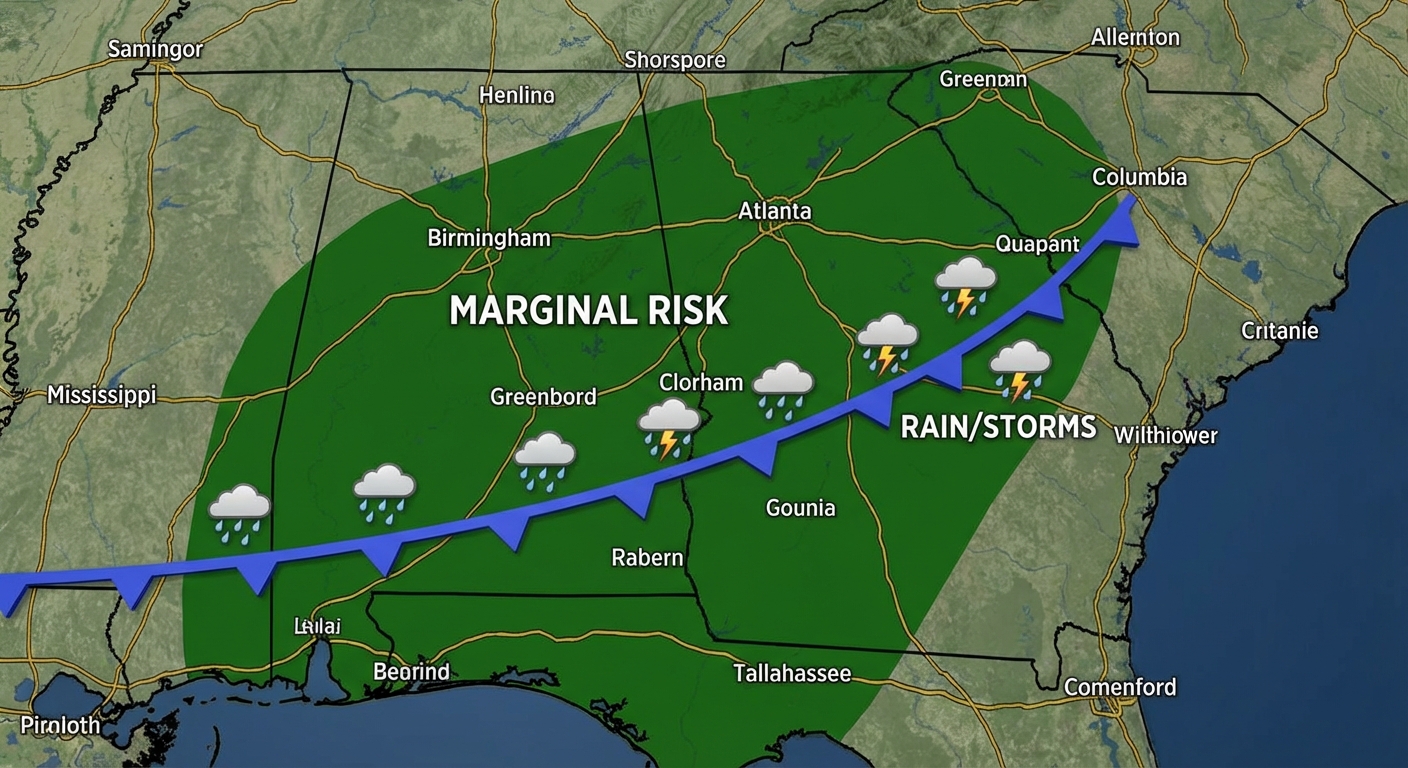
Here is the setup: A surface low is developing along the tail end of that front. It is not going to be an outbreak like we saw in the Midwest yesterday, but we have a 5% risk of damaging winds and a 2% spin-up tornado risk.
If you have outdoor plans—maybe you are heading to the Jacksonville Chocolate, Wine & Whiskey Festival tomorrow or catching some Spring Training action (I see the Yankees are playing the Orioles in Sarasota tonight)—you need to stay weather aware. The worst of this should push offshore by early Saturday morning, but don't be surprised if you get a quick deluge or a nasty gust of wind today.
The Northeast: Winter is Not Done With Y'all
I know I have seen a lot of folks in DC and Boston searching for snow updates. Here is the deal. As this system moves up the coast, it is going to tap into some colder air.
We are looking at a messy mix for the I-95 corridor, but the real snow potential is further north. The WPC is highlighting a risk for heavy snow in northern New York and New England going into the weekend. If you are in Vermont or New Hampshire, get ready for another round of shoveling.
For the rest of the Mid-Atlantic, it is going to feel like a slap in the face after some of the milder temps we have had. We are talking about a "colder snap" with wind chills dropping into the single digits back in the Midwest (Illinois and Indiana, bundle up while you are cleaning up).
The Plains: The Danger is Dry
While the East deals with water, the Southern Plains are dealing with wind and dust.
That Ranger Road Fire in Kansas and Oklahoma was a monster yesterday, fueled by those hurricane-force gusts. Today, the winds are dying down a little bit, but the air is still bone dry.
We have a Critical Fire Weather risk for eastern New Mexico and West Texas today. Places like Lubbock, Amarillo, and Roswell. The humidity is going to drop to 10-15%. That means if a fire starts, it can still spread fast. Please, be careful with anything that could throw a spark.
The West Coast: A Brief Breather
After the "Sierra Siege" dropped over 90 inches of snow in four days (absolutely bonkers totals), the West Coast is getting a temporary break today and tomorrow.
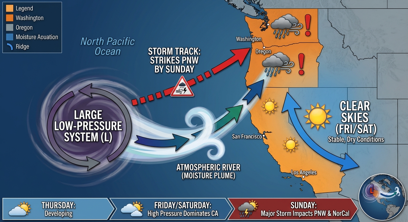
Enjoy it while it lasts. By Sunday, another system is knocking on the door of the Pacific Northwest and Northern California. It won't be as intense as the last one, but it will bring more rain and mountain snow. If you are traveling through the passes this weekend, do it on Saturday if you can.
Bottom Line
- Southeast: It is a "keep your phone on loud" kind of day. Marginal severe risk for AL, GA, SC, and FL Panhandle.
- Northeast: Rain/Snow mix incoming. Heavy snow for Northern New England, messy slush for the coast.
- Southern Plains: Fire danger is still high. Don't let your guard down just because the winds aren't 70 mph anymore.
- Everyone else: It is going to feel like winter again this weekend. Grab the hoodies.
Stay safe out there, y'all!
https://ryanhallyall.com/blog/the-storm-that-wont-quit-weekend-plans-snow-risks-the-morning-after