Blog Article
Severe Weather Threat Shifts to Missouri and Iowa Today
An Enhanced Risk of severe thunderstorms targets Missouri and Iowa today. Read the latest on the tornado threat, critical fire weather, and aurora chances.
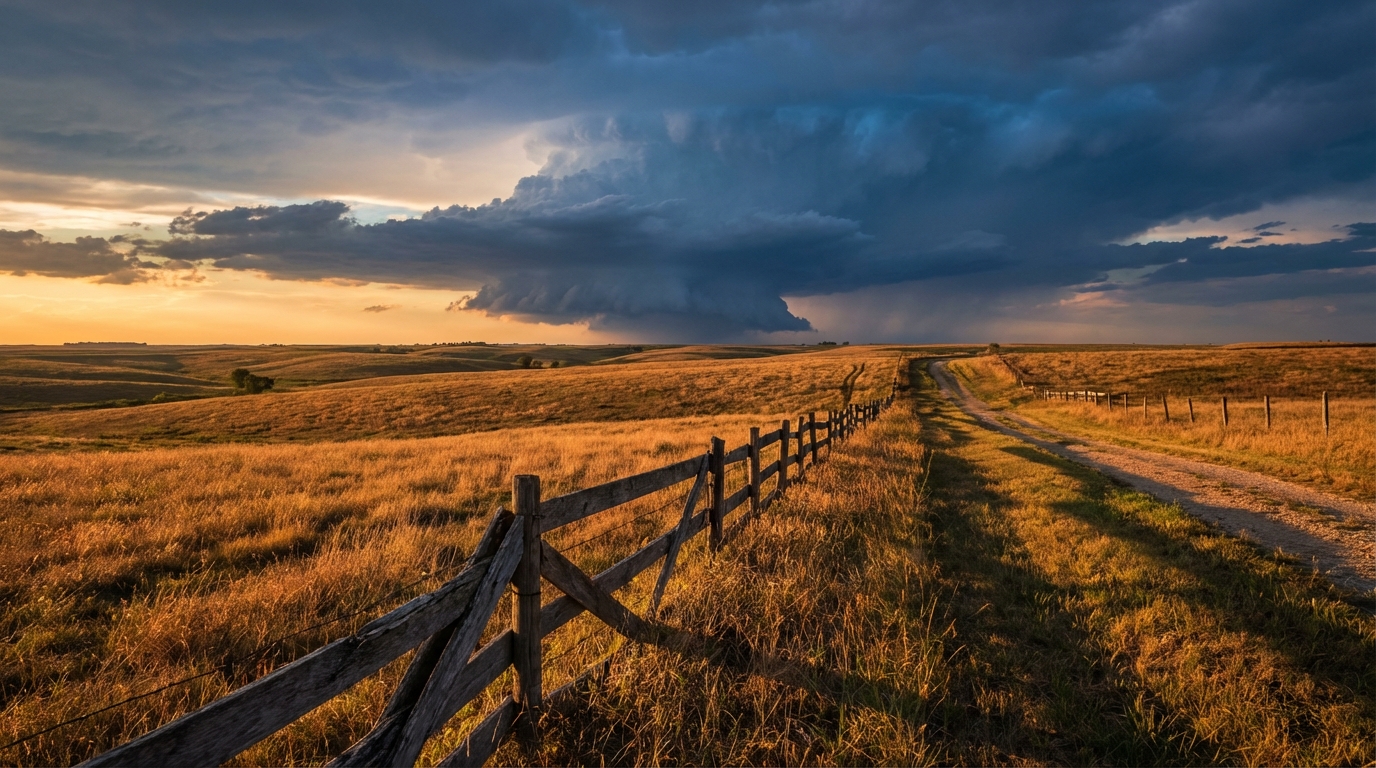
The Storms Aren't Done: Severe Threat Shifts to Missouri and Iowa
Alright y'all, we need to talk about the hangover from yesterday's storm system. If you read yesterday's post, we warned you about that squall line moving through Chicago. Midway Airport clocked a 69 mph wind gust last night. We also saw confirmed tornadoes rip through eastern Iowa and a crippling ice storm drop half an inch of ice on central Wisconsin. It was a rough 24 hours.
Here is the thing. The atmosphere is still highly agitated. We have another busy Friday ahead.
The Midwest Severe Threat
The Storm Prediction Center has an Enhanced Risk posted for northern Missouri and southern Iowa today. This covers places like St. Joseph, Kirksville, and up toward Ottumwa and Indianola. A broader Slight Risk stretches from Oklahoma City all the way up to Des Moines.
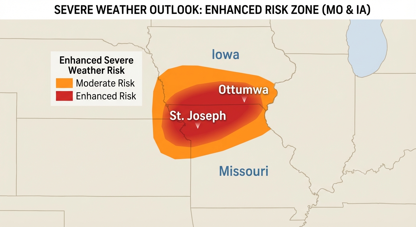
We are looking at a line of storms evolving by Friday evening. The main threats are large hail and damaging winds. A few tornadoes are absolutely possible if sustained supercells can get going ahead of the main line.
Normal high temperatures for Kansas City in early April sit right around 66 degrees. We are pulling in much warmer, juicier air than that right now. That heat and moisture act as pure rocket fuel for these storms. If you have outdoor Friday evening plans, like a high school baseball game or a patio dinner, you need to pay attention. Keep your phones charged and have your weather radio handy.
Critical Fire Danger Out West
While the Midwest deals with storms, the Southern High Plains are facing a completely different problem. We have a Critical Fire Weather area covering eastern New Mexico, the extreme western Texas Panhandle, eastern Colorado, and western Kansas.
It is incredibly dry out there. A surface low is kicking up strong winds across the region. If a fire starts today, it will spread incredibly fast. Do not burn brush today. Just hold off until the winds die down and we get some moisture back in the dirt.
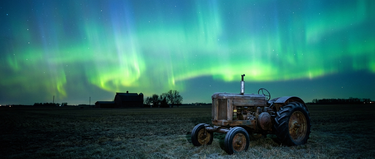
A Look at the Night Sky
I want to leave you with some good news. The Space Weather Prediction Center is tracking a coronal mass ejection that left the sun yesterday. They have issued a G3 Strong Geomagnetic Storm watch.
What does that mean for you? If the skies clear out tonight across the northern tier of the country, you might catch a really nice view of the Northern Lights.
Bottom Line
The severe threat shifts to the Ohio Valley by Saturday, but today is all about Missouri and Iowa. Have multiple ways to get warnings tonight. If you live in the Plains, respect the fire danger and avoid any activities that could spark a flame.
https://ryanhallyall.com/blog/the-storms-arent-done-severe-threat-shifts-to-missouri-and-iowa