Blog Article
Midwest Flood Threat & Hatched Tornado Risk Today
Tracking a Moderate Risk for flash flooding in the Midwest and a Slight Risk for severe storms capable of EF2+ tornadoes from the Plains to the Ohio Valley.
The Sunday Setup: Tracking a Major Flood Threat and Hatched Tornado Risk
Get this, y'all. Yesterday was a heavyweight kind of weather day. We saw 91 mph wind gusts out in Kansas and grapefruit-sized hail in Nebraska. Down south, the Gulf Coast dealt with serious flash flooding that put water inside folks' homes. If you are waking up this Sunday morning hoping for a quiet Father's Day, I have some tough news. The atmosphere is reloading.
Temperatures across the Midwest are sitting right around their late-June normals in the low to mid 80s. That warm summer air is providing plenty of fuel for a potent shortwave and surface low ejecting out of the central Plains today. We have a dual threat on our hands, and it is going to impact a lot of outdoor plans.
The Midwest Flood Threat
The Weather Prediction Center has issued a Moderate Risk for excessive rainfall today. That covers a stretch from northern Missouri right through central Illinois and Indiana. A Moderate Risk means there is at least a 40 percent chance that rainfall will exceed flash flood guidance.
This system is dragging a whole lot of moisture with it. The ground in a lot of these spots simply cannot take much more water. If you are heading to the Blue Jays and Cubs game up in Chicago or driving along I-70 or I-74 today, you need to expect delays. Heavy, blinding rain is going to cause water to pool quickly on the roadways.
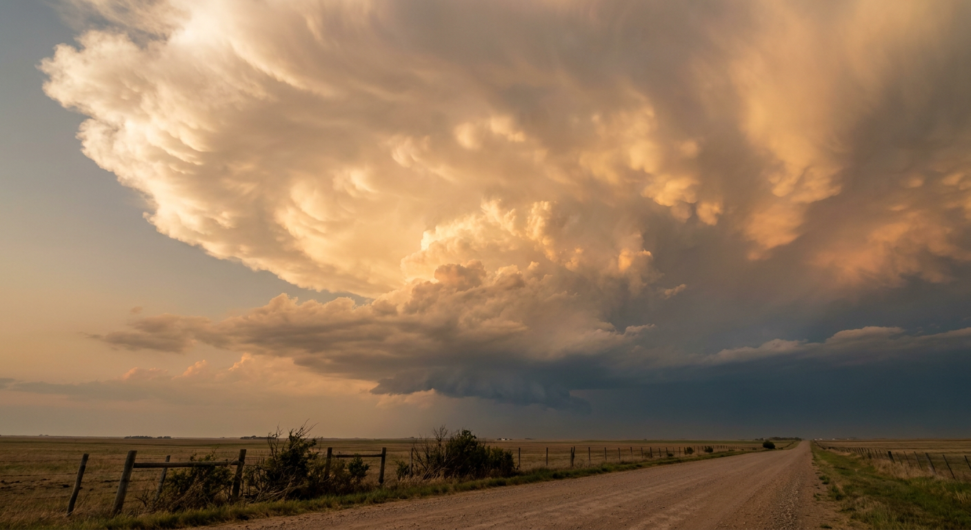
The Severe Setup
It is not just rain today. The Storm Prediction Center has a Slight Risk posted from the central and southern Plains through the Ozarks and into the Ohio Valley. Places like Indianapolis, Kansas City, Oklahoma City, and Louisville are in the crosshairs.
Here is the part you need to pay extra attention to. There is a 5 percent, Level 2 risk for tornadoes today. Inside that zone, there is a specific hatched area over parts of Missouri, Illinois, and Indiana. That hatched area means any tornadoes that do form could reach EF2 intensity or stronger.
We are also tracking a 15 percent Level 2 risk for damaging winds and severe hail. The data shows a hatched risk for significant wind gusts over 75 mph and hailstones reaching 2 inches in diameter. That is hen-egg size, which is plenty big enough to dent your car or ruin a roof.
Looking Ahead to Monday
By tomorrow, this main system pushes east. We are looking at a Day 2 Slight Risk for severe storms stretching from the Carolinas up into the Mid-Atlantic. If you live in Washington D.C., Baltimore, or Charlotte, you will want to keep an eye on the sky Monday afternoon and evening for scattered damaging wind gusts.
Key Things to Watch
- Flash Flooding: The Moderate Risk zone in MO, IL, and IN is the prime area for rapid water rises.
- Tornado Potential: The hatched risk area means we cannot rule out a few strong tornadoes this afternoon and evening.
- Large Hail: The central Plains and Ohio Valley could see hailstones over 2 inches in diameter.
- Travel Impacts: Expect significant delays at major airport hubs like Chicago and Kansas City today.
Bottom Line: If you have outdoor plans or are traveling through the Midwest and Ohio Valley today, you need to be proactive. Have a reliable way to receive severe weather warnings that will wake you up if you are asleep. Do not drive your vehicle through flooded roadways, no matter how shallow the water looks.