Blog Article
NWS Changes Severe Weather Outlooks Ahead of 2026 Outbreak
The NWS just updated how they warn you about tornadoes and large hail. Learn how to read the new SPC intensity maps before Friday's severe weather outbreak.
The Weather Service Just Changed How They Warn You (And The Timing Could Not Be Better)
Alright folks, if you have been scrolling social media today, you might have noticed a couple of things. First off, "WFAA radar" is trending right alongside the blood moon eclipse. Second, you might have seen some news articles about the National Weather Service changing how they do severe weather forecasts.
Well, get this. The Storm Prediction Center just completely overhauled their warning maps for the first time in years. And they did it just in time for the first major, multi-day severe weather outbreak of 2026.
While everyone else on your feed is just screaming that a massive storm is coming, we are going to actually break down what these new maps mean for you and your family. Let's get into it.
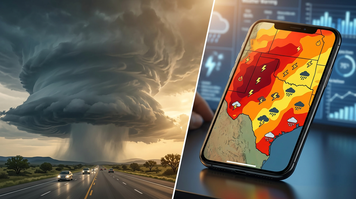
RIP to the "Hatched Area"
If you have followed my channels for a while, you know I am always talking about the "hatched area" on our severe weather maps. That was the old way the NWS showed where the most extreme tornadoes or giant hail would happen.
Here is the thing, it was confusing for a lot of folks. So as of yesterday, the SPC launched the "Conditional Intensity Groups."
Instead of just a striped blob on a map, forecasters are now giving us specific intensity levels for tornadoes, wind, and hail. It is basically a Level 1, 2, or 3 threat system for the exact type of hazard headed your way. This is a massive win for public safety, because you finally know exactly what kind of monster you are dealing with before the sirens ever go off.
The First Big Test: A Multi-Day Severe Outbreak
We are going to get very familiar with these new maps over the next 48 hours. We have a classic spring-like setup knocking on the door, and it is going to bring a whole lot of chaos to the central US.
Tonight and into Thursday, we are looking at a Slight Risk of severe weather kicking off along a dryline from northwest Texas up into southern Kansas. If you live in Amarillo or Lubbock, y'all need to be weather aware. We are expecting discrete supercells to fire up late Thursday afternoon. The low-level jet stream is cranking, which means the atmosphere has plenty of spin. A few strong tornadoes, damaging winds, and some really big hail are all on the table.
But Friday is the day that has my full attention.
For Friday, the SPC has already issued an Enhanced Risk for a corridor stretching from eastern Kansas and Oklahoma right into western Missouri. This includes places like Oklahoma City, Tulsa, Wichita, and Kansas City. A powerful storm system is going to eject out of the Rockies and clash with some incredibly warm, moist air. This is a very serious setup, and my team will be tracking it closely.
Fire, Ice, and the Blood Moon
There is a whole lot more going on than just severe storms right now.
If you are stepping outside tonight to catch that Blood Moon total lunar eclipse, your view is going to depend entirely on where you live. If you are in the Ohio Valley or the Ozarks, you are probably out of luck. A stalled out frontal system is dumping heavy rain right now, and the WPC has issued a Slight Risk for excessive rainfall. Flash flooding is a real concern tonight from Missouri across to the Ohio River.
Out west of our severe weather dryline, things are dangerously dry. Tomorrow brings Critical Fire Weather conditions to eastern New Mexico, southeast Colorado, and the western Oklahoma panhandle. Wind gusts up to 45 mph combined with humidity dropping to 6 percent means any spark will spread like crazy.
And let's not forget the Northeast. While the Plains deal with severe storms, northern New York and New England are bracing for a nasty ice storm. Cold air is getting trapped against the mountains, and we are expecting up to a quarter-inch of freezing rain across the Adirondacks and Berkshires by Friday morning. Your Friday commute up there is going to be a mess.
Your Severe Weather Checklist
Y'all, we are officially transitioning into spring weather mode. With this new SPC warning system in place and a major severe threat peaking on Friday, now is the time to prepare.
- Know your safe place: Is it a basement? An interior bathroom? Figure it out tonight, not when the tornado warning is issued.
- Check your alerts: Make sure your phone is set to receive emergency alerts, and grab a NOAA weather radio if you can.
- Gas up the car: With gas prices spiking right now due to overseas conflicts, you do not want to be stuck on empty if you lose power or need to relocate.
We are going to be watching this system like a hawk. Stay safe, keep your eyes on the skies, and I will talk to y'all tomorrow.