Blog Article
Weekend Winter Storm: Coastal Snow & Arctic Blast Update Jan 29
A major winter storm targets NC and VA with heavy snow and wind. Florida faces another hard freeze, while the PNW sees rain on snow. Weather update for Jan 29.
The Weekend Storm is Real: Rare Coastal Snow & The Big Chill Returns
Alright folks, grab your coffee and pull up a chair. As we talked about yesterday, we were keeping a close eye on a "weekend wildcard" developing off the Southeast coast. Well, the data is coming into focus this morning, and it is looking less like a wildcard and more like a serious winter event for folks who don't usually see this kind of action.
Here is the thing: While the deep freeze is the broad story, this developing coastal storm is the immediate headline. Let's break down what the latest models are showing.
The Southeast Coastal "Bomb"
Get this—a wave of low pressure is going to move across the South and hit the Atlantic Ocean by Friday evening. Once it hits that warm Gulf Stream water, it is expected to rapidly intensify (we call this "bombing out") as it tracks northeast.
Who needs to watch this?
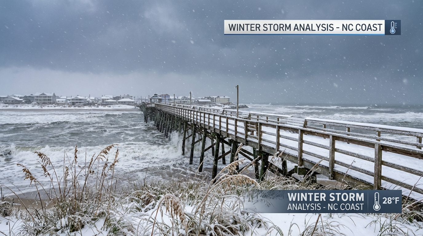
If you are in Eastern North Carolina, Southeastern Virginia, and even down into the South Carolina Lowcountry, you are in the bullseye. The Weather Prediction Center is now highlighting a risk for heavy snow—we're talking probabilities of over 50% for 8+ inches of snow in parts of eastern NC.
But it's not just snow. Because this low pressure system is deepening so fast, the winds are going to be howling. We could see gusts near hurricane force along the Outer Banks. The combination of heavy snow and high winds means near-blizzard conditions are on the table for northeastern North Carolina and southeastern Virginia on Saturday. Travel there is going to be extremely treacherous.
For my friends in Charleston, SC, the local forecast discussion is mentioning a "dry" snow event Saturday, which is rare for y'all. It's so cold that the snow ratio could be 20:1 (that means fluffy, powdery snow), so even a little moisture could pile up fast.
Florida: Freezing (Again)
Just when you thought you could cover the plants and forget about it, winter is reloading. This storm system is going to pull down another surge of Arctic air right behind it.
If you are in Tampa or Orlando, get ready for another round of glorious but frigid sunshine. We are looking at widespread hard freeze conditions returning Saturday night and Sunday night.
I see a lot of y'all heading out to the Shipwrecked Music Festival in Tampa this Saturday. Look, it's going to be sunny, but with that north wind whipping on the backside of this storm, it is going to feel bitterly cold. You might be dancing, but keep the layers handy. The National Weather Service in Tampa is also warning about extremely hazardous marine conditions, so if you had plans to take the boat out, keep it docked.
The Northeast: Wind Chills & Lake Effect
Notes from the Boston and Buffalo offices tell us the cold isn't done with the North either. A reinforcing shot of Arctic air arrives tonight into Friday. We are talking wind chills dropping to -20°F to -30°F in parts of New England and Upstate New York.
Speaking of New York, the lake-effect snow machine off Lake Ontario is still cranking. Rates of 3 inches per hour have been reported. If you are near Oswego or the Tug Hill Plateau, you know the drill, but please be careful on the roads. Visibility is near zero in those bands.
The West Coast: Snow Levels Rising
Over in the Pacific Northwest, the pattern is shifting slightly. We still have that atmospheric river pointing a firehose at Washington and Oregon, but the air is getting warmer.
Snow levels are rising to around 6,000 feet. That means rain falling on top of the snowpack at lower elevations in the Cascades. This creates a sloppy mess and increases the risk for runoff and river flooding, particularly for the Skokomish River. If you are commuting through the passes or live near those flood-prone rivers, keep your eyes peeled.
Bottom Line
- Southeast Coast: This is a serious winter storm for Saturday. Prepare for heavy snow and high winds if you are east of I-95 in NC/VA.
- Florida: Don't put away the plant covers. Hard freeze likely Saturday/Sunday nights.
- Travel: I-95 from NC to VA could be a mess Saturday. I-90 in NY is dealing with intense lake effect snow.
- Stay Warm: The cold air is recharging. Frostbite can happen in minutes with these wind chills up North.
Stay safe out there, y'all!
https://ryanhallyall.com/blog/the-weekend-storm-is-real-rare-coastal-snow-the-big-chill-returns