Blog Article
World Cup Heat and Mid-Atlantic Storms: The July Weather Link
The World Cup Final hits New Jersey July 19. The same humid, storm-prone pattern is already driving an ENHANCED severe risk over Philadelphia and DC tonight.

The World Cup Comes to Jersey This Month, and the Weather's Already Rehearsing
Alright folks, if you've had one eye on the World Cup this week, you've seen the same headline I have. Search traffic is blowing up around Lincoln Financial Field in Philly and how these summer matches are turning into some of the hottest games ever played. Players are cramping. Athletes are getting subbed for heat. Folks are asking what actually happens to a body when you make it run for 90 minutes in a swampy East Coast July.
Here's the thing. The Final is coming to MetLife Stadium in East Rutherford, New Jersey on July 19. And the weather pattern that's going to greet that crowd? It's already here, running a full dress rehearsal across the Mid-Atlantic right now.
Why summer soccer in the Northeast is a weather story
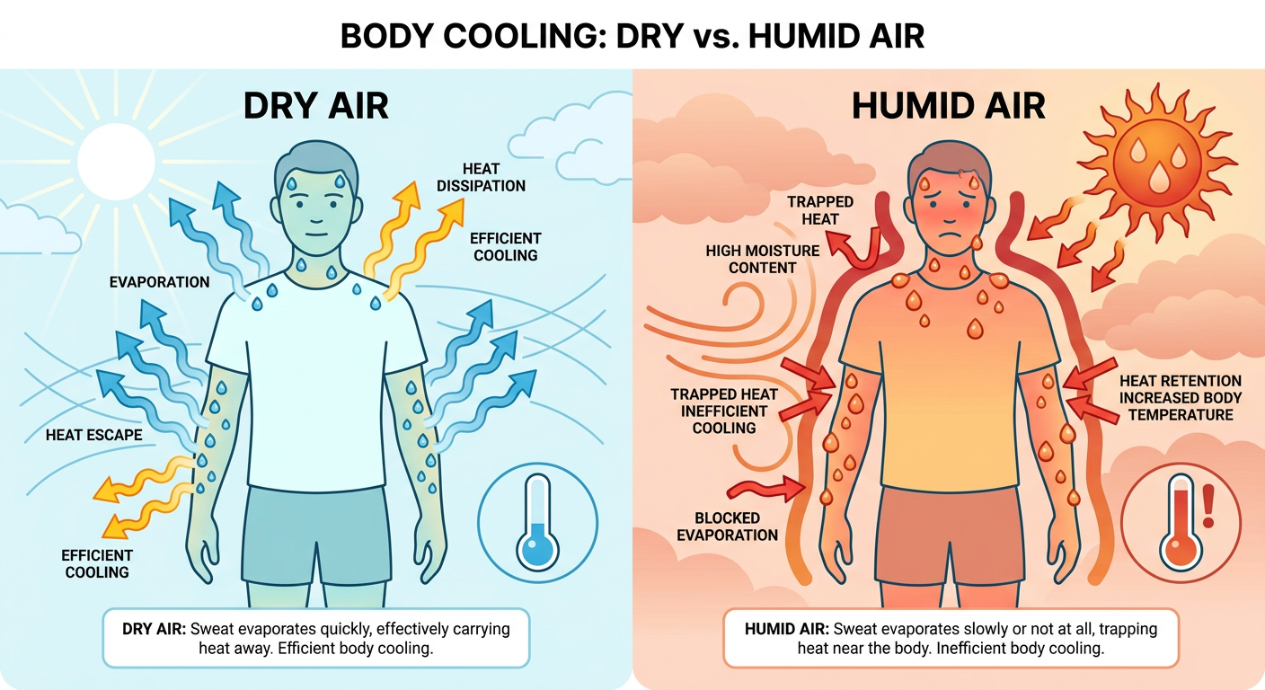
When people say "it's not the heat, it's the humidity," they are, for once, being scientifically precise. Your body cools itself by sweating. Sweat evaporates, and evaporation pulls heat off your skin. Simple. But when the air is already loaded with moisture, that sweat has nowhere to go. It just sits there. Your built-in air conditioner stalls out.
That's the difference between a dry 95 and a muggy 95. Same thermometer reading, completely different experience for a body under load. It's why the heat index exists, and it's why a soccer match in humid air is a genuinely different physical challenge than the same match in dry heat.
What the Mid-Atlantic is dealing with tonight
This evening, the Storm Prediction Center has an ENHANCED risk of severe thunderstorms, that's a level 3 out of 5, right over Philadelphia, Washington DC, Baltimore, and Wilmington. Tulsa, Oklahoma is in that same category out on the Southern Plains. The main threat is damaging wind. In the strongest zone, the wind probability climbs to 45 percent, with gusts that could reach 75 mph or higher.
And this isn't coming out of nowhere. Look at what happened yesterday. A big complex of storms rolled off the Alleghenies and into the I-95 corridor, and the reports piled up. Trees down across New Jersey. Wires down in Pennsylvania. A 75 mph gust measured at the Wilkes-Barre Scranton airport. Storm reports lit up from Morristown to Atlantic Highlands. One report near Maryville, Tennessee even had a fireworks tent collapse in the wind.
Here's why this keeps happening. A cold front is sagging south and stalling over the region, and it's sitting in a warm, moist, unstable air mass. That front is a trigger. The humidity is the fuel. Every afternoon the sun heats things up, storms fire along the boundary, and they've got plenty of energy to work with.
The flood risk is stacking up too
The Weather Prediction Center has a SLIGHT risk of excessive rainfall over the Mid-Atlantic tonight and again Sunday. The concern for Sunday is real: localized totals up to 5 inches are possible across central and eastern Pennsylvania, northern New Jersey, and northern Maryland.
What makes that dangerous is timing. Rain falling tonight soaks the ground. Then more rain lands on top of it Sunday. Saturated soil can't absorb much, so the next round runs straight off into creeks and storm drains. That's how you get flash flooding without a single historic rain total. The setup does the work.
For context on how loaded this pattern has been, central Iowa saw more than 12 inches of rain on July 3. Nobody's forecasting that for the Northeast. But it tells you the atmosphere across the middle of the country has been holding a lot of water this week, and the Mid-Atlantic is now in the crosshairs.
So what does this mean for the next two weeks?
The World Cup Final on July 19 is still too far out for a specific forecast, and I'm not going to pretend otherwise. But the pattern is instructive. The Northeast in mid-July gets hot and sticky. New York's normal July high is 85 with lows near 68. Philadelphia runs about 87 for a high. Add humidity and afternoon storm chances, and you've got the recipe both for miserable heat and for pop-up thunderstorms that can delay an outdoor event.
And it's not just the Final. Philadelphia hosts the MLB All-Star Game on July 14. The Nathan's Hot Dog Eating Contest is happening in Brooklyn today. Baseball is playing all across this stormy corridor this weekend, from the Bronx to DC to Cincinnati. Every one of those outdoor events lives and dies by the same front and the same muggy air mass.
The takeaway
The World Cup conversation about heat isn't some far-off concern. It's the exact same weather machine that's putting an ENHANCED severe risk over Philly and DC tonight and threatening flooding on Sunday. Summer in the Mid-Atlantic means heat, humidity, and storms that build fast on a stalled front.
If you've got outdoor plans this weekend across the Northeast, check the radar before you head out, know where you'd shelter if the sky turns, and drink more water than you think you need. That's true whether you're watching baseball, running the Peachtree in Atlanta, or just grilling in the backyard. The same air that's making athletes cramp on the world stage is sitting right over your cooler.