Blog Article
World Cup Final Weather: The Stormy Mid-Atlantic Pattern
The 2026 World Cup Final hits open-air MetLife Stadium July 19. Here's the storm-prone Mid-Atlantic pattern that's been soaking the corridor and what it could mean.
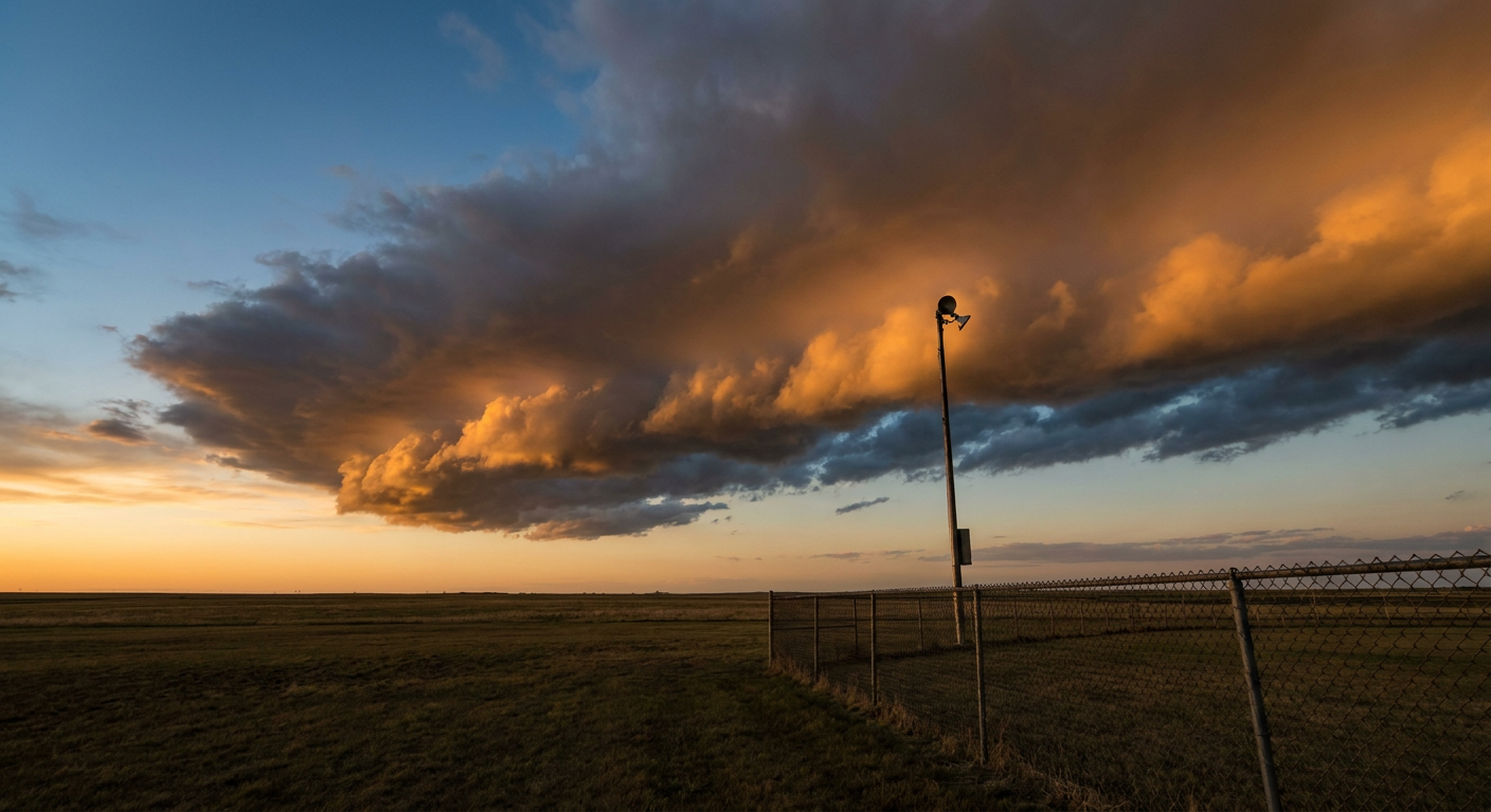
The World Cup Final Is Ten Days Out. Here's What the Sky Over New Jersey Has Been Doing.
Alright folks, the whole planet is watching the same thing right now. The golden boot race is trending with 5,000-plus searches, Messi and Mbappe and Haaland and Kane are all still alive in it, and in ten days the 2026 FIFA World Cup Final kicks off at MetLife Stadium in East Rutherford, New Jersey. Biggest single sporting event on American soil this year. Maybe this decade.
So here's the thing nobody in the soccer world is talking about yet, but should be: that stretch of New Jersey has been sitting under one of the wettest, most storm-prone patterns of the summer. And the weather map that's produced it isn't going anywhere in a hurry.
Let me walk you through what's been happening, why it's happening, and what it tells us about the road to July 19.
The Corridor That Can't Catch a Break
Just today, the Weather Prediction Center put central New Jersey and the Jersey suburbs of New York City in a Slight Risk for excessive rainfall. That's a Level 2 out of 4. The reason, straight from the WPC discussion, was strong storms moving through this afternoon into evening with real flash flood concern along I-95 and the urban corridor.
And this isn't new. Get this. Earlier in the week, Philadelphia and the New York City metros already saw urban flash flooding. The Storm Prediction Center had Philadelphia inside a Slight Risk for severe storms today too, with a 15% scattered damaging wind threat running up the Mid-Atlantic.
Rewind to yesterday and you'll see why I'm not shrugging this off. Across Virginia and North Carolina, we logged dozens of wind damage reports. Trees down in Ferrum, Cascade, Raleigh, Cary, and clear out to the coast near New Bern, where an ASOS clocked a 70 mph gust. This same weather regime has been grinding through the eastern third of the country for days.
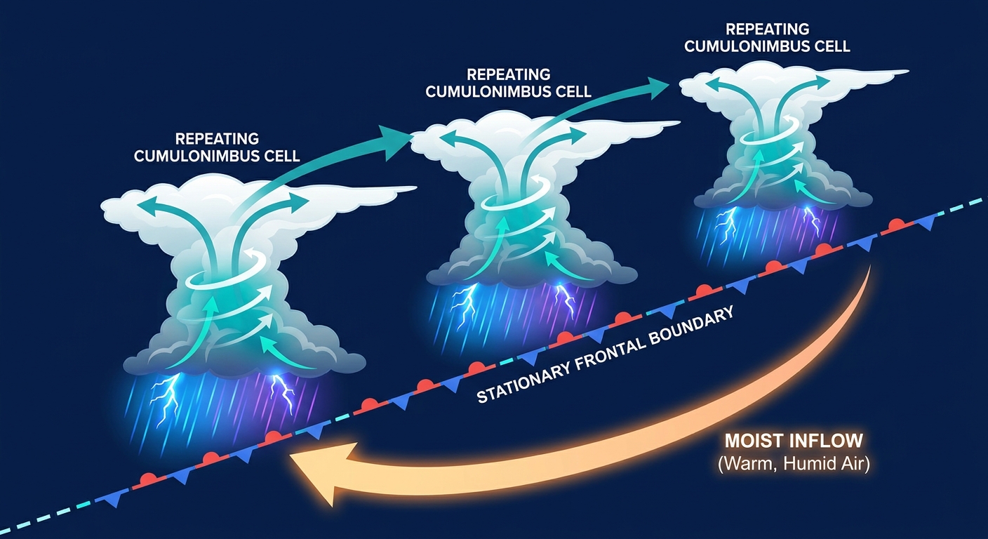
Why the Same Places Keep Flooding
Here's the science, and I'll keep it plain.
When you get a stalled boundary, basically a line in the atmosphere where warm sticky air meets slightly less sticky air, storms will fire along it and then ride that boundary like cars on a train track. The meteorology term is literally "training," because one storm follows another over the exact same ground.
Stack that up with precipitable water values over 2 inches, which is a fancy way of saying the atmosphere is holding a nearly record amount of moisture, and you get rainfall rates of 1 to 2 inches an hour. In a city like Philadelphia or the New Jersey suburbs, where the ground is mostly pavement and storm drains, that water has nowhere to go but the streets. That's why the WPC keeps flagging the I-95 corridor specifically. It floods fast and it floods with less rain than a rural area would need.
For context, Philadelphia's normal July high is 87 degrees with a low of 69. The heat itself isn't the story here. It's the humidity riding along with it, the dewpoints and the moisture, that loads the atmosphere like a wet sponge waiting to get wrung out every afternoon.
So What About July 19?
Let me be straight with you, because I don't fabricate what the data doesn't show. We cannot forecast the World Cup Final ten days out. Nobody can, not honestly. The Storm Prediction Center and WPC outlooks only run reliably a few days ahead, and the specifics of any single afternoon that far away are guesswork.
What I can tell you is the pattern. This has been a summer of repeated Mesoscale Convective Systems and stalled boundaries hitting the same corridors over and over. The Mid-Atlantic has been a magnet for it. If that regime holds, and mid-July climatology says afternoon and evening storms are just part of the deal here, then the smart money says a pop-up thunderstorm is at least on the table for the New York area that week.
MetLife is an open-air stadium. No roof. So this matters for the biggest match in the sport.
Here's what I'd tell you if you've got tickets or you're heading to a watch party in the region:
- Build in buffer time. Mid-Atlantic summer storms love the late afternoon and evening, right in the window when a big match plays.
- Watch the short-range forecast, not the ten-day. Around July 16 or 17, the outlooks get trustworthy. That's when to actually plan.
- Lightning stops play. A soaked field is one thing, but lightning within striking range means delays. It's happened at big American sporting events before.
- Flash flooding is the sneaky risk. If storms fire before the match, the drive in and the parking situation around the stadium can go sideways fast.
The Bigger Picture
There's a nice bit of symmetry here. This week's morning post was all about the Pacific Northwest sitting pretty at 71 degrees and cloudless while the middle and eastern parts of the country got worked over. The World Cup Final is happening in the part of the map that's been on the wrong end of that split.
The golden boot race will come down to inches and moments. The weather in New Jersey on July 19 might come down to whether one stalled boundary decides to park itself over northern New Jersey that afternoon. Both are out of anybody's control right now. Both are worth watching.
Check back with us the week of the final. That's when the sky over MetLife stops being a guess and starts being a forecast.