Blog Article
World Cup Weather: Severe Storms Threaten Summer Events
The World Cup has America watching, but a stormy June pattern threatens festivals and games from the High Plains to the Midwest. Here's what to know tonight.
The World Cup Is in America, and the Weather Is the One Opponent Nobody Drafted For
Get this, y'all. Morocco vs Haiti is pulling 50,000-plus searches right now, with folks glued to the World Cup match down in Atlanta. The whole tournament is in our backyard this summer, matches in NFL stadiums from coast to coast, and the FIFA World Cup Final is set for July 19 in East Rutherford, New Jersey. America's hosting the biggest sporting event on the planet during the most volatile weather month we've got.
And here's the thing about June 2026. It has been relentless.
Let me catch you up on what this month has actually thrown at us, because it matters for everything happening outside right now.
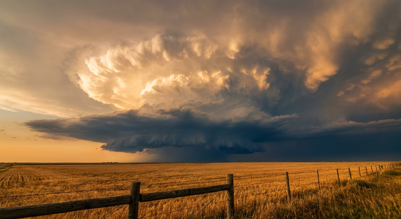
A June for the Record Books, and Not the Fun Kind
This month alone we've logged a measured 113 mph wind gust at Salina Regional Airport in Kansas on June 8. Then another 113 mph gust near Akron, Colorado on June 22. Tropical Storm Arthur came ashore near Matagorda County, Texas on June 17. The remnants stalled out and dumped between 12 and 26.7 inches of rain on Louisiana and Mississippi, enough to fail the Anker Lake Dam in Pearl River County. Tornado outbreaks tore through southern Illinois and Indiana. Logan County, Colorado got 6 inches of hail on the roads. They had to send snowplows. In June.
Just yesterday, a Particularly Dangerous Situation Flash Flood Emergency hit Atoka County, Oklahoma after 4 to 8 inches of rain. A semi-truck got flipped near Seymour, Texas by an 85 mph gust. Water rescues in West Virginia. This is not a quiet stretch.
So when the World Cup brings hundreds of thousands of people to outdoor watch parties and stadiums, the question isn't whether the soccer's good. It's whether the sky cooperates.
Where the Trouble Sits Tonight
The Storm Prediction Center has an Enhanced Risk, that's a Level 3 of 5, across the central High Plains for this evening. We're talking Cheyenne, Wyoming and the northeast Colorado corridor through Greeley and Fort Morgan. The concern there is large to very large hail, severe wind gusts, and a couple of tornadoes possible.
Get this on the hail. Inside a hatched zone in that High Plains setup, the data flags the potential for hailstones up to 3.5 inches. That's softball size. The kind that dents hoods and shatters windshields.
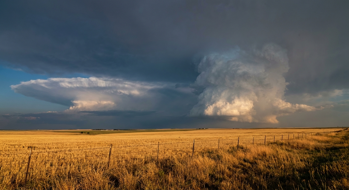
A broader Slight Risk, Level 2 of 5, stretches across a big chunk of the High Plains and Midwest and catches Chicago, Denver, Milwaukee, and Madison. And that's where the cultural calendar starts bumping into the forecast.
Summerfest, Electric Forest, and the Weekend Crowd
Summerfest Weekend 2 kicks off in Milwaukee on Thursday. Electric Forest opens the same day up in Rothbury, Michigan. Both of those sit inside states under that Slight Risk for severe storms in the SPC outlook. Southern Wisconsin knows this drill. As recently as June 22, 2024, the Madison and Milwaukee area saw two EF2 tornadoes in this same late-June window. That's not a scare tactic. It's a reminder that a Slight Risk is not a low-impact day. The Chicago-area EF3 on June 20, 2021 happened in this exact part of the season.
If you're heading to Summerfest grounds or camping at Electric Forest, here's the plain advice: know where the nearest sturdy shelter is before the music starts, and keep weather alerts on your phone turned up. Festival crowds and lightning do not mix, and the time to figure out your plan is not when the sirens go off.
On the baseball side, the Brewers play the Reds in Cincinnati tonight, the Cubs are at the Mets in Queens, and the Red Sox are at the Rockies in Denver. That Denver game sits right under the Slight Risk umbrella. Coors Field's no stranger to a rain delay, and tonight's the kind of setup that could bring one.
What Thursday Looks Like
The pattern doesn't quit. It shifts. By Thursday the severe threat slides east and south, with a Slight Risk targeting southern Kansas, northern Oklahoma, and into the Ozarks. The SPC discussion flags EF2-or-stronger tornado potential there as a strong low-level jet, running 40 to 50 knots, interacts with storm motions along a boundary.
And the rain is the bigger long-term worry. The Weather Prediction Center has a Slight Risk of excessive rainfall Thursday across central and eastern Kansas through Missouri, with a training-storm scenario that could pile up 3-plus inches in a hurry. The ground across Oklahoma, Arkansas, and Louisiana is already saturated from everything that's fallen this month. Saturated soil plus more heavy rain is how you get flash flooding fast.
Out west, it's the opposite problem. Western and central Utah, including Salt Lake City, is under a Critical fire weather highlight for scattered dry thunderstorms. Relative humidity is dropping into the single digits in spots, and lightning hitting cured fuels with no rain to follow is exactly how new fires start.
The Takeaway
The World Cup put America center stage this summer, and the weather's reminding us it gets a vote in how every outdoor plan goes. If you're in the central or southern Plains, the Midwest, or heading to a festival in Wisconsin or Michigan this weekend, build a weather check into your plans the same way you'd check the lineup before a match. The forecast tonight isn't a sure thing. Severe storms in the High Plains, heavy rain creeping toward the saturated southern Plains, and fire risk out in Utah. Know your shelter, watch the sky, and don't let a beautiful afternoon talk you out of having a plan.