Blog Article
Hurricane Lowell Nears Hawaii, Severe Storms Hit East
Three East Pacific hurricanes are active as Lowell nears Hawaii, while a Slight Risk for damaging wind shifts from the Ohio Valley to the Carolinas this weekend.

Three Hurricanes Spin in the Pacific While the Ohio Valley and Mid-Atlantic Watch the Sky Again
Alright y'all, let's start where the biggest story actually is: the East Pacific, where three hurricanes are spinning at the same time. That's not something you see every week, and one of them has Hawaii's attention for real.
Hurricane Lowell Is the One to Watch in Hawaii
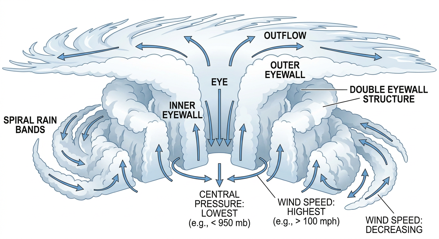
Hurricane Lowell is a strong Category 3 storm right now, packing 127 mph winds and sitting about 555 miles south-southwest of Honolulu. It's been through some ups and downs in the last day, with a double-eyewall structure showing up on satellite and microwave data overnight. That kind of structure often means a storm is working through an intensity cycle, so don't be surprised if the numbers wobble some before this is all said and done.
Here's the part that matters for the islands. Lowell's forecast track brings it within about 67 kilometers of Kauai's South Shore, with closest approach expected late Monday into early Tuesday. The RHY impact model has Kauai's North, South, and East shores in a "prepare" threat tier right now, four and a half days out. Oahu's west and south shores are one notch down at "aware." That's not a coastal warning yet, but it is exactly the kind of lead time where you want your hurricane kit checked and your plan written down before the cone tightens up.
Behind Lowell, Hurricane Karina is a Category 2 storm well east of the islands, moving away from Hawaii more than toward it, so it's an "aware" level item for Maui and nothing more right now. And out toward the eastern side of the basin, Hurricane Marie is a Category 2 storm several hundred miles southwest of Baja California. Marie's not forecast to threaten land directly, but her moisture plume is going to matter for the Desert Southwest this weekend. WPC has already flagged a Slight Risk of excessive rainfall for southeastern Arizona and western New Mexico today, and Marie's tropical moisture feeding into the Southwest trough is part of why Sunday's excessive rainfall risk expands into the Colorado River Valley.
There's also a broader area of interest off southwestern Mexico that NHC gives a medium, 50 percent chance of development by day 7. Nothing imminent, but worth a mention since it's the fourth system in that stretch of ocean right now.
Back Home: Slight Risk Corridor Shifts From the Great Lakes Toward the Carolinas
Y'all remember yesterday. Destructive-tagged severe thunderstorm warnings tore through northeast Ohio and western Pennsylvania with radar-indicated gusts to 80 mph, tornado warnings popped over southeast Michigan and the Pittsburgh area, and swift water crews pulled people out of flooded cars and even ten folks out of a flooded apartment building near Greensburg. Over 290,000 customers lost power in southeast Michigan alone. That front is still working through the system today.
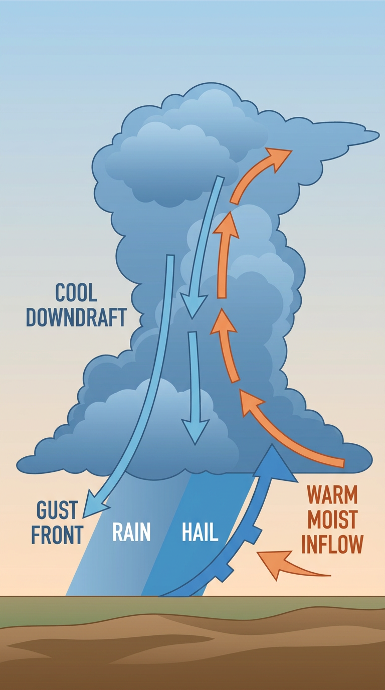
SPC has a Slight Risk posted for today running from Columbus and Cleveland through Detroit and into Washington, D.C., and Virginia Beach. A Marginal Risk wraps around that, covering Baltimore, Raleigh, Cincinnati, Dayton, and Flint. The setup calls for a couple of organized storm clusters through today and tonight, with damaging wind gusts the headline threat. SPC's wind probabilities actually bump up to a 30 percent, Level 3 "numerous damaging wind" category over parts of that corridor, which is a step up from a typical Marginal or low-end Slight day. Hail risk stays low, around 5 percent for quarter-size stones.
Saturday, that risk slides south and east. The Day 2 Slight Risk shifts to Charlotte, Raleigh, and the central Appalachians, running from eastern Kentucky and West Virginia down through Virginia and North Carolina, with a Marginal Risk stretching from Louisville and Cincinnati out to Virginia Beach and Norfolk. A warm, humid air mass with 2,000 to 2,500 J/kg of instability ahead of a southward-diving cold front, paired with 25 to 35 knot effective shear, is enough to organize storm clusters again, with scattered 60 mph-plus gusts the main concern.
For context, this is running about where you'd expect early September to sit climatologically. Raleigh's average high this time of year is 82, Charlotte's is about the same, and D.C. sits around 80. Nothing unusual on the thermometer, it's the moisture and shear coming together with that front that's doing the work here, not extreme heat.
Sunday, the Marginal Risk drops down into the Southeast (Tallahassee and Savannah) and separately into the northern Plains, but SPC calls that northern Plains piece "more uncertain and conditional," so don't lock in your weekend plans around it just yet.
College Football Saturday Sits Right in the Slight Risk Zone
A lot of Saturday's big kickoffs land right inside that Carolinas-and-Appalachians risk area. Kent State at South Carolina in Columbia, Furman at Tennessee in Knoxville, Liberty at James Madison in Harrisonburg, The Citadel at Charlotte, and Maine at App State in Boone are all afternoon or evening games sitting inside or near the Slight Risk zone. If you're headed to any of those, keep an eye on the sky during pregame and don't be shocked by a weather delay if a cluster fires up nearby. Games further west, like Boise State at Oregon or Fresno State at USC, are clear of this system entirely.
What Else We're Watching
- Lowell's track and intensity trend as it nears Kauai early next week
- Whether Saturday's Carolinas/Appalachians storms stay scattered clusters or organize further
- Coastal North Carolina's Slight excessive rainfall risk Saturday, where a back-door front and repeated storm rounds could stack up rain on top of already-wet ground
- Marie's moisture feeding Southwest monsoon rainfall into early next week
- Elevated fire weather continuing across the northern High Plains and northern Rockies
- A minor G1 geomagnetic storm possible September 25-26, well down the road and no cause for concern right now
Bottom Line
If you're in Hawaii, especially Kauai, this is the week to get your hurricane kit squared away and know your evacuation zone. Lowell isn't a lock to make a direct hit, but "prepare" is exactly the word NHC wants you to hear right now. If you're anywhere from Cleveland and Detroit through D.C. today, or in the Carolinas and central Appalachians Saturday, keep half an eye on the radar during outdoor plans and have a way to get warnings, because damaging wind gusts are the real threat, not just rain. Everybody else, enjoy a pretty normal early September weekend, because the nicest air of the whole outlook window sits over the Great Lakes and Mid-Atlantic once this front clears out.