Blog Article
Memorial Day Weekend Weather: Gulf Coast Rain & Plains Hail
Get your Memorial Day weekend weather forecast. We are tracking flash flood risks for the Texas Gulf Coast and a Sunday hail threat in the Central Plains.
Tracking Gulf Coast Downpours and a Sunday Hail Threat for the Plains
Alright folks, we are officially in the thick of Memorial Day weekend. If you were keeping an eye on the sky yesterday, you know things got a little rowdy. We had landspout tornadoes in the Texas Panhandle and some serious flash flooding down in Alabama and Mississippi.
Today, the weather is splitting the country into a few different camps. We have some stubborn rain hanging over the Gulf Coast, a new severe setup brewing for the Plains on Sunday, and some absolutely gorgeous weather out West.
The Gulf Coast Water Hose
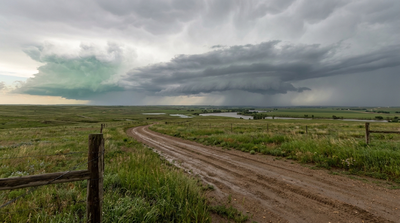
As we talked about yesterday, the setup over East Texas and western Louisiana is just waterlogged. The Weather Prediction Center still has a Slight Risk for excessive rainfall posted today and tomorrow for places like Houston, Beaumont, and Lake Charles.
Here is the thing. The ground down there is already saturated. When you get these slow-moving thunderstorms tapping into deep Gulf moisture, the water has nowhere to go. If you are hitting the road along I-10 or heading out to a local Memorial Day event, you need to watch out for water ponding on the roads. Do not try to drive through flooded intersections.
Sunday's Hail Threat in the Plains
While the South deals with rain, we are tracking a different hazard shifting into the Central and Northern Plains for Sunday. A weak disturbance is moving into the Upper Midwest. The Storm Prediction Center has a Marginal Risk for severe storms from central Nebraska up into southwest Minnesota.
Now, a Marginal Risk is a Level 1 out of 5. It is not a day to cancel all your plans. But get this. Inside that risk area, forecasters have highlighted a specific zone where hailstones could reach two inches in diameter. That is hen-egg size.
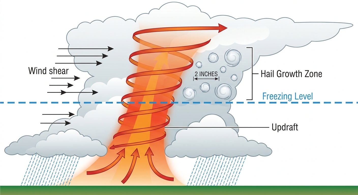
Why is this happening? We have a combination of steep lapse rates and about 40 knots of wind shear in the mid-levels of the atmosphere. In plain English, that means the air gets cold very quickly as you go up, and the winds are changing speed and direction. That allows storm updrafts to get strong enough to hold hailstones in the freezing air until they get big and heavy. With average late-May highs sitting around 69 degrees in Minneapolis, tomorrow's setup will bring enough warmth and instability to really get those updrafts going. If you live around Grand Island or Sioux Falls, park the car in the garage tomorrow afternoon.
The Good News
It is not all storms and rain this weekend. Folks up in the Northern Plains and the Desert Southwest have hit the weather jackpot. We are talking dry air, clear skies, and comfortable temperatures. It is perfect weather for firing up the grill or heading to a baseball game. Just remember that the late-May sun angle is high. The UV index will be pushing past 8 in a lot of these clear-sky spots, so keep the sunscreen handy.
Bottom Line
- Gulf Coast: Keep the umbrella close and watch for localized flash flooding from Houston to New Orleans today and tomorrow.
- Central Plains: Have a plan for your Sunday afternoon if you are in Nebraska or southwest Minnesota. Watch for fast-developing storms with large hail.
- Travelers: Check your flight status if you are connecting through Houston or Atlanta, as those slow storms will cause delays.
Keep your weather radio on and your cooler stocked.
https://ryanhallyall.com/blog/tracking-gulf-coast-downpours-and-a-sunday-hail-threat-for-the-plains