Blog Article
Tropical Storm Amanda, X-Class Solar Flare, & Plains Hail Threat
Tropical Storm Amanda is trending online, but an X1.0 solar flare and a severe hail threat in the Plains are the real weather stories for June 3, 2026.

Tropical Storm Amanda is Trending, but the Sun is the Real Story Today
Get this, y'all. My phone has been blowing up today with people asking about "Tropical Storm Amanda." It is getting thousands of searches online right now. People hear "tropical storm" in early June and immediately start checking their summer vacation plans.
Here is the thing. Amanda is out in the Eastern Pacific. It has sustained winds of 40 mph and it is pushing some south swell toward Hawaii. It is not going to bother the US mainland. You can leave your beach trips alone.
But while everyone is looking at the Pacific Ocean, the sun is actually putting on a much bigger show.
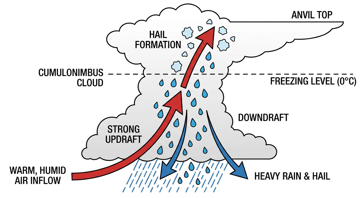
The X-Class Solar Flare
We just had an X1.0 solar flare pop off this morning. A highly active sunspot called Region 4455 has been busy today. It fired off a couple of moderate flares before launching the big X-class event.
When a flare like this happens, it often throws a Coronal Mass Ejection, or CME, out into space. The data shows a CME is currently visible and heading out from the sun. This means we might see some geomagnetic storming and maybe some Northern Lights in a couple of days.
The Real Danger is in the Plains
If you live in the Dakotas or Nebraska, you probably will not see any auroras. You are going to be looking at some very angry clouds instead.
We have a Slight Risk, which is a level 2 out of 5, for severe thunderstorms tonight from the eastern Dakotas down into northern Nebraska. If storms form here, we are looking at a 15 percent chance of scattered damaging winds over 60 mph. But the main event is the hail.
Inside that risk area, we have a hatched zone for significant hail. That means hailstones could reach 2 inches in diameter. That is hen-egg size, y'all. It is big enough to dent your truck and ruin your night.
Tomorrow, that threat keeps rolling right along. On Thursday, the Slight Risk covers the northern High Plains across South Dakota, northern Nebraska, and into southwest Minnesota. We are looking at the exact same ingredients. A 15 percent chance for scattered damaging winds and another hatched risk for 2-inch hail.
If you are heading to the Royals and Twins game in Minneapolis tomorrow night, you might catch the eastern edge of this system. The city is in a Marginal Risk for isolated severe weather, so keep an eye on the sky if you are sitting in the bleachers.
Flash Flooding Concerns
We are also watching a flash flood threat. Tomorrow, the Weather Prediction Center has outlined a Slight Risk for excessive rainfall across eastern Nebraska and western Iowa. A weak mid-level wave is going to kick off scattered to widespread thunderstorms in the afternoon and evening. The ground can only hold so much water before it starts pooling on the roads.
So let the surfers track Amanda, and let the astronomers track the solar flares. If you are in the Plains, you just need to track the local radar.
https://ryanhallyall.com/blog/tropical-storm-amanda-is-trending-but-the-sun-is-the-real-story-today