Blog Article
Hurricanes Nolo, Rachel Spin in Pacific; Gulf Coast Flood Risk
Two East Pacific hurricanes, a new tropical disturbance, Gulf Coast flood risk, and SoCal fire weather all in today's forecast roundup for October 3, 2026.

Two Hurricanes Spin Out in the Pacific While the Gulf Coast Gets Soaked Again
Alright y'all, grab your coffee. We've got two hurricanes spinning in the East Pacific this morning, a new area to watch south of Mexico, and a Gulf Coast rainfall setup that just won't quit. Let's get into it.
Nolo and Rachel: A Pacific Double Feature
Get this. As of this morning there are two hurricanes active at the same time in the East Pacific, and they're doing very different things.
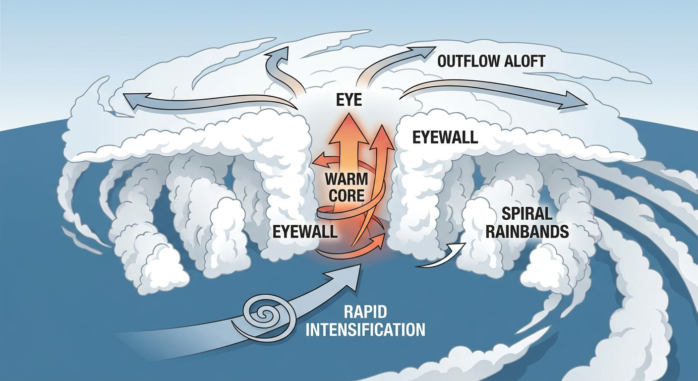
Hurricane Nolo is the stronger of the two, a Category 2 with 109 mph winds, and it is rapidly intensifying. The National Hurricane Center says cold cloud tops are expanding symmetrically around a very warm eye, which is forecaster-speak for "this storm means business." Nolo passed closest to Kauai's south shore earlier today, coming within about 40 miles, but the good news is that's open water near the uninhabited Papahanaumokuakea Marine National Monument, not the main Hawaiian Islands. A Tropical Storm Warning is up for that remote stretch of the monument. Nolo is now pulling west at 10 mph, away from the main islands.
Hurricane Rachel is the opposite story. It was a Category 2 not long ago but has lost its eyewall and is trending down, now a Category 1 with 92 mph winds sitting about 270 miles south-southwest of the tip of Baja California. There are no coastal watches or warnings in effect. Our experimental impact model flags Cabo San Lucas, San José del Cabo, and La Paz at an "aware" level, basically keep an eye on surf and rip currents, nothing more serious than that right now.
Neither storm is a US mainland threat. Think of these as the kind of systems you watch on a map with your coffee, not ones you prep for.
One to Watch Down the Road
The National Hurricane Center is also tracking a broad area of low pressure that's forecast to form south of southern Mexico late this weekend or early next week. The seven-day formation chance on that one is sitting at 80 percent, which NHC calls a High risk category. It's too early to talk tracks or impacts, this is a "we're watching it" item, not a "here's what to do" item. We'll keep you posted as model guidance comes into better agreement.
Gulf Coast: Same Soggy Story, Expanding Footprint
If you feel like you've read this paragraph before, you kind of have. A tropical wave moving across the Gulf is funneling record to near-record atmospheric moisture into the central Gulf Coast today. WPC has a Slight Risk of excessive rainfall up for the central Gulf Coast and the lower Texas coast through Sunday morning, and that Slight Risk footprint is forecast to slide northeastward into the Southeast and Carolinas by Monday.
We're talking potential rainfall totals of 4 to 8 inches from Louisiana through the Florida Panhandle this weekend, with isolated spots near 10 inches if thunderstorms keep training over the same neighborhoods. Southern coastal Texas, from around Corpus Christi down to Brownsville, could pick up another 2 to 4 inches on top of what's already fallen, locally more right along the coast.
New Orleans and Mobile are both in the thick of this. Expect urban flash flood potential in low-lying spots and standing water on streets that drain slow even on a good day. If you're flying through the Southeast this weekend, build in extra time. GSP, MOB, PNS, and RIC airports are all sitting in caution territory for delays tied to low cloud ceilings and heavy rain, while the rest of the country, more on that in a minute, looks great for air travel.
This comes on the heels of a brutal first half of September for flash flooding nationwide, from West Des Moines picking up nearly 8 inches in a day to the Northeast's 3 to 5 inch urban flood event a few weeks back. The ground and the rivers across the Southeast have had a wet month, so new rainfall on top of that soaks in less and runs off faster.
Southern California: Elevated Fire Weather Returns
Out west, an upper-level ridge is driving dry, offshore easterly winds across Southern California today and tomorrow. Relative humidity is forecast to drop to 15 to 20 percent with 10 to 15 mph winds, and the San Diego foothills could see gusts up to 30 to 40 mph. Fuels are sitting in the 70th to 80th percentile for this time of year and climbing toward the 90th percentile by Sunday as things dry out further. That combination earns an Elevated fire weather designation from SPC both days. If you're in the foothills east of San Diego, this is a good weekend to have your go-bag ready and skip the backyard fire pit.
The Best Weather in the Country Today
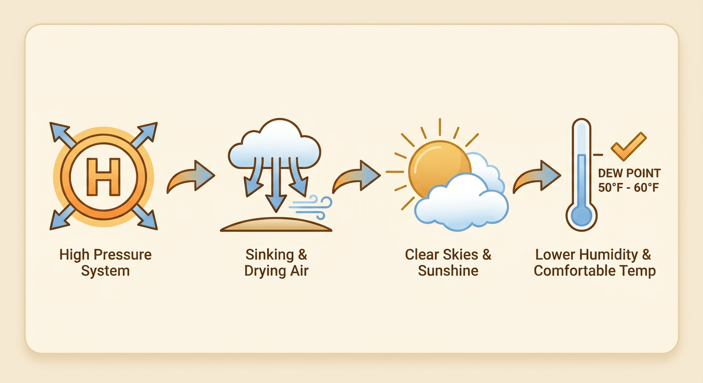
Here's your silver lining. Building high pressure behind a departing cold front has set up genuinely perfect conditions across the central Great Lakes and Ohio Valley today, clear skies, light wind, crisp dewpoints. If you're anywhere near Chicago, Cleveland, or Indianapolis this weekend, this is about as good as October gets. That same corridor shifts toward the Plains and Midwest on Sunday, with Bismarck, Sioux Falls, and Cleveland all looking beautiful, and by Monday the sweet spot stretches from Chicago through Kansas City down into the Texas Panhandle.
If you're headed to the Albuquerque International Balloon Fiesta this weekend, or driving in for Austin City Limits, the broader Southwest and southern Plains pattern looks dry and should support good flying and good outdoor conditions, though Austin itself will need to watch the Gulf moisture plume creeping toward the Texas coast later in the weekend.
A Quick Space Weather Note
Nothing to lose sleep over, but SWPC is watching for an isolated period of G1 (Minor) geomagnetic storming late today as a coronal hole high-speed stream arrives. If you're an aurora chaser up in the northern tier, it's worth a glance north after dark, though G1 is a pretty modest storm level.
What We're Watching
- Hurricane Nolo (Cat 2, 109 mph) pulling away from Hawaii's Northwestern Islands, still intensifying
- Hurricane Rachel (Cat 1, 92 mph) weakening well off Baja California, no US impacts
- New Pacific disturbance south of Mexico with an 80 percent, seven-day formation chance
- WPC Slight Risk of excessive rainfall, central Gulf Coast and southern Texas coast through Sunday, expanding into the Southeast by Monday
- Elevated fire weather for Southern California, especially the San Diego foothills, through Sunday
- Beautiful high-pressure weather sliding from the Great Lakes today into the Plains and Midwest through midweek
Bottom Line
No US mainland hurricane threat today. Hawaii dodges the worst of Nolo since it's already pulling away from the main islands, and Rachel stays offshore of Baja with no watches posted. The real headline for anyone on the ground is the Gulf Coast, where another 4 to 8 inches of rain is possible from Louisiana to the Florida Panhandle through the weekend, with flash flooding a real concern in New Orleans, Mobile, and points along the southern Texas coast. If you're in Southern California, especially the San Diego foothills, treat today and tomorrow as a fire weather day: no outdoor burning, be ready to move fast if a Red Flag Warning goes up. Everybody else from the Great Lakes through the Plains has a genuinely gorgeous few days ahead, so get outside while you can.