Blog Article
Fay, Odalys, and an Oklahoma Severe Weather Slight Risk
Tropical Storms Fay and Odalys stay offshore, but a busy Pacific tropical corridor and a Slight Risk of severe storms in Oklahoma headline today's forecast.
Two Tropical Storms Spin Harmlessly Offshore While Oklahoma Watches the Sky
Alright y'all, good Sunday morning. Let's start where the National Hurricane Center's attention is: two named storms on the board, and get this, a Pacific corridor that's basically a tropical storm assembly line right now. None of it threatens the U.S. today, but there's enough happening out there that it's worth a few minutes before we get to the stuff that actually affects your afternoon plans in Oklahoma and Chicago.
Out to Sea: Fay and Odalys Don't Threaten Land (Yet)
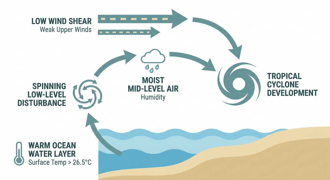
Tropical Storm Fay formed overnight in the central Atlantic, sitting about 450 miles southwest of the Azores with 46 mph sustained winds. It's a compact little storm, tropical-storm-force winds only extend about 40 miles from the center, and it's crawling north-northeast at 5 mph. NHC's forecast keeps Fay's closest approach to any land more than 600 kilometers away, out near the Azores late today. No coastal watches or warnings anywhere. This one's a fish storm, plain and simple.
Over in the eastern Pacific, Tropical Storm Odalys just got named this morning, way out about 1,245 miles southwest of the southern tip of Baja California. Here's the thing though: NHC's forecast track does eventually bring Odalys within a few hundred kilometers of San Quintín in Baja California, but that's five days out, and the storm is expected to stay offshore. We'll keep an eye on it, but there's no landfall forecast at this point.
What's actually more interesting is what's brewing behind Odalys. The Pacific has two disturbances carrying a 90% chance of development over the next two days, one of them sitting southwest of Manzanillo, Mexico, where NHC says a tropical depression is likely to form soon. A third area in the central Pacific carries a 60% chance over seven days. Translation: this corner of the Pacific is primed, and we could be naming another storm or two by midweek. None of this points at the U.S. mainland right now, but if you've got friends or family along Mexico's Pacific coast, it's worth having on your radar.
Oklahoma, Texas, and Kansas: Today's Severe Weather Slight Risk
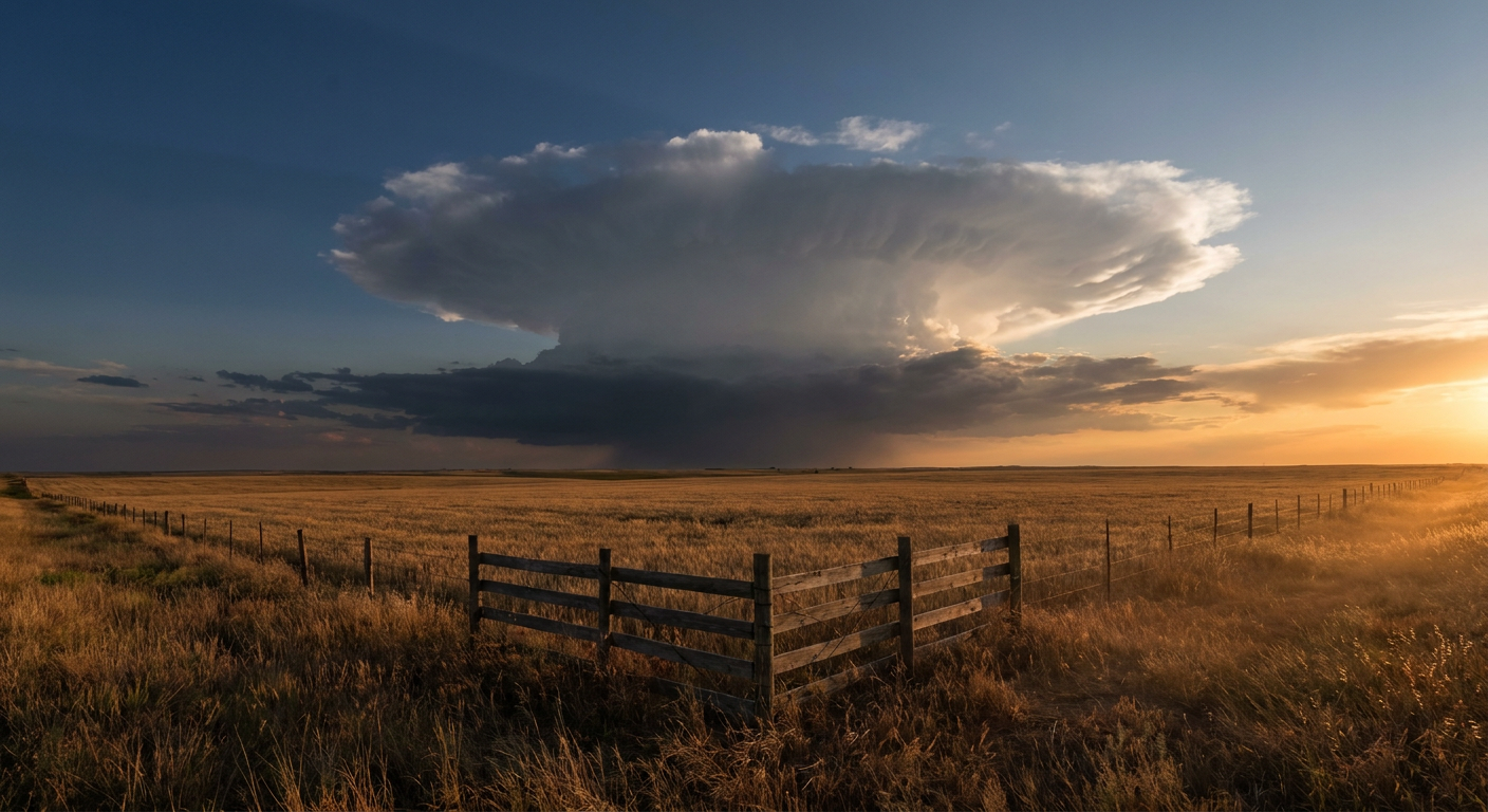
Here's the part of the forecast that matters if you're waking up in the southern Plains today. SPC has a Slight Risk posted across central and eastern Oklahoma, stretching into far western Kansas and eastern Colorado. Oklahoma City, Tulsa, Wichita Falls, Lawton, and Stillwater are all inside that zone, and if that Stillwater and OKC combo sounds familiar, yeah, the Oklahoma State Fair is still going in Oklahoma City. If you've got fairgrounds plans this evening, keep half an eye on the sky.
The setup: mid-level southwesterly flow is digging into the Plains, and MLCAPE values are climbing into a range that supports organized storms by afternoon and evening. SPC's probabilities put the wind threat at 15%, that's a scattered damaging wind threat, meaning 60+ mph gusts are possible if storms fire up. Hail probabilities sit at that same 15% level for quarter-size or larger stones. Tornado probability is low, just 2%, so isolated tornadoes aren't out of the question but they're not the headline here. A broader Marginal Risk fans out from the Ozarks into the Ohio Valley, touching Columbus, Indianapolis, Louisville, Cincinnati, and even Lubbock.
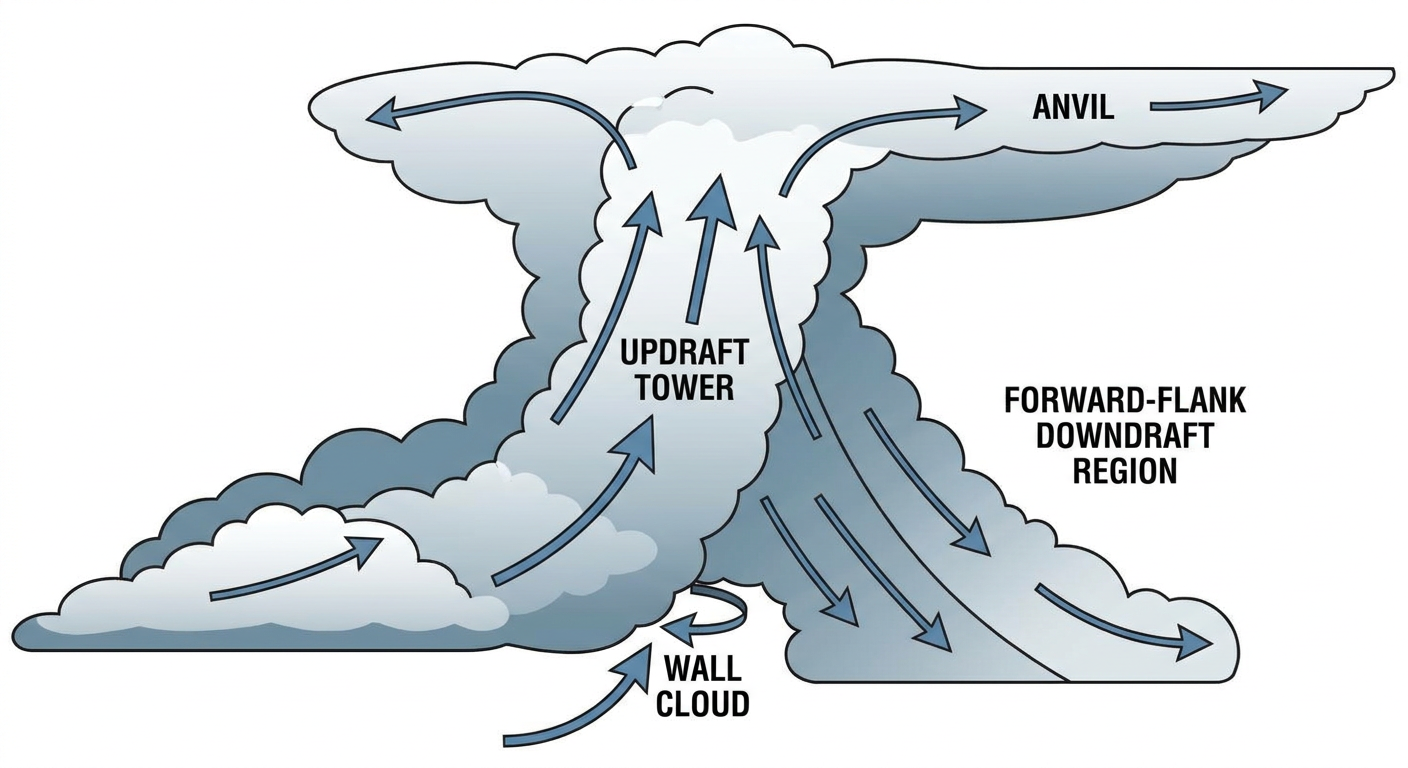
This follows a stretch of genuinely wild severe weather across the Plains this month, remember the 87 mph gust near Colby, Kansas on the 10th, and that 84 mph gust in Chanute, Kansas just last weekend that knocked down power poles. Today's setup isn't expected to be quite that intense, but the ingredients are similar enough that a strong cell or two producing damaging wind and hail wouldn't shock anybody.
Chicago's Getting Soaked (Again), and So Are Flights
While the Plains deal with severe storms, the Midwest and Ohio Valley are stuck under a Slight Risk for excessive rainfall today, with a Marginal Risk stretching into the northern High Plains. Overnight convection is lingering into the morning across southeastern Iowa and northern Missouri, slowly working east into the Ohio Valley through the day. That trending headline about hundreds of canceled flights out of O'Hare isn't a coincidence, this is exactly the kind of low-ceiling, heavy-rain pattern that grounds Midwest air travel. If you've got a flight through Chicago, Milwaukee, or the Great Lakes hubs today, build in extra time and check your airline app before you leave the house.
This is a much quieter setup than what we saw a week ago, when Des Moines picked up nearly 7.8 inches of rain in a single day and pushed Walnut Creek into moderate flood stage. Today's threat is more about localized downpours and reduced visibility than widespread flash flooding, but soils across that corridor are still saturated from the last few weeks, so it won't take much to cause localized ponding on roads.
Looking Ahead: Monday and Tuesday's Focus Shifts East
By Monday, the severe weather threat slides eastward. SPC's Day 2 outlook puts a Slight Risk over the central and southern Appalachians, covering Knoxville, Roanoke, and the Kentucky towns of Corbin, Hazard, and Jackson. A Marginal Risk spreads southwest to Charlotte, Nashville, Huntsville, Birmingham, and Chattanooga as a cold front pushes down from Texas. The setup favors wet downbursts and isolated 60 mph gusts rather than a tornado threat.
Tuesday, that Marginal Risk holds over the southern Appalachians and into the Southeast, again touching Charlotte, Atlanta, Birmingham, Knoxville, and Chattanooga. Isolated wind damage is the main concern, nothing widespread. WPC also has a Slight excessive rainfall risk lining up over the Appalachians and New Mexico for Tuesday, so if you're traveling through the mountains midweek, watch for localized heavy downpours.
On the temperature side, the broader pattern through midweek keeps a ridge parked over the central U.S., which means the southern Plains and Gulf Coast stay warm and humid. That's not far off normal for late September in places like Dallas (average high 90) or Houston (average high 89), but it does mean the AC stays busy a while longer down there while the northern Rockies and High Plains get the crisper, drier air first.
One More Thing: A Minor Geomagnetic Storm is Possible Late Next Week
Space weather is quiet right now, solar activity is running low and NOAA expects mostly quiet geomagnetic conditions through Tuesday. But SWPC's 27-day outlook flags a G1 (Minor) storm window returning September 24 through 26, on the heels of a similar Kp 5 spike back on the 16th and 17th. Nothing disruptive expected, but if you're way up north and you like chasing aurora, that stretch is worth a glance at the forecast again closer to the date.
Bottom Line
- Tropics: Fay (Atlantic) and Odalys (East Pacific) are no threat to land. Watch the corridor southwest of Manzanillo, Mexico, where a new depression is likely to form within days.
- Today's severe risk: Slight Risk across central/eastern Oklahoma into far western Kansas. OKC, Tulsa, Lawton, and Stillwater should watch for damaging wind gusts and large hail this afternoon and evening, especially if you're headed to the State Fair.
- Flight delays: Heavy rain and low ceilings are disrupting Midwest air travel today, especially through Chicago. Build in buffer time if you're flying through O'Hare or Midway.
- Monday/Tuesday: The severe threat shifts to the Appalachians and Southeast, mainly a wind and heavy rain story, not a tornado one.
- Temperatures: Warm and humid holds across the southern Plains and Gulf Coast through midweek, close to seasonal norms for late September.
Check back tomorrow as we track whether that Manzanillo disturbance gets a name, and how Monday's Appalachian severe threat shapes up.