Blog Article
Vance's Moisture Brings Flood Risk to West Texas This Week
Tropical Storm Vance weakens offshore Mexico but its moisture fuels a West Texas flash flood risk Thursday-Friday. Plus severe storms in MN/WI today and early Rockies snow.
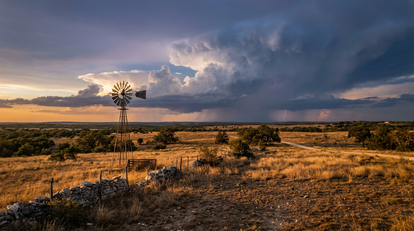
Vance Fades Offshore, But Its Moisture Is About to Soak West Texas
Alright y'all, let's start where the National Hurricane Center is watching this morning: Tropical Storm Vance, sitting about 280 miles west of Manzanillo, Mexico, with 40 mph winds and a pressure of 1003 mb. Vance has been fighting strong westerly wind shear for days now, and that fight is starting to show. Winds are down from 50 mph yesterday to 40 mph now, and the storm's low-level circulation is partially exposed on satellite.
Here's the thing though. Vance doesn't need to stay strong to matter to us. The storm is drifting north and is forecast to bring tropical-storm-force wind chances, up to a 1 in 10 shot, to Mazatlan by Wednesday night into Thursday. That's a Mexico story, not a US one. But the moisture riding along with Vance is going to peel off and head north into Texas, and that's where this gets relevant for folks in the Lone Star State.
Today's Severe Weather: Upper Mississippi Valley
Before we get to Texas, there's a more immediate concern up north. SPC has a Slight Risk posted today across east-central Minnesota and west-central Wisconsin, including the Twin Cities, Red Wing, and St. Croix Falls. A deepening surface low and a shortwave trough moving through a more zonal pattern are going to bring a few strong-to-severe storms this afternoon and evening.
The tornado probability sits at 5%, Level 2, meaning a few tornadoes are possible, and SPC has hatched part of that area for potential EF2-or-stronger tornadoes if storms do organize. Hail and damaging wind threats are lower, around 5%, Level 1. This isn't an outbreak-level setup, but if you're in that corridor this afternoon, know where you'll go if a warning comes through.
Thursday Into Friday: Vance's Leftovers Soak West Texas
Now back to the moisture story. WPC has bumped up the excessive rainfall risk for Thursday into Friday, with a Slight Risk now covering portions of West and Central Texas, stretching from the Edwards Plateau and western Hill Country out to Midland-Odessa and the Permian Basin. A Marginal Risk extends that threat into the broader West Texas region, the Panhandle, and southern New Mexico.
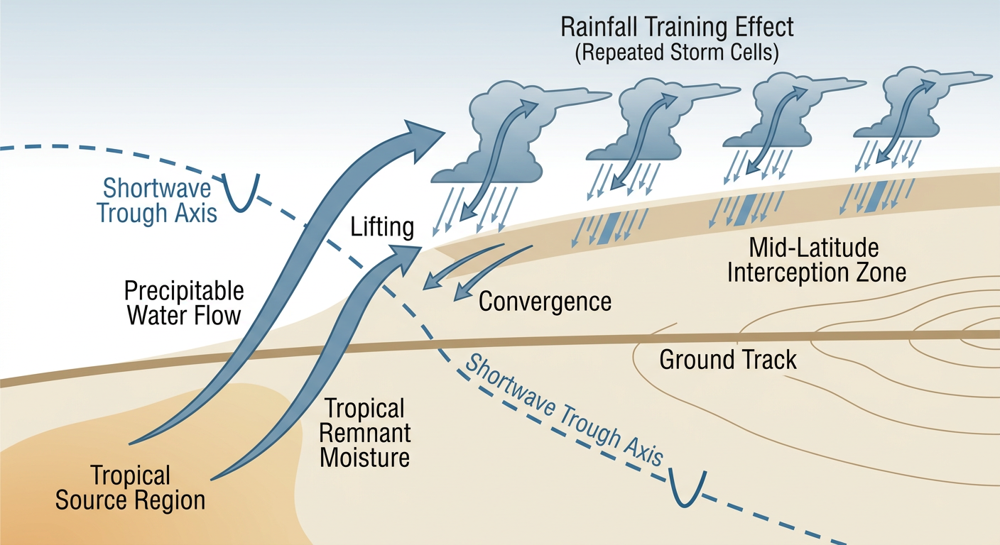
The setup: remnant moisture from Vance tracks north into Mexico before a mid-level shortwave trough scoops it up and pulls it into Texas. Precipitable water values are forecast to climb to around 1.5 to 2 inches, which is plenty juicy for this time of year. If storms start training (moving repeatedly over the same areas), rainfall rates of 1.5 to 2.5 inches per hour are possible. That's enough to cause flash flooding fast, especially given how saturated parts of this region already are.
And that saturation point matters. This has been a rough month for flooding in the Southwest. We lost someone in Socorro County, New Mexico, on Monday when their vehicle was swept away in floodwaters, and earlier in October the San Juan River flooded an estimated 1,500 structures near Farmington. Soils and burn scars across this stretch of the country don't have much give left in them. If you're in the Hill Country, the Permian Basin, or southeastern New Mexico, Thursday and Friday deserve your attention, especially around washes, low water crossings, and canyon terrain.
For context, San Antonio's average high this time of year is 82°F and Dallas sits around 79°F. We're not dealing with a temperature story here. This is a moisture and rainfall-rate story riding into a warm, humid atmosphere that's still running close to typical late-October warmth.
Looking Ahead: Early Snow for the Rockies
Jump out to the weekend and we've got our first real taste of mountain winter. An expansive upper-level trough is forecast to dig across the western US, and by Day 5 (Sunday) there's a 15% chance of accumulating snow across the Intermountain West and Central Rockies, including Provo, Orem, and Grand Junction. By Day 6 (Monday), that same risk shifts into the Central High Plains, with Denver, Aurora, and Fort Collins picking up a 15% shot at accumulating snow as the trough closes off and spins up a surface low over the Plains.
Denver's average high in late October sits around 66°F, so any snow accumulation this early would be a noticeable jump below normal. It's not a lock yet, 15% is a real but modest chance, so keep an eye on the forecast as we get closer to the weekend.
Quick Hits
- Tropical Storm Vance: weakening, no direct US threat, but feeding moisture into the West Texas rain event Thursday-Friday
- SPC Slight Risk today: east-central MN and west-central WI, isolated tornado and hail/wind threat this afternoon
- WPC Slight Risk Thursday-Friday: Edwards Plateau, Hill Country, Midland-Odessa, Permian Basin; flash flooding is the main concern given already-saturated ground across the Southwest
- Rockies snow watch: 15% accumulating snow chances Sunday into Monday across the Intermountain West, Central Rockies, and into Denver
- Nice weather bright spot: Thursday brings a near-PERFECT pocket of crisp, dry air to northeastern Nebraska, northwest Iowa, and southern Minnesota, with highs in the mid-50s to low 60s, right around Minneapolis's seasonal norm of 58°F
- Breeders' Cup watch: Friday's forecast favors central Ohio, West Virginia, and northeastern Kentucky with the day's best weather, good news if you've got plans tied to Lexington that weekend
- Space weather: a minor G1 geomagnetic storm is possible around Halloween night, nothing that affects daily life, but aurora watchers at high latitudes might get a peek
Bottom Line
Vance is winding down and isn't a US threat on its own, but don't let that distance fool you. Its moisture is the fuel for a legitimate flash flood setup across West and Central Texas Thursday into Friday, especially the Hill Country, Permian Basin, and Panhandle. If you live or travel through that corridor, have a plan for sudden heavy rain and avoid low water crossings after dark. Up north, keep half an eye on the sky this afternoon across the Twin Cities and west-central Wisconsin, where a few strong storms and an isolated tornado are possible. And if you've got mountain plans this weekend, the Rockies might just see their first real snow of the season.
https://ryanhallyall.com/blog/vance-fades-offshore-but-its-moisture-is-about-to-soak-west-texas