Blog Article
Vance's Remnants Bring Flood Risk to Texas, NM Before Arizona
Tropical Storm Vance's remnant moisture triggers a flood risk in West Texas and New Mexico today, shifting to Arizona Friday with severe storms and flash flooding.
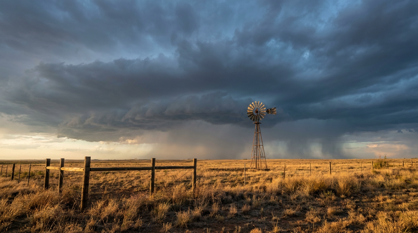
Vance's Leftovers Soak West Texas Today, Then Arizona Gets a Turn Friday
Alright y'all, Tropical Storm Vance never made it to hurricane strength and it's staying offshore of Mexico, so there's no landfall threat to worry about there. But don't let that fool you into thinking it's done causing trouble. The moisture plume riding ahead of this system is about to give West Texas and southeastern New Mexico another round of heavy rain, and that part of the country has already had a rough month for flooding.
Today's Flood Watch: West and Central Texas, Southeastern New Mexico
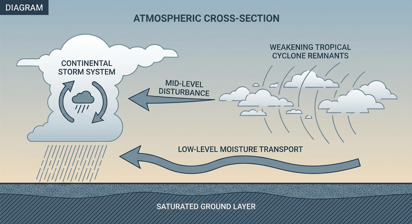
WPC has a Slight Risk of excessive rainfall up today across portions of West and Central Texas and southeastern New Mexico. Here's the setup: a mid-level disturbance tied to Vance's remnant energy is swinging into the region this afternoon, and southeasterly low-level flow out ahead of it is pulling in plenty of moisture. That's going to prime the atmosphere for some heavy rain producers through tonight.
This matters because the ground in this region is not in a forgiving mood right now. Remember, we're coming off a month that already included a flood fatality near Bernardo in Socorro County, New Mexico, a levee breach that forced evacuations in Escondida and Pueblito, and major river flooding along the San Juan River that shut down I-40 near Seama. Soils across parts of New Mexico and West Texas are saturated, and slow-moving storms don't need to drop extreme totals to cause trouble when the ground's already full.
The WFOs in Midland/Odessa and Austin/San Antonio are the ones to watch here. Expect their forecast discussions to zero in on storm training potential along the I-35 corridor and the western Edwards Plateau tonight.
Arizona's Turn: Friday Into Saturday
Once today's rain pushes through Texas, the focus shifts west. SPC has posted a Marginal Risk of severe thunderstorms for Friday across southern and central Arizona, including Phoenix and Tucson. A mid and upper level shortwave is going to dig out of the Rockies and slide southeast, and with it comes the chance for isolated strong to severe storms. We're talking damaging wind gusts and quarter-size hail with the strongest cells, nothing widespread, but enough that if you're outside in that corridor Friday afternoon or evening, keep half an eye on the sky.
At the same time, WPC has bumped Arizona into a Slight Risk for excessive rainfall both Friday and Saturday. A strong southern stream jet approaching Baja is going to put Arizona in the favorable left exit region for upper level divergence, and that combined with southerly low-level moisture means flash flooding becomes a real concern in washes, slot canyons, and especially burn scar areas. Flagstaff and the Mogollon Rim are in the bullseye for steep terrain runoff. If you've got plans in a canyon or wash this weekend, this is the kind of setup that turns a dry creek bed into a dangerous spot in a hurry.
Weekend and Beyond: Rockies Snow, Then a Plains Low
Looking further out, our winter outlook has accumulating mountain snow across the Intermountain West and the Northern and Central Rockies showing up by Sunday into Monday, with Denver, Fort Collins, and the Ogden/Logan corridor in Utah sitting in a 15% risk zone for day 4 and 5 impacts. As that system ejects into the Plains later next week, milder air should keep most of that precipitation liquid outside the higher terrain, but it's an early look at the kind of pattern change that typically ramps up once we get into November.
A Quick Nod to the Nice Weather Out There
Not every map today is about hazards. If you're in eastern Nebraska, northeastern Colorado, or eastern North Carolina, today is about as good as it gets this week, dry high pressure, light winds, clean air. That BEAUTIFUL-tier air mass actually shifts east tomorrow, settling over the central Appalachians, Ohio Valley, and Carolinas. That's good news if you're headed to the Breeders' Cup in Lexington, Kentucky, this weekend. Eastern Kentucky sits right in that pleasant zone Friday, so horse racing weather should cooperate nicely.
On the sports front, today's Packers-Panthers game in Green Bay comes after yesterday's severe weather in the Upper Midwest finally cleared out overnight, so conditions should be calmer for kickoff.
And for you marathon folks, the New York City Marathon is Sunday, November 1st, and early chatter has temperatures running warmer than normal for race day. We'll have more specifics as that gets closer, but if you're training in NYC this week, it's worth packing lighter layers than you might expect for early November.
Space Weather: Watch the Sky Halloween Night
One more thing for the sky watchers. NOAA's Space Weather Prediction Center has a G1 Minor geomagnetic storm likely on October 31st as a coronal hole high-speed stream arrives, with Kp reaching 5. That's not a disruptive event for most of us, but if you're in the northern tier and the skies are clear Halloween night, it's worth a glance upward for a shot at some aurora.
Key Factors We're Watching
- Storm training potential tonight across West Texas and southeastern New Mexico, where soils are already saturated from recent flooding
- Friday's shift of both the severe and flash flood threat into central and southern Arizona, with burn scars and slot canyons especially vulnerable
- Weekend mountain snow building across the Intermountain West and Rockies, Denver included
- A G1 geomagnetic storm possible Halloween night for northern aurora watchers
- Tropical Storm Vance itself poses no US landfall threat and continues weakening offshore Mexico
Bottom Line
If you're in West Texas, the Permian Basin, or southeastern New Mexico, today's the day to watch for sudden heavy downpours, especially this afternoon through tonight. Low-lying roads and washes can go from dry to dangerous fast given how saturated the ground already is this month. Arizona, your turn comes Friday into Saturday: keep storm safety and flash flood awareness in mind if you're near washes or burn scar terrain. Everybody else, especially in the Ohio Valley and Carolinas, enjoy the pleasant stretch while it lasts.
https://ryanhallyall.com/blog/vances-leftovers-soak-west-texas-today-then-arizona-gets-a-turn-friday