Blog Article
Viral Snow Maps Debunked: Real Forecast for Ohio Valley & California
Ignore the viral 'snow bomb' maps. We break down the real severe weather threat for the Ohio Valley and the dangerous conditions in the Sierra Nevada.
Viral Snow Maps vs. Reality: Why The East Is Sweating While The West Is Buried
Alright folks, gather 'round. We need to have a little family meeting about what you are seeing on your timeline right now.
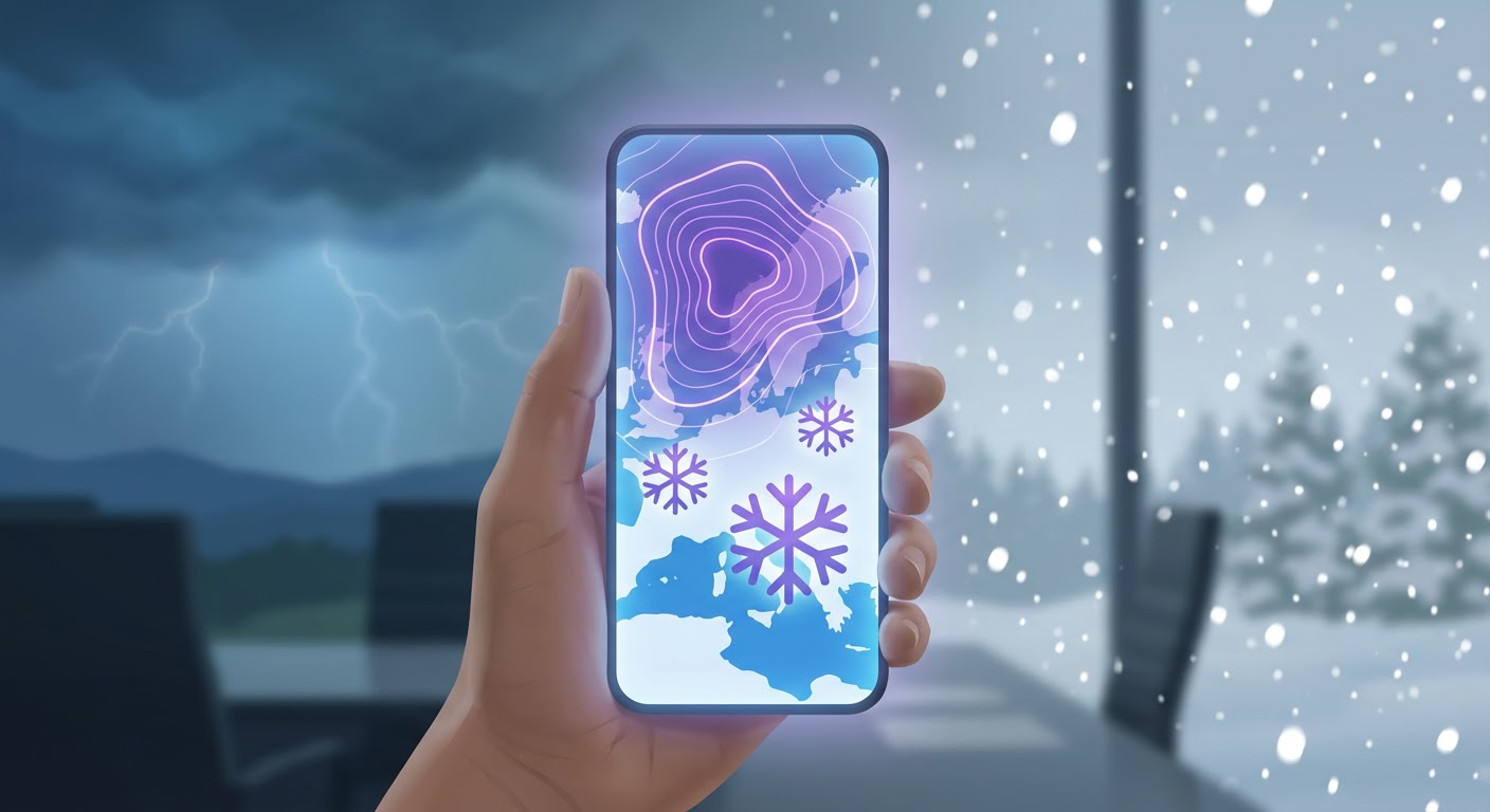
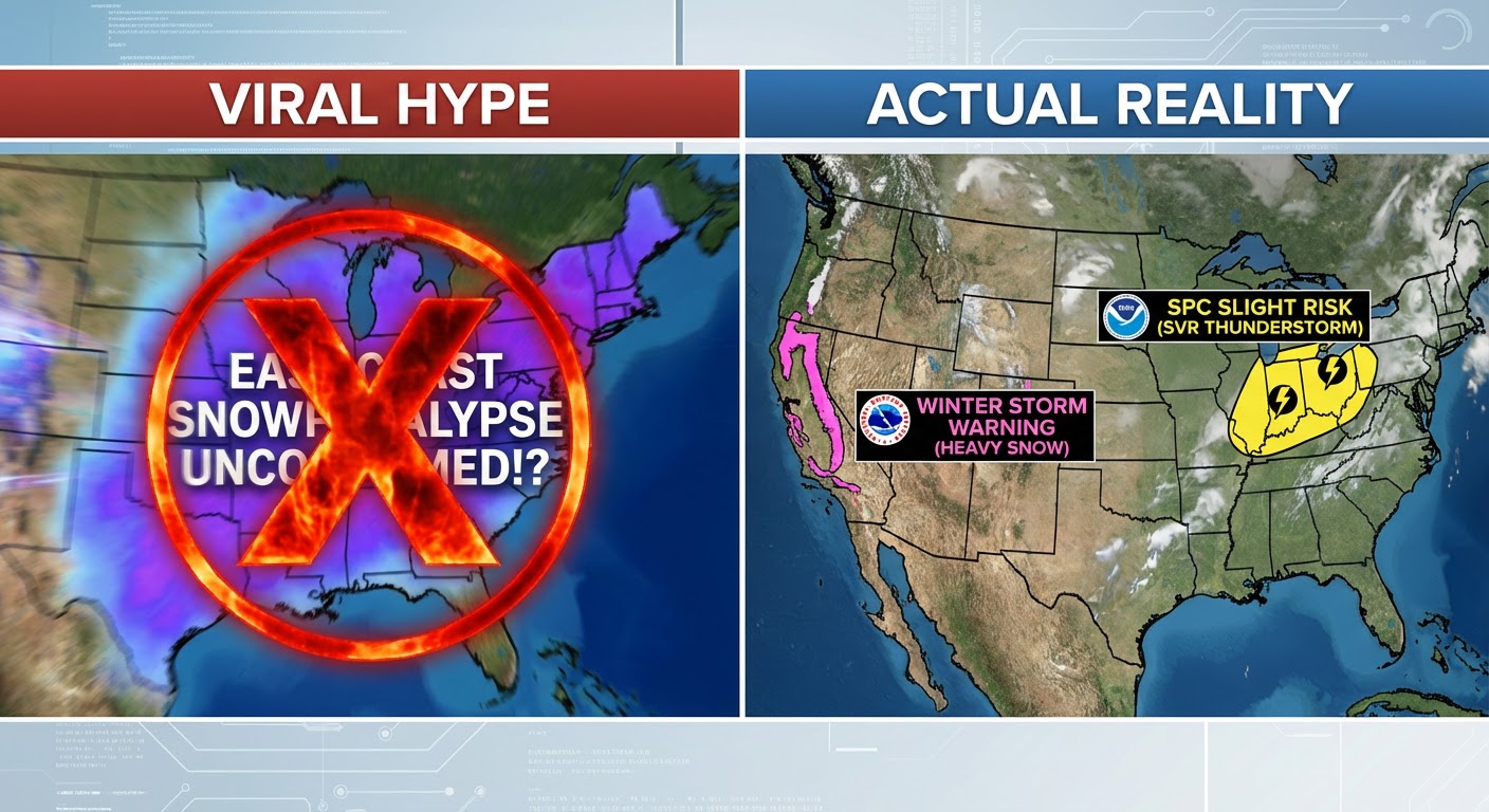
If you have been scrolling through TikTok or Twitter today, you have probably seen them. I call them the "sparkly snowmaps of doom." You know the ones. They show a massive purple blob covering the entire East Coast with 40 inches of snow a week from now. They get thousands of shares and get everyone excited for a snow day. But here is the thing. That is not happening.
We are seeing a major trend of "wishcasting" right now. That is when people share raw model data that looks cool but has zero basis in reality. While the internet is freaking out about phantom blizzards, the real weather story is actually a lot more dangerous—and it is happening tomorrow.
The Tale of Two Winters
We are living in a split-screen reality this week. Just look at the Winter Olympics over in Italy. Headlines are talking about the games being on "thin ice" because it is so warm. Well, the Eastern U.S. is feeling that same heat. We have record warmth surging up through the Mississippi and Ohio Valleys. And where you have heat meeting a cold front in February, you don't get snow. You get storms.
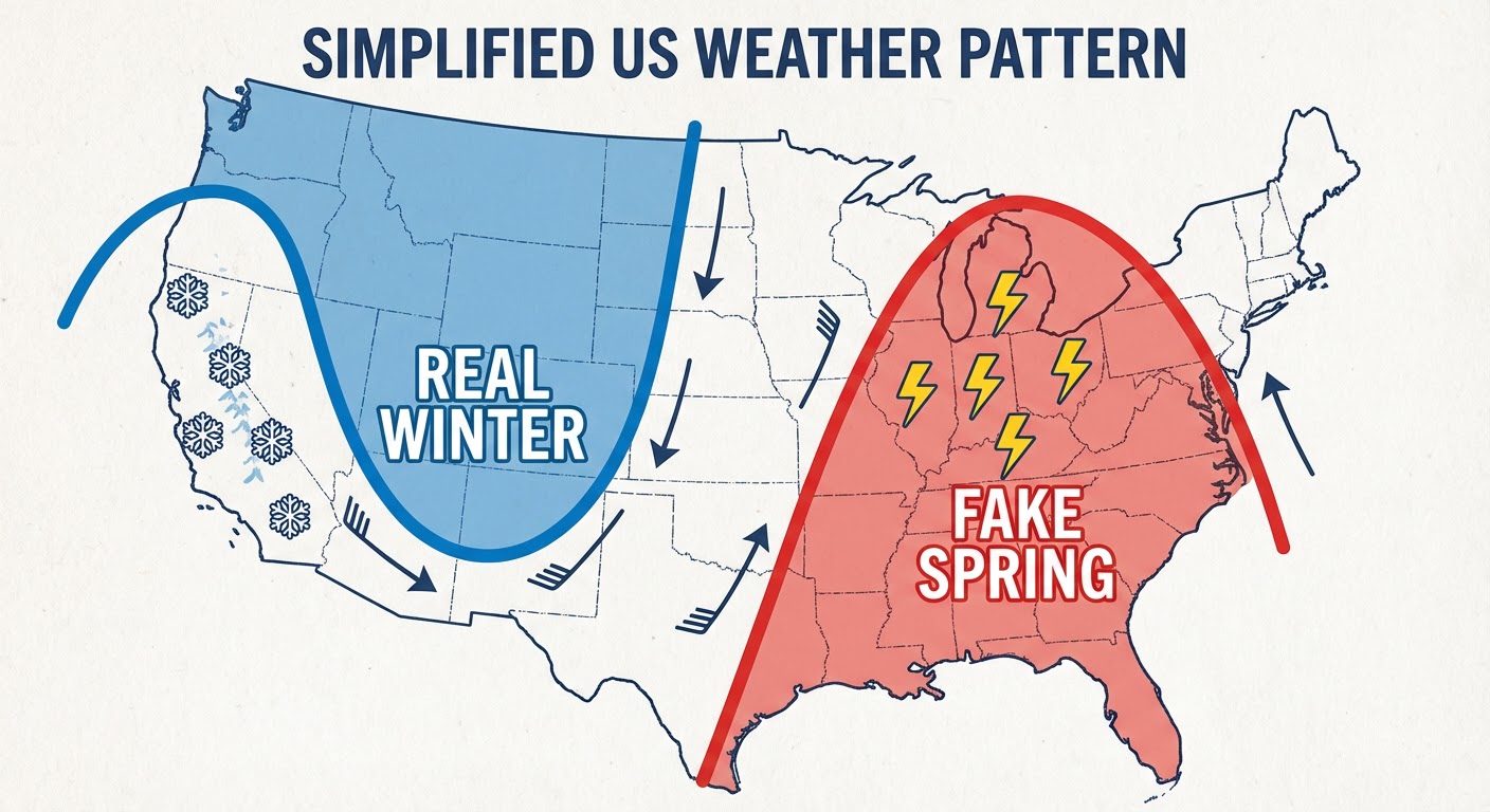
Thursday's Severe Threat (The Real Deal)
Instead of a blizzard, parts of the Ohio Valley need to be weather aware for severe thunderstorms tomorrow, Thursday the 19th. The Storm Prediction Center has issued a Slight Risk (that is a 2 out of 5 on the scale) for a chunk of the country that includes:
- Indianapolis, IN
- Cincinnati, OH
- Louisville, KY
- Springfield, IL
Here is how this plays out. A dryline is going to surge east tomorrow afternoon. We are looking at supercells capable of damaging winds, large hail, and yes, a few tornadoes. If you are in southern Indiana or northern Kentucky, have a way to get warnings tomorrow afternoon. Do not let the warm temps lull you into a false sense of security.
The West Coast: Where Winter Is Actually Dangerous
While the East is dealing with "fake spring," the West Coast is dealing with a very serious, life-threatening winter event. I saw the news today about the backcountry skiers caught in an avalanche in California. My heart goes out to those families. It is a tragic reminder that this "Sierra Siege" is not just a pretty photo op.
We have another system moving in that is going to drop snow levels down to 4,000 feet. The WPC is calling for another 1 to 2 feet of snow in the high country. This fresh powder is piling on top of the massive base we built over Presidents Day weekend. If you are near the Sierra or the Cascades, please respect the road closures and avalanche warnings. Mother Nature is not playing fair right now.
Don't Forget The Plains
I also want to mention our friends in Oklahoma and the Texas Panhandle. The fires we saw yesterday, especially that massive Ranger Road fire, were terrifying. The winds are shifting, but the fire threat is still Critical for places like Oklahoma City and Amarillo. That dry air coming off the Rockies is acting like a blow dryers on the landscape.
The Bottom Line
So here is the takeaway for tonight. If you see a map on social media showing the apocalypse ten days from now, check your source. Is it the NWS? Is it a trusted meteorologist? Or is it an engagement farmer?
The real weather is happening now. It is the tornado risk in the Ohio Valley tomorrow. It is the avalanche danger in California. And it is the fire threat in the Plains. Stay safe, ignore the hype, and keep your eyes on the sky.
Y'all stay safe out there.