Blog Article
Weather Whiplash: Northeast Snow vs Arizona Heatwave
From record-breaking snow in RI to 90-degree heat in AZ, we break down the extreme weather divide and what's coming next for the weekend.
Weather Whiplash: From record blizzards to 90 degrees
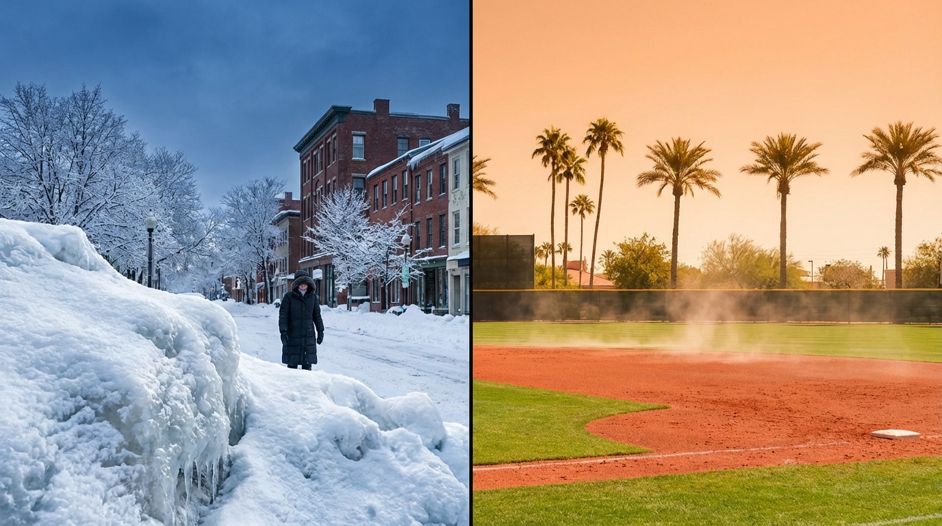
Alright folks, let's take a deep breath. If you are in New England, specifically Rhode Island or Eastern Mass, you are probably reading this while taking a break from shoveling what is officially a record-breaking amount of snow. Warwick, Rhode Island picking up nearly 38 inches is absolutely bonkers. That is the kind of snow you tell your grandkids about.
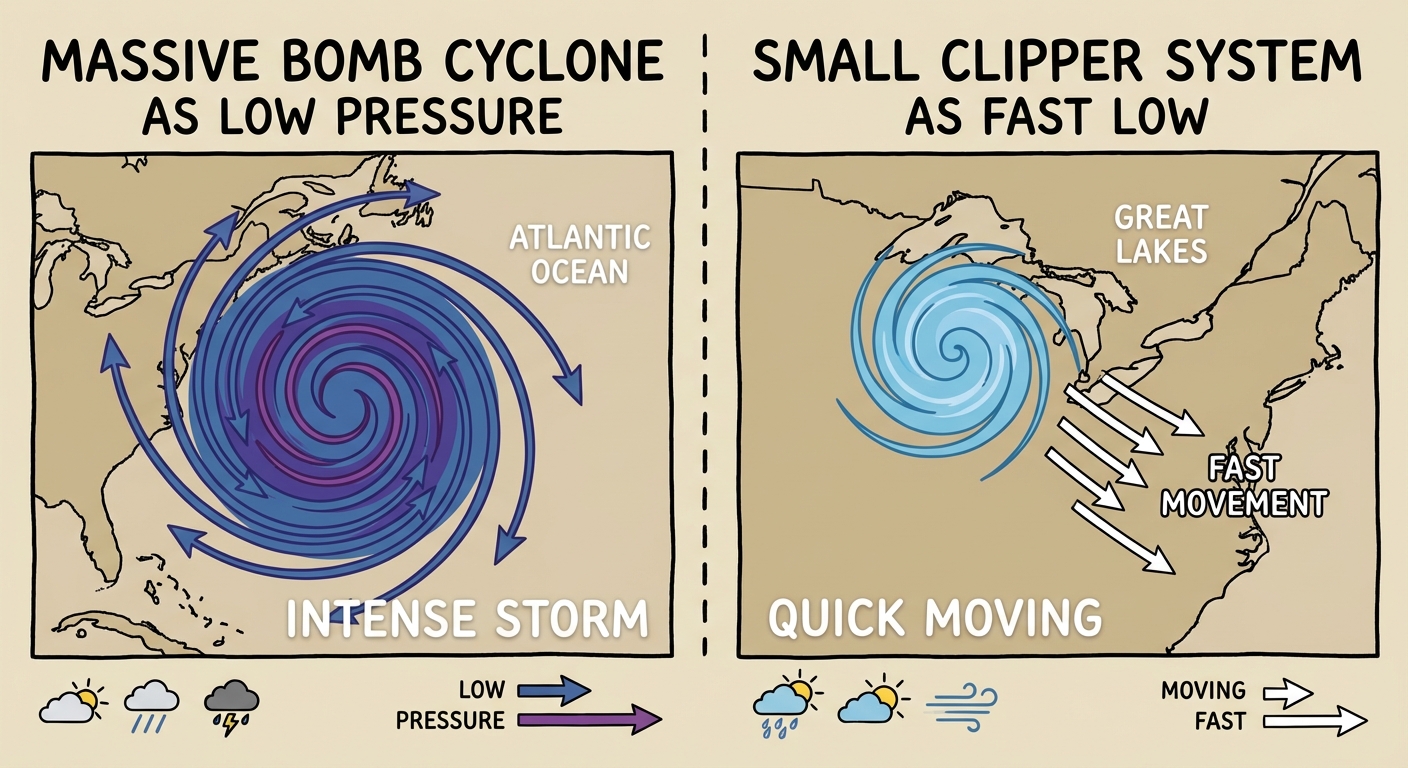
But here is the thing. The atmosphere doesn't like to sit still. While the East Coast is digging out from that historic bomb cyclone, the rest of the country is entering a period of extreme weather whiplash. We are talking about a swing from blizzard recovery to near-record heat in the Southwest. It is a split-screen reality today.
The Northeast: One Last Jab
I know y'all don't want to hear this, but we aren't completely done with the snow just yet. Now, don't panic. The monster storm is gone. But we have a "clipper" system diving down from Canada today and tomorrow.
Think of a clipper like a fast-moving compact car compared to the 18-wheeler that just hit you. It moves quick and it doesn't carry a ton of moisture. However, because it is so cold, the snow that falls will be fluffy and stick immediately.
Here is what to watch for:
- Great Lakes to Tug Hill: You could see another 4+ inches of lake-effect snow.
- I-95 Corridor: This looks mostly like a nuisance. Maybe a coating to an inch to cover up the plowed streets again.
- Temperatures: It is going to stay cold, so that snow isn't melting naturally anytime soon.
The Southwest: Summer in February?
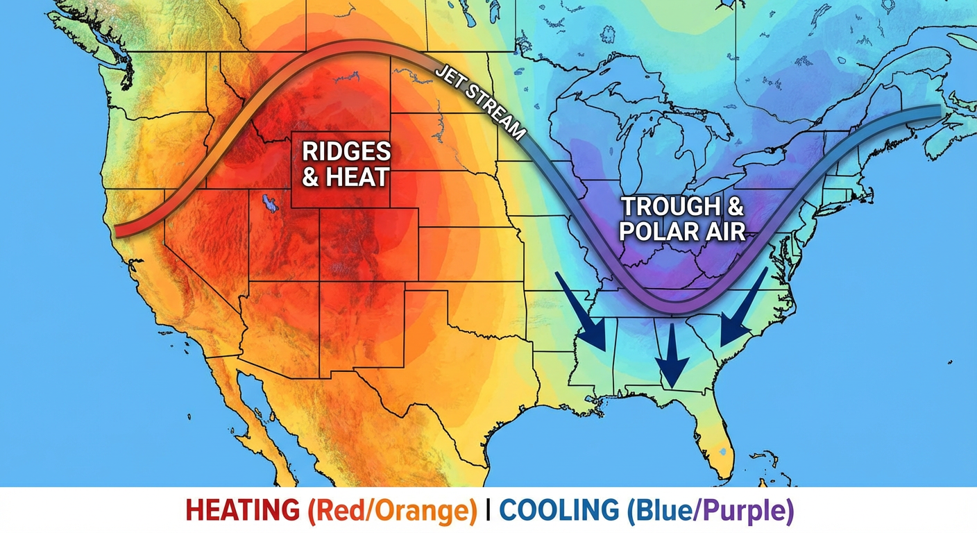
While the East is shivering, check out what is happening out West. We have a massive ridge of high pressure building, and it is shutting off the atmospheric river machine that has been soaking California.
If you are heading out to Spring Training games in Arizona today—maybe watching the Dodgers or the Guardians—you need to ditch the hoodie and grab the sunscreen. We are forecasting highs exceeding 90 degrees in parts of Arizona and Southern California.
This heat is expanding into the Southern Plains too. But there is a downside. The combination of this heat, dry air, and gusty winds is creating Critical Fire Weather conditions in Eastern New Mexico and West Texas. If you are in Roswell or Hobbs, please be careful with anything that could spark a flame. The ground is dry and the wind is ready to carry a fire fast.
The Next Pattern Flip
We are watching a major pattern change heading into the weekend. This warm-up in the Central US is what I call a "False Spring." Enjoy it while it lasts, because a strong cold front is going to come crashing down from the north by Saturday and Sunday.
Here are the key factors/timeline:
- Friday: Rain and thunderstorms for the Southeast (beneficial rain for the drought, not a major severe outbreak).
- Saturday: The cold front sweeps through, dropping temps significantly.
- Sunday - Tuesday: This is the timeframe I am watching closely. Models are hinting that moisture might overrun that cold air in the Tennessee Valley and Mid-Atlantic.
Depending on how that sets up, parts of the Mid-Atlantic or Northeast could see a messy wintry mix early next week. It is too early for specifics, but just know that winter isn't packing up its bags just yet.
Bottom Line
If you are in the Northeast, keep the shovel handy for a light dusting, but the worst is behind you. If you are in the Southwest, stay cool and hydrated. And for everyone in the middle, enjoy the rollercoaster. We will keep watching that threat for early next week and update you as soon as the data gets clearer.
Stay safe out there, y'all!
https://ryanhallyall.com/blog/weather-whiplash-from-record-blizzards-to-90-degrees