Blog Article
Winter Storm Warning: Ice & Snow Target South and East This Weekend
A significant winter storm threatens the South with freezing rain and snow this weekend. Plus, a new Arctic blast for the Plains. Get the latest forecast.
Weekend Warning: The Ice Threat Grows for the South & East
Alright folks, look alive. We have been tracking this pattern for a few days now, and the data is starting to paint a clearer picture. And to be honest with y'all, I don't love what I am seeing for the weekend. We have already had a wild week with that historic solar storm giving folks in Alabama a light show and lake effect snow burying parts of New York. But now, our attention has to shift to a developing situation that could bring a messy mix of ice and snow to the South and Mid-Atlantic.
Here is the thing. We still have that heavy, cold Arctic air parked over the country. It is not going anywhere. In fact, it is about to get a recharge. When you combine that stubborn cold with moisture coming up from the Gulf, you get trouble.
The Midwest Clipper: Quick but Tricky
Before we get to the weekend mess, we have to talk about what is happening right now in the Midwest. A "Clipper" system—that is a fast-moving low pressure system diving down from Canada—is sweeping through the Great Lakes region through Wednesday.
If you are in Iowa, southern Wisconsin, northern Illinois, or Michigan, expect a quick burst of snow. We are generally talking 1 to 3 inches, but if you are near Lake Michigan, lake enhancement could bump that up to 6 inches in spots. If you are commuting around Chicago or Grand Rapids, take it slow. We saw that nasty pileup on I-196 yesterday, and we do not want a repeat of that.
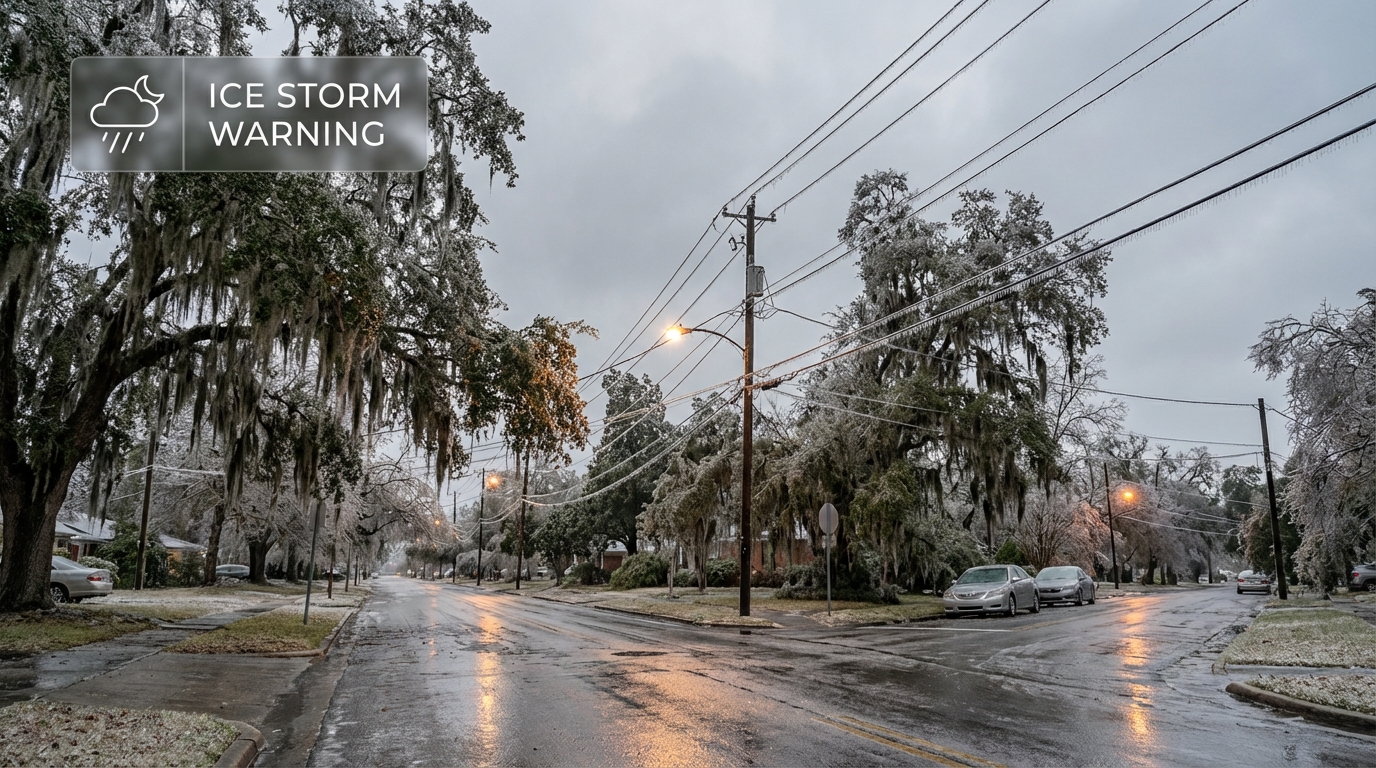
The Main Event: Significant Icing Threat
Now, let's talk about the big story. Starting Friday, energy from the Southwest is going to interact with that deep freeze. The WPC is calling for a "significant winter storm" and confidence is increasing.
Here is the timeline:
- Friday: It starts in the Southern Plains. We are watching Oklahoma and Texas closely. North Texas could see snow, but central Texas is in a danger zone for freezing rain. If you have plans for the KidsLinked North Austin festival prep, keep an eye on this. Roads could get slick fast.
- Saturday: The mess moves east into Arkansas, Tennessee, and the Deep South. The cold air is going to be deep and shallow, which is a classic setup for sleet and freezing rain.
- Saturday Night into Sunday: The system targets the Carolinas and the Mid-Atlantic. I am looking at you, Charlotte. I know the Big Southern Classic Battle of the Bands is scheduled for Saturday. This forecast is trending toward a wintry mix that could make travel very difficult.
Why I am worried about ice:
When we talk about snow, it is fun. When we talk about freezing rain, it is dangerous. The data suggests a "warm nose" of air aloft will melt the snow, but surface temps will be in the 20s. That rain freezes on contact. This can weigh down power lines and snap tree branches. If you are in that corridor from Central Texas across to North Carolina, now is the time to check your emergency kits.
The Reinforcing Cold Shot
Behind this system, the bottom falls out again. We are looking at another surge of Arctic air plunging into the Northern Plains late week. We could see wind chills drop to -50 degrees in the Dakotas and Minnesota. That is not just cold. That is life-threatening if you are outside for more than a few minutes.
Even down in Florida, you are not escaping this. By the weekend, that cold front pushes through, and we could be looking at more freeze warnings for the Sunshine State. If you are heading to the Boca Raton Beer Wine and Spirits Fest on Saturday, you might need a heavy coat over your festival gear.
Bottom Line
- Midwest: Watch for slick roads through Wednesday morning from the Clipper system.
- The South: Friday and Saturday look increasingly messy. There is a high risk of travel disruptions from Texas to the Carolinas due to ice and snow.
- Mid-Atlantic: Sunday is your day to watch. Snow and ice could impact the I-95 corridor.
- Prepare: If you live in the icing threat zone, make sure you have batteries and blankets ready in case the power flickers.
We will keep watching the models and update you as we get closer. Stay safe and keep warm, y'all!
https://ryanhallyall.com/blog/weekend-warning-the-ice-threat-grows-for-the-south-east