Blog Article
World Cup Fans Face Extreme US Weather: Floods & Supercells
International tourists are getting a crash course in extreme American weather this week, from Texas flash floods to Central Plains supercells.
Welcome to America: Soccer, Brisket, and Flash Floods
Get this, y'all. The World Cup is in full swing. Hundreds of thousands of fans from all over the globe are visiting the States right now. I read a story today about tourists discovering Buc-ee's, brisket, and big dogs for the first time. It is a massive culture shock.
But they are getting a crash course in something else, too. Extreme American weather.
Tourists are shocked by it. Locals are just trying to get through it. The atmosphere over the United States operates on a completely different scale than most of the world, and we are seeing two perfect examples of that right now.
The Texas Water Hose
If you are down on the Texas or Louisiana coast, you know exactly what I mean. We have a Moderate Risk of excessive rainfall in effect right now for the central Gulf Coast.
The remnants of Tropical Storm Arthur are basically acting like a giant water hose stuck in the "on" position. Houston usually sits around 91 degrees this time of year. Right now, it is just saturated. We are talking about intense rainfall rates that have already caused major issues. The ground simply cannot take any more water.
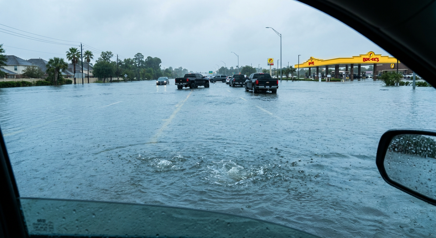
When you get tropical moisture trapped along the coast like this, the water rises fast. It does not care if you are trying to get to work or trying to get to a soccer match at NRG Stadium.
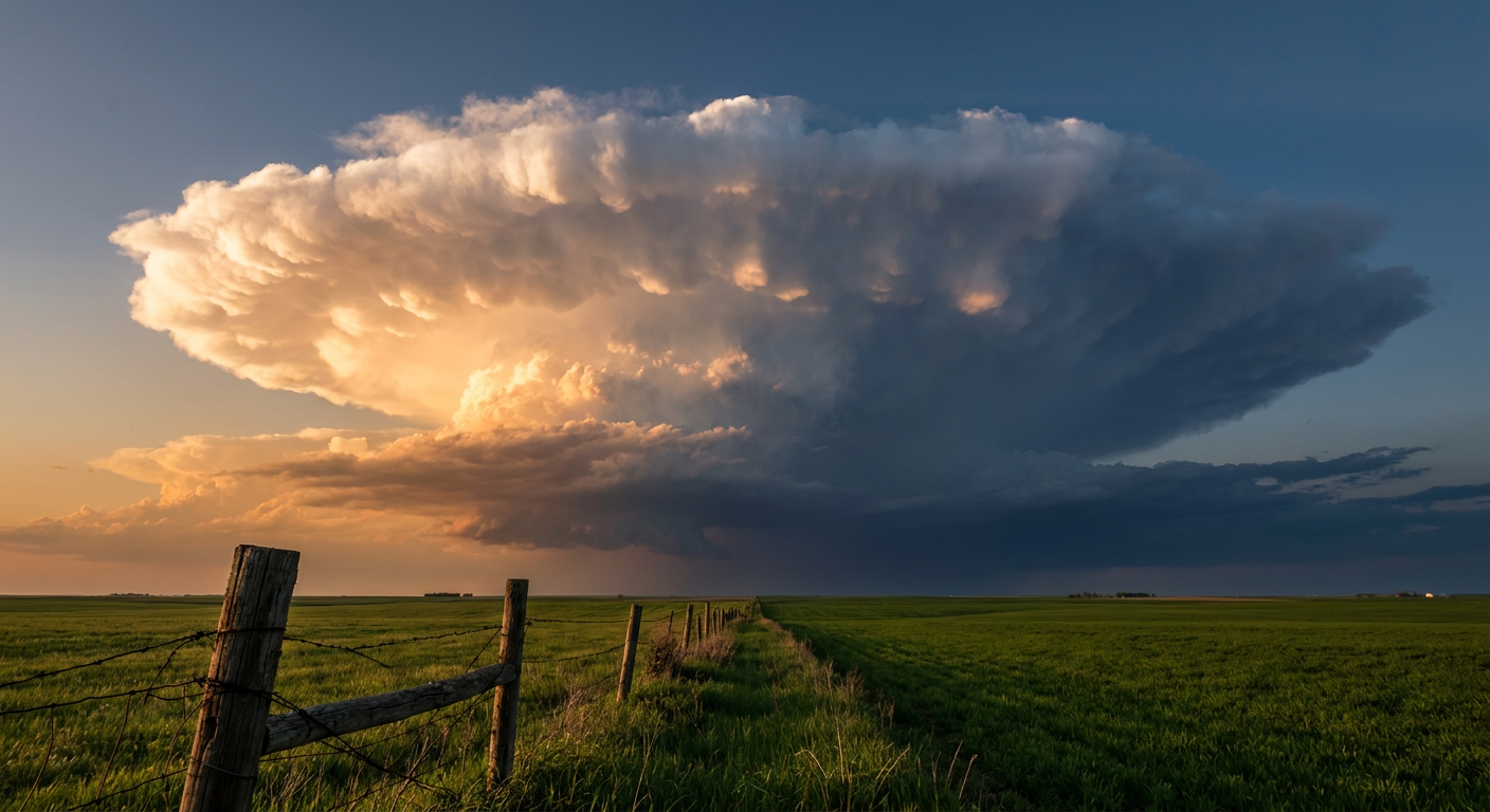
Tomorrow's Main Event: The Central Plains
But the Gulf Coast is not the only place putting on a show. Tomorrow is Saturday, and the Central Plains are setting up for a classic, high-end severe weather outbreak.
The Storm Prediction Center has issued an Enhanced Risk for eastern Colorado and western Kansas. Cities like Burlington, Colorado, and Beloit, Kansas, are right in the bullseye.
Here is the setup. A low-pressure system is going to deepen right off the Rocky Mountains tomorrow afternoon. It is pulling rich moisture north into the plains. When you mix that humid air with the dry air coming off the mountains, things get highly volatile.
The data shows a 30 percent chance for severe wind and hail in this zone. But the intensity is what you really need to watch. We have a hatched area for hail, meaning we could see stones two inches across. That is hen-egg size. We also have a hatched area for wind, meaning gusts could top 75 mph.
And yes, there is a 5 percent hatched risk for tornadoes in that same Colorado and Kansas area. That specific hatched label means if a tornado forms, the environment supports it reaching EF2 strength or higher.
The Bottom Line
American weather does not do anything halfway. We have feet of rain falling in the South and massive supercells brewing in the Plains. If you have friends or family visiting from out of the country for the games, do them a favor. Make sure they have a good weather app on their phone. Explain what a tornado warning actually means.
We are used to this kind of atmospheric chaos. To the rest of the world, it is a completely different ballgame.
https://ryanhallyall.com/blog/welcome-to-america-soccer-brisket-and-flash-floods