Blog Article
Texas Severe Weather: Big Hail and Flash Floods Tuesday
A new weather system brings a threat for 2-inch hail to West Texas and nocturnal flash flooding to the Hill Country on Tuesday. Read the full forecast.
West Texas Braces for Big Hail, While the Southeast Stays Soaked
Happy Memorial Day, y'all. If you are grilling in the Southeast today, you probably have a tarp over the smoker. We are still tracking that steady plume of moisture dropping heavy rain from the Central Gulf Coast up into the Southern Appalachians. We have a Slight Risk for excessive rainfall there today, so keep the umbrellas handy if you are heading to a local parade or outdoor event.
But as we look ahead to Tuesday, the active weather shifts back west. We have a potent setup taking shape across Texas that requires your attention.
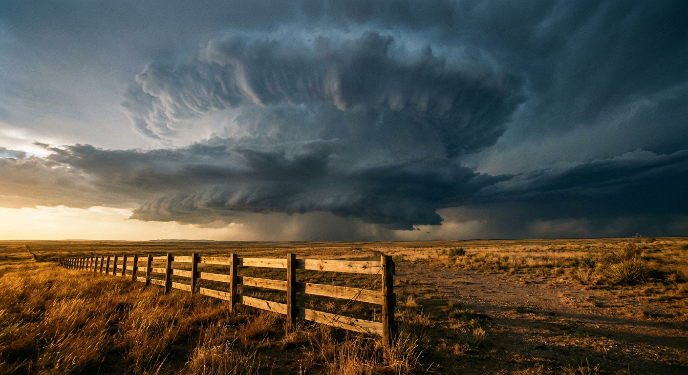
The West Texas Hail Threat
Tomorrow afternoon, a robust upper-level trough is going to dig into the Great Basin. That energy will sweep east and spark scattered severe storms across West Texas and Southeastern New Mexico.
The Storm Prediction Center has a Level 2 Slight Risk posted for Tuesday, covering places like Midland, Odessa, and Andrews. The main hazard here is large hail. The data shows a 15 percent probability for severe hail, and there is a specific hatched area highlighting a significant hail threat. That means if a discrete supercell gets going, it could drop hailstones two inches in diameter or larger. That is hen-egg size, which will absolutely dent a vehicle or damage a roof.
We are also looking at a 15 percent chance for damaging wind gusts over 60 mph and a 2 percent chance for an isolated tornado. The tornado threat is low, but you still need to have your warning plan ready.
Flash Flooding for the Hill Country
The severe threat is just the first part of the story. As those storms move east Tuesday night, they are going to merge into a larger complex and dump a lot of water.
The Weather Prediction Center has outlined a Slight Risk for excessive rainfall across Central and West Texas for Tuesday into Wednesday. This includes the Hill Country and the I-35 corridor down through San Antonio. Normal high temperatures in San Antonio are in the upper 80s this time of year, so the atmosphere holds plenty of moisture.
We are particularly concerned about a nocturnal flash flood threat. When heavy rain falls over the rocky terrain of the Hill Country in the dark, water levels in creeks and low water crossings can rise incredibly fast.
Fire and Heat Up North
While Texas deals with storms, the northern tier of the country has a completely different setup. We have a Critical Fire Weather area today for northwestern Nevada into southeastern Oregon. Winds are picking up ahead of a cold front, and the humidity is dropping down to 15 percent. Any spark there will spread quickly.
Meanwhile, eastern Montana is baking. Temperatures there could approach 100 degrees today. That is major heat for late May, creating a dangerous environment for anyone spending extended time outdoors.
The Bottom Line
If you live in the Permian Basin, park your cars in the garage or under a carport Tuesday afternoon to protect them from potential hail. If you are in the Texas Hill Country or along the I-35 corridor, make sure your phone is charged and your weather alerts are turned on loud enough to wake you up Tuesday night. Never drive through a flooded low water crossing. Turn around and find another route.
https://ryanhallyall.com/blog/west-texas-braces-for-big-hail-while-the-southeast-stays-soaked