Blog Article
What is TDS? Tornadic Debris Signatures & Ohio Valley Storms
TDS is trending online, but what does it mean in weather? We explain Tornadic Debris Signatures and break down Friday's severe storm risk in the Ohio Valley.
What "TDS" Actually Means For Weather Nerds
Alright folks, I was looking at what is trending online tonight, and I noticed a whole lot of people searching for the phrase "what is tds". Now, I know the political news is driving that search right now. But in the weather community, those three letters mean something completely different. And honestly, it is something we have seen way too much of lately.
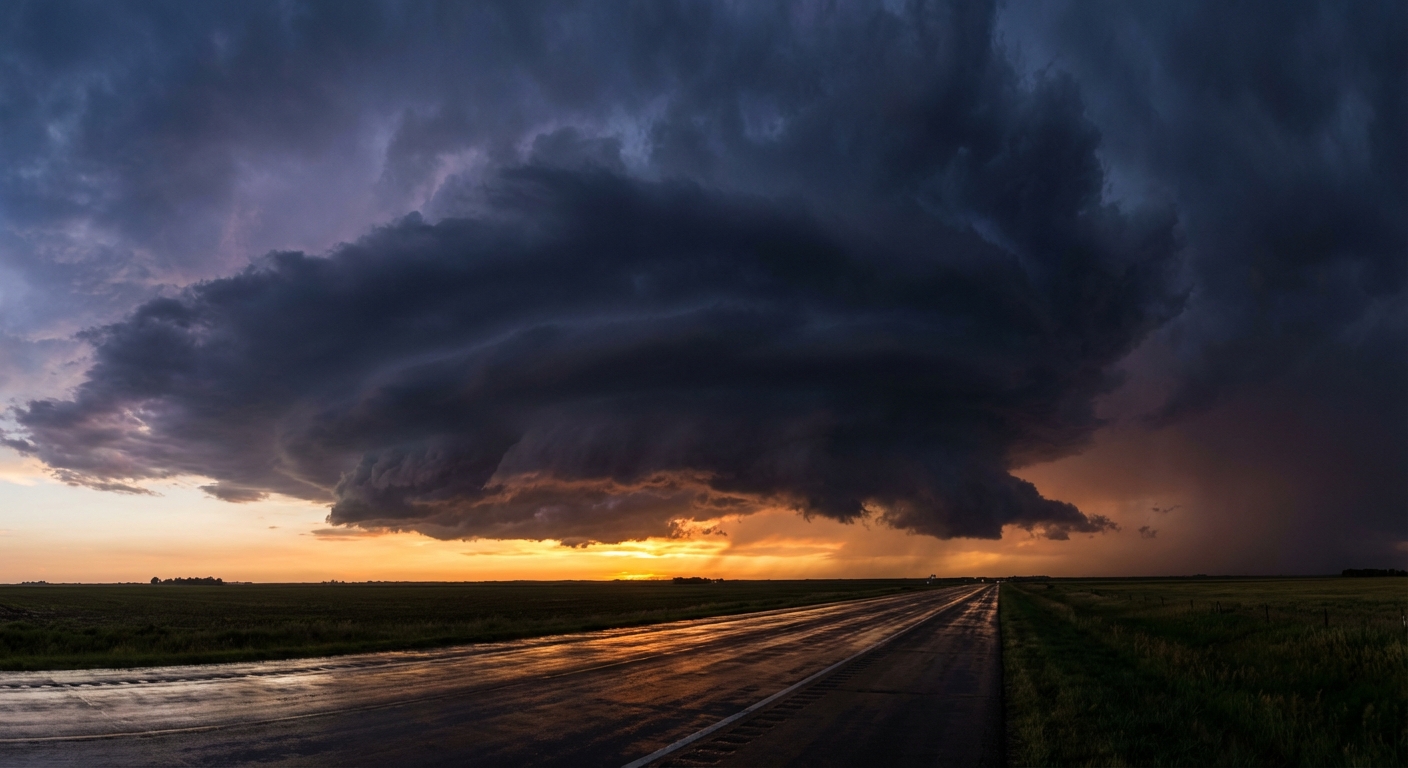
In meteorology, TDS stands for Tornadic Debris Signature. Here is the thing. When a tornado touches down and starts doing damage, it lofts pieces of trees, leaves, dirt, and sometimes parts of buildings high into the air. Modern weather radar sends out a dual-polarized beam that can actually tell the difference between raindrops and flying debris. When we see a tight area of rotation paired with a sudden drop in what we call "Correlation Coefficient", that is a TDS. It is absolute proof that a tornado is on the ground doing damage.
If you have been following our coverage this month, you know we have used that term a lot. From the tragic tornadoes in Beggs, Oklahoma, to the destructive long-track storms in Indiana, our radar screens have lit up with TDS markers. It has been a wild, destructive March.
Your Weekend Forecast: March Madness and Marginal Risks
Speaking of wild, the atmosphere is having its own March Madness tournament right now. Get this. We have an unbelievable temperature divide across the country. Phoenix is already hitting 100 degrees, which is just crazy for this early in the year. Meanwhile, folks in upstate New York and Vermont are bracing for another 2 to 5 inches of wet, heavy snow tomorrow.
But right in the middle, we are tracking a severe weather threat for your Friday.
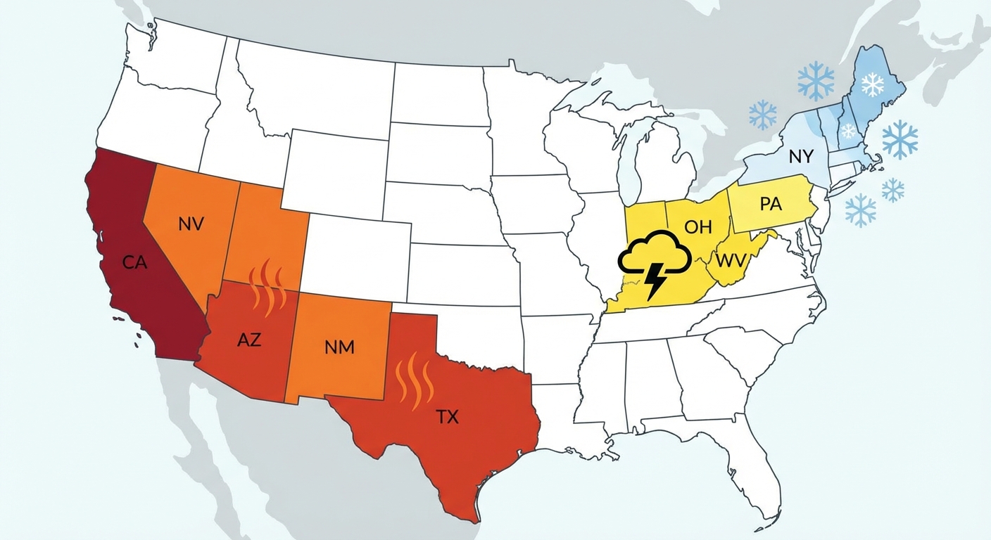
The Storm Prediction Center has outlined a Marginal Risk, which is a level 1 out of 5, for the Upper Ohio Valley. This includes cities like Columbus, Cincinnati, and Pittsburgh.
- The Timing: Late Friday afternoon into the evening.
- The Threats: We are mainly looking at a 5 percent chance for damaging wind gusts and large hail.
- Tornado Risk: There is a low 2 percent risk for a brief spin-up tornado.
Now, a 2 percent risk is low, but it is never zero. If you are heading out to a sports bar in Ohio or Pennsylvania tomorrow night to catch the big VCU basketball game or just enjoy the start of the weekend, you need to stay weather aware. The moisture return is a bit questionable, so we might just see some heavy rain and gusty winds, but we will be watching the radar closely to see if any of those storms start rotating.
We are also keeping a very close eye on Wyoming, where critical fire weather conditions are ongoing. The winds are howling out there and the humidity is bone dry.
Stay safe, keep an eye on the sky, and have a great weekend, y'all!
https://ryanhallyall.com/blog/what-tds-actually-means-for-weather-nerds-plus-your-friday-storm-risk