Blog Article
Severe Weather in February? Tornado Risk for Ohio Valley & Midwest
A multi-hazard storm brings fire danger to the Plains and a Level 2 tornado risk to Indiana, Kentucky, and Ohio this Thursday. Here is what you need to know.
Whiplash Weather: Why We're Talking Tornadoes in February
Alright folks, grab your coffee and pull up a chair. If you have been following along with us since yesterday, you know we talked about how the internet loves to hype up "doom maps" while ignoring the real threats. Well, today those real threats are knocking on the door.
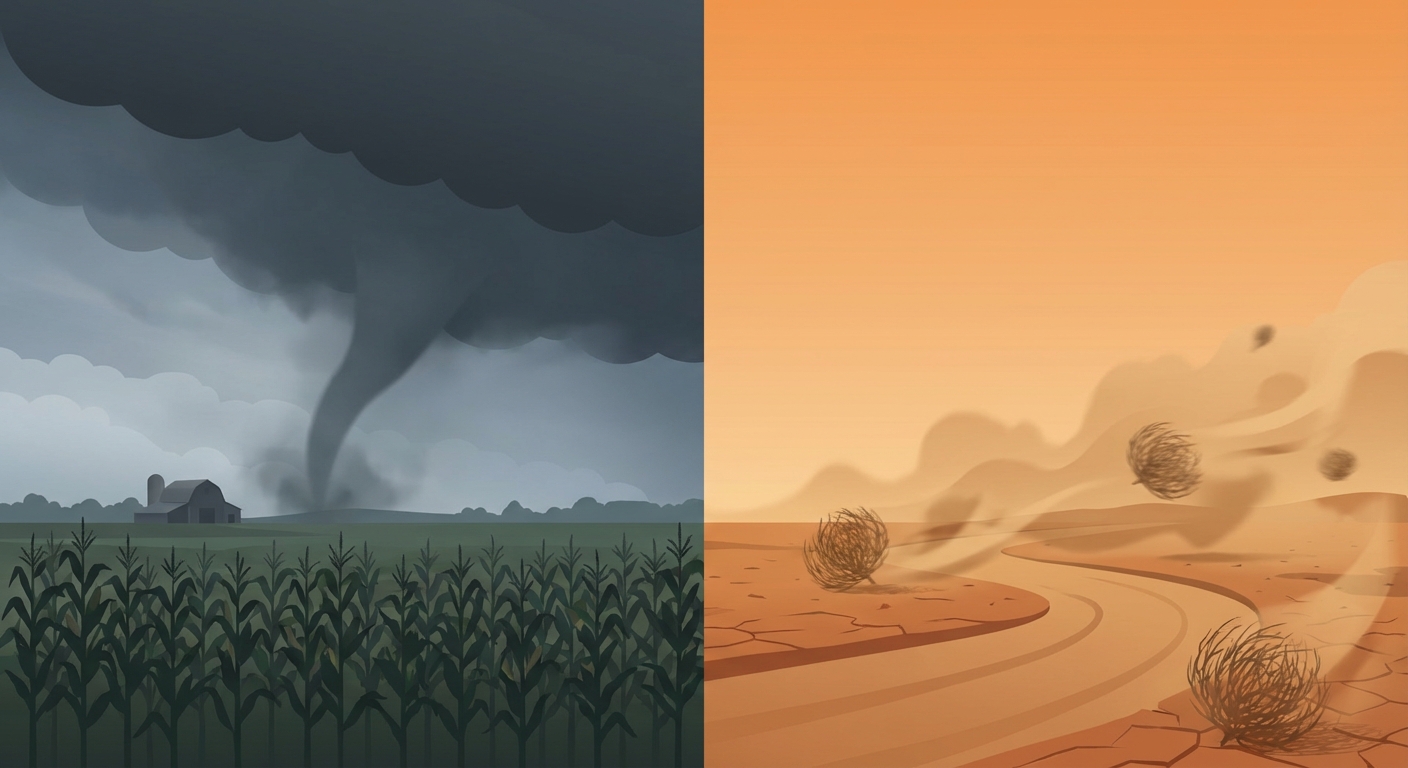
We are looking at a classic case of weather whiplash. Yesterday we saw that heartbreaking Ranger Road fire explode in Oklahoma and scary pileups on I-80 in Wyoming. That same storm system is now moving east, and it is changing its personality completely.
The Thursday Threat: Severe Storms in the Midwest
Here is the thing. usually in February, we are talking about wind chills and snow shovels in the Ohio Valley. But tomorrow, on Thursday, we need to be talking about wind shear and tornado sirens.
The Storm Prediction Center has issued a Slight Risk (that is a Level 2 out of 5) for severe weather across parts of Illinois, Indiana, Kentucky, and Ohio.
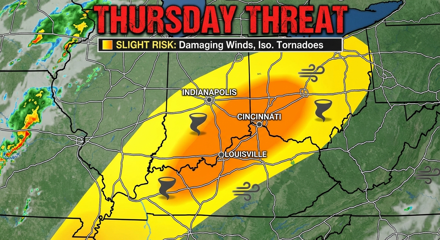
This low-pressure system is dragging a cold front right into some unseasonably warm, unstable air. If you are in Indianapolis, Cincinnati, Louisville, or Dayton, you need to be weather aware tomorrow afternoon and evening.
Here is what we are watching for:
- Damaging Winds: This is the main threat. We could see gusts over 60 mph that can knock down power lines.
- Spin-up Tornadoes: The atmosphere has enough "spin" in it that a few tornadoes are possible. These aren't likely to be long-track monsters, but any tornado is dangerous if you aren't prepared.
- The Timing: This looks like a Thursday afternoon into the evening event. That means it could mess up your evening commute.
The Fire & Ice Divide Continues
While the Midwest gears up for storms, the backend of this system is still causing headaches out West.
If you are heading out to Spring Training games in Arizona—like the Diamondbacks or Rockies fans in Scottsdale—don't let the calendar fool you. It is cooler than average out there. You are going to want a hoodie, not just a jersey.
Meanwhile, the fire danger is still Critical today for parts of the Texas and Oklahoma Panhandles. The winds are shifting, but it is still bone dry. Please, do not burn anything today. We saw yesterday how fast a spark can turn into a 100,000-acre disaster near Woodward.
A Heads Up for the Weekend
I also want to give a quick heads up to my friends in the Northeast.
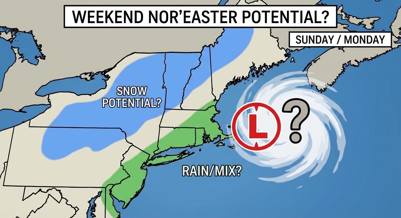
By the time we get to Sunday and Monday, this energy is going to try to form a coastal storm. The data is still a bit messy, but there is a chance for a Nor'easter bringing rain to the coast and snow inland. It is too early to promise snow totals, but if you have travel plans Sunday night, keep an eye on this.
Bottom Line
Here is what you need to do:
- If you are in the Ohio Valley (IL, IN, KY, OH): Charge your devices and have a way to get warnings tomorrow. The severe threat is real.
- If you are in the Plains: No outdoor burning. Period. The fire risk remains high.
- If you are traveling West: I-80 has been a mess with snow squalls. Check the road reports before you go.
Stay safe out there, y'all.
https://ryanhallyall.com/blog/whiplash-weather-why-were-talking-tornadoes-in-february