Blog Article
Why WSFA Weather is Trending: Alabama Severe Storms Tonight
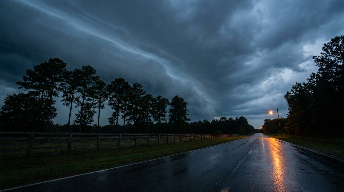
Severe storms are threatening Mississippi and Alabama tonight. Here is a look at the tornado and flash flood risks keeping the Deep South awake.
Why Everyone is Searching for Montgomery Weather Tonight
Get this, y'all. If you check the national internet trends right now, you will see a massive spike for "WSFA weather." That is the local news station down in Montgomery, Alabama. They are not trending because of a viral blooper or a funny meme. They are trending because hundreds of thousands of folks are glued to their phones, waiting to see what the sky is going to do next.
The Deep South is in the crosshairs tonight. While the West Coast is enjoying a nine-day streak of perfect sunshine, folks from Jackson, Mississippi, over to Birmingham and Montgomery are dealing with a very different reality.
The Setup Over the South
The Storm Prediction Center has an Enhanced Risk for severe thunderstorms across southern Mississippi and central Alabama through tonight. That is a Level 3 out of 5 risk. We have a cold front crashing into a very warm, unstable tropical air mass sitting over the Gulf Coast.
Normally in May, a city like Birmingham tops out around 82 degrees. But right now, we have a thick, muggy airmass that is refusing to cool down. When the sun sets, we usually expect storms to lose their energy. That is not happening tonight. A strong low-level jet stream is kicking in, pumping warm, moist air directly into these storm updrafts.
The Nighttime Hazards
Here is exactly what the data shows for the overnight hours:
- Tornadoes: There is a 10 percent probability area stretching across this region. More importantly, that area is hatched. That means if a tornado forms, it has the potential to reach EF2 or stronger.
- Large Hail: We are looking at a 15 percent chance for severe hail. Inside that zone, another hatched area warns that hailstones could reach 2 inches in diameter. That is hen-egg size, loud enough to wake up the whole house.
- Excessive Rainfall: The Weather Prediction Center has upgraded portions of Mississippi and Alabama to a Moderate Risk (Level 3 of 4) for excessive rainfall. Local forecast offices are warning about 4 to 5 inches of rain.
That last point is critical. Flash flooding in the dark is incredibly dangerous. You cannot see the water covering the road until your headlights hit it, and by then, it is often too late to stop.
The Human Element
This is why local stations like WSFA are trending. When the sun goes down and the sirens go off, people want a trusted voice. Nighttime tornadoes are stressful. Parents are pulling kids out of bed to put helmets on them. People are hiding in interior closets listening to the wind rattle the roof. It is a draining experience for the communities in the path, and it is a long shift for the meteorologists tracking every radar scan.
Tomorrow, this system finally sags south. The severe threat drops to a Marginal Risk (Level 1 of 5) for the central Gulf Coast over into South Carolina. The main concern Thursday morning will be isolated damaging winds.
Meanwhile, down in the Florida Peninsula, the problem flips completely. They are looking at 90-degree heat, humidity dropping down to 25 percent, and 15 mph winds. That combination has triggered an Elevated Fire Weather threat.
If you are in Alabama or Mississippi tonight, keep your phone volume all the way up. Make sure your emergency alerts can bypass your "Do Not Disturb" settings. Have your safe space ready, and look out for your neighbors.
https://ryanhallyall.com/blog/why-everyone-is-searching-for-montgomery-weather-tonight