Blog Article
Wind Advisories and Severe Storms: Wednesday Weather Forecast
Record heat in the West is triggering dry microbursts, while Montana faces a Slight Risk of severe storms with 75 mph winds and critical fire weather.
Why Everyone Is Searching for Wind Advisories Tonight
Get this, y'all. If you looked at Google search trends today, you might have noticed a massive spike for the term 'wind advisory'. People are noticing the wind, and they have good reason to.
We have a fascinating and somewhat dangerous setup unfolding across the western half of the country. Reno just broke a heat record. Over in Utah, places like Salt Lake City are baking well above their normal May high of 73 degrees. But this heat is not just making you sweat. It is actually acting as the fuel for some serious wind threats as we head into Wednesday.
Here is exactly how this heat is going to mess with our weather over the next 24 hours.
The Hair Dryer Effect in the Great Basin
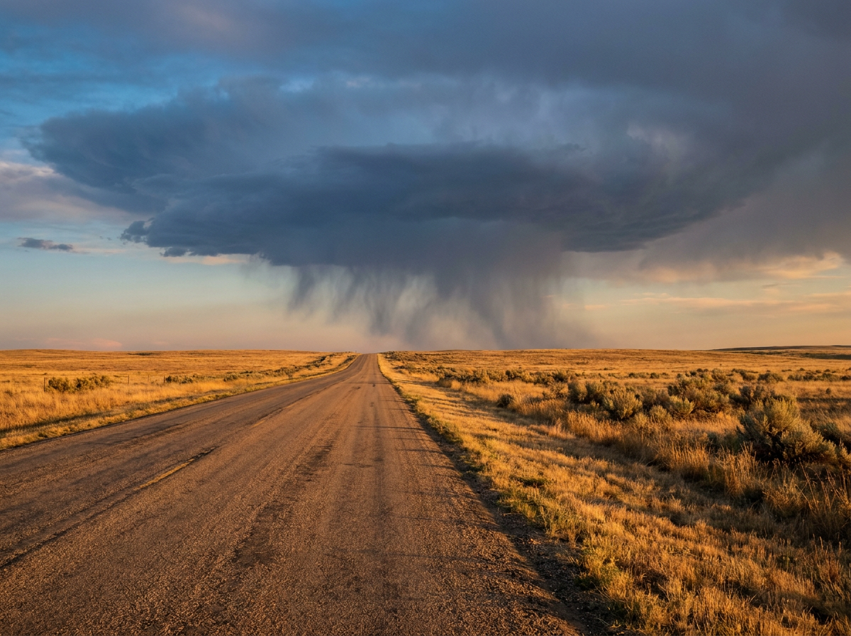
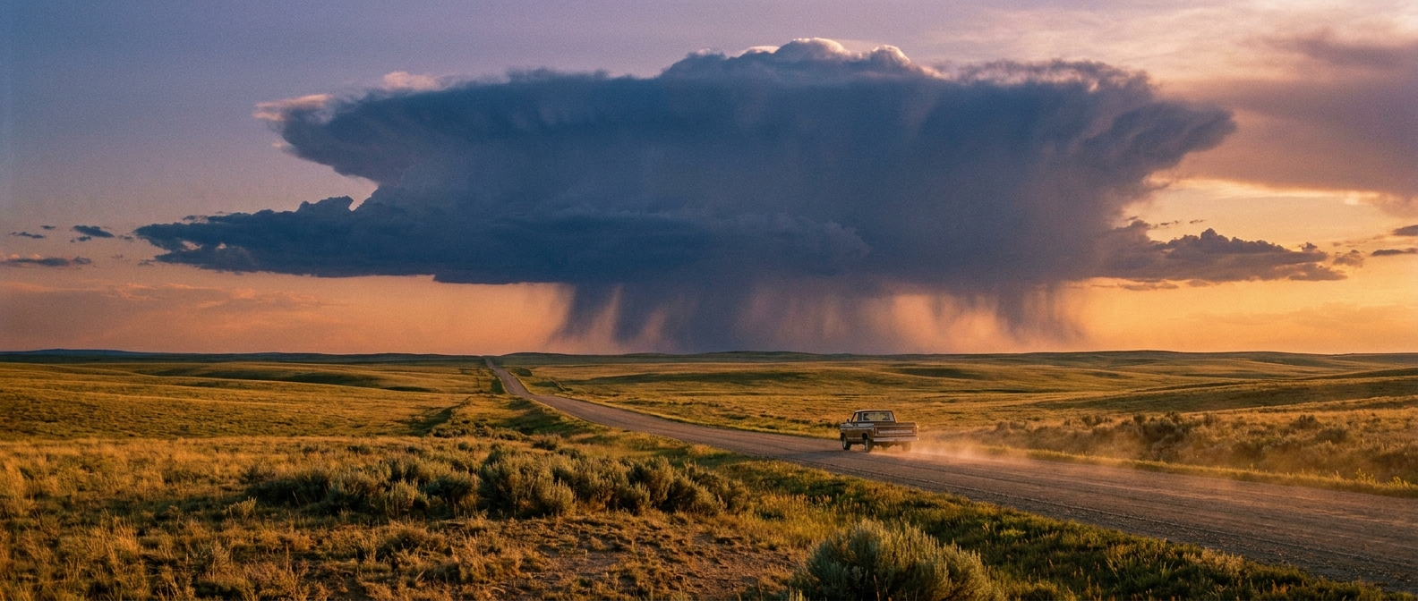
When you have record-breaking heat and bone-dry air at the surface, thunderstorms behave a little differently. Instead of dropping heavy rain, they tend to produce something called a dry microburst.
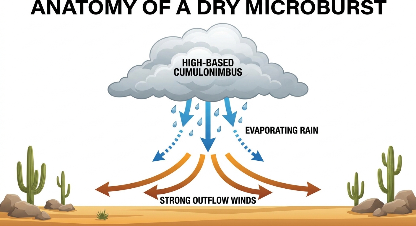
Here is the science behind it. A high-based storm tries to rain. That rain falls into the super dry air below and evaporates before it ever hits the dirt. Evaporation is a cooling process. It cools the surrounding air rapidly. Because cold air is dense and heavy, it drops like a rock.
It hits the ground and spreads out in all directions. We are talking about a sudden, invisible wall of wind hitting 60 mph or more. The Storm Prediction Center has a Marginal Risk for severe storms over northern Utah on Wednesday specifically for this threat. If you are outside in the heat and suddenly feel a rush of cool air, secure your patio furniture immediately.
Montana's Double Threat
Further north, the wind threat gets even more intense. A potent weather system is swinging into the Northern Rockies and High Plains on Wednesday afternoon.
The Storm Prediction Center has outlined a Level 2 out of 5 Slight Risk for severe storms in north-central Montana, including Great Falls. The primary hazard here is not tornadoes or giant hail. It is straight-line wind.
Within that risk area, meteorologists have highlighted a specific hatched zone. That means the conditions are ripe for significant severe wind gusts. If a line of storms gets organized, we could see gusts topping 75 mph. That is hurricane-force wind sweeping across the plains.
To make matters worse, we have a Critical Fire Weather area right next door in northeastern Montana and northwestern North Dakota. Places like Williston and Miles City are going to see strong southerly winds pulling in incredibly dry air.
When you mix bone-dry vegetation, low humidity, and the potential for 75 mph thunderstorm gusts nearby, you get a highly volatile fire environment. A single spark in those conditions can travel miles before anyone even knows a fire has started.
Looking Ahead to Thursday
By Thursday, the main severe weather threat shifts further south into the Central Plains. We are looking at a Level 2 out of 5 Slight Risk for central and eastern Kansas. Cities like Wichita, Topeka, and Lawrence need to be on alert for widely scattered severe storms capable of producing large hail and severe wind gusts.
But for Wednesday, the wind is the main character. If you are driving a high-profile vehicle on I-15 in Utah or I-90 in Montana, keep two hands on the wheel. The atmosphere is moving a lot of air around right now, and it will absolutely push you out of your lane if you are not paying attention.
https://ryanhallyall.com/blog/why-everyone-is-searching-for-wind-advisories-tonight