Blog Article
Lala's Category Flip Explained: What It Means for Hawaii
Tropical Storm Lala weakened from a hurricane, but Hawaii's threat isn't over. Here's why storms flip categories and what it means for the mainland flood risk.

Why Lala Keeps Changing Its Name, and Why Hawaii Isn't Out of the Woods
Y'all saw the headline today. "Lala is again a tropical storm." And if you're not a weather nerd, that sentence probably made you tilt your head. Wasn't it a hurricane yesterday? Did it get weaker? Stronger? What's actually happening out there south of Honolulu?
Let's clear it up, because the category flip-flop is a real teaching moment, and the storm is still very much a threat to the islands tonight.
The whiplash, explained
Yesterday, Lala spun up into a Category 1 hurricane as it passed south of the Big Island. That's when Mauna Kea Summit clocked a jaw-dropping 140 mph wind gust (non-thunderstorm, mountain-top downslope wind, but still wild), and Molokai saw gusts near 82 mph. Trees came down across half the state. Roads closed. Roofs got peeled back in parts of Honolulu.
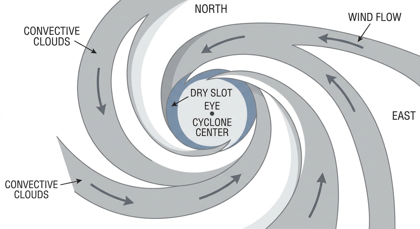
Since then, Lala has weakened back to tropical storm strength. As of this afternoon, it's packing 63 mph winds, a pressure of 994 millibars, and sitting about 140 miles west of Honolulu, still moving west-northwest at a solid 16 mph. The National Hurricane Center's discussion says the satellite presentation has a large dry slot wrapping around the storm's southern and eastern side, and the intensity estimates have been trending down all morning.
That's the short version of why storms lose steam fast in this part of the Pacific. Dry air gets pulled into the circulation, chokes off the thunderstorm engine near the center, and the storm can't sustain the wind field it had a day earlier. It's not that the atmosphere "decided" to calm down. It's that the fuel source, warm moist air feeding into the core, got cut off on one side.
Weaker on paper, still dangerous on the ground
Here's the part that matters if you've got family on Oahu or Kauai: a tropical storm is not a "nothing burger." Lala's outer bands are still dumping heavy rain and gusty wind on Maui County, Oahu, and Kauai County right now. The storm's closest pass to Kauai's south shore is happening basically as this post goes up, somewhere around 60 to 70 miles offshore, with 55 to 61 mph winds still possible near the islands.
This comes on the heels of a genuinely rough 24 hours. Yesterday's hurricane passage brought landslides and rockfalls that shut down Route 11 and Route 19 on the Big Island, power outages, and roof damage reported from Punchbowl to Kaimuki to Kalihi. So even with the downgrade, crews are still clearing downed trees and roads while a second round of wind and rain moves through. Weaker category, same ongoing recovery.
The lesson for anyone scrolling past that confusing headline: watch the local warnings, not just the word "hurricane" versus "tropical storm." Hawaii's still under active impacts tonight.
Meanwhile, back on the mainland: the same pattern that hit Indiana is setting up over ballparks
While Hawaii deals with Lala, the mainland story this week has been water. Central Illinois and central Indiana caught 5 to 8 inches of rain in a single stretch on Friday and Saturday, enough to close Interstate 74, flood neighborhoods in Bloomington-Normal, and trigger boat rescues in Indianapolis and Hamilton County. That system is why the news is still running headlines about deadly flooding and more rain on the way for Indiana.
Tonight, the moisture axis has shifted east into the Ohio Valley, and it's sitting right under a lineup of MLB games. The Storm Prediction Center has a Slight Risk of severe storms tonight stretching from the Ohio Valley into the Mid-Atlantic, and the Weather Prediction Center has gone a step further, issuing a Moderate Risk of excessive rainfall for West Virginia, with a Slight Risk covering southern Ohio and parts of the Mid-Atlantic. That's the highest excessive rainfall category WPC issues short of high risk, and it's driven by a mesoscale convective vortex rolling in with precipitable water values near 2.25 inches. Translation: the atmosphere is loaded with moisture, and storms that fire up tonight can train, meaning they repeat over the same spot instead of moving through.
Cincinnati's hosting the Cardinals this week, and Detroit's playing Pittsburgh, both cities sitting inside or near tonight's slight risk zone for damaging wind and the flash flood threat. If you've got tickets or you're just trying to get home from the ballpark, keep an eye on the radar loop, not just the forecast for kickoff or first pitch. A single slow-moving storm cell over saturated ground can shut down streets fast, the same way it did in Illinois and Indiana this past week.
The takeaway
A storm's category tells you about its peak wind speed. It doesn't tell you whether the danger has passed. Lala proved that twice in 24 hours, first by strengthening into a hurricane, then by weakening back to a tropical storm that's still lashing Hawaii's south shores tonight. And a thousand miles away, the same soggy setup that flooded Indiana streets this week is now creeping toward Ohio Valley ballparks. Watch the warnings, not the headline.
https://ryanhallyall.com/blog/why-lala-keeps-changing-its-name-and-why-hawaii-isnt-out-of-the-woods