Blog Article
March Weather Chaos: Polar Vortex Split & Midwest Tornado Threat
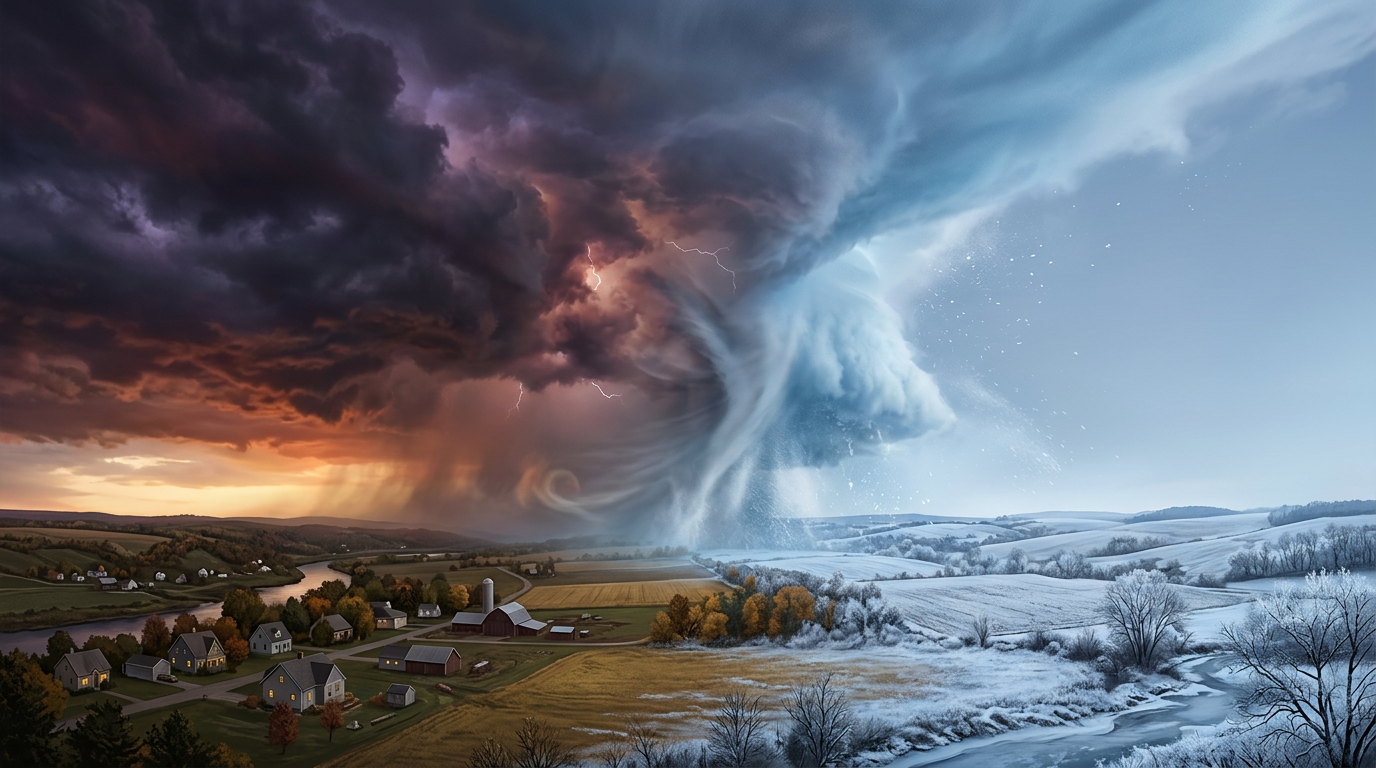
A rare polar vortex split is driving extreme weather whiplash, from tragic Michigan tornadoes to a 60-degree temperature crash. Read the evening forecast.
Why March Weather is Breaking the Internet (And the Polar Vortex Split Explained)
Alright folks, grab a cup of coffee and pull up a chair. We need to talk about what is happening out there.
If you have been on social media today, your feed is probably full of two things. First, the absolutely heartbreaking footage out of Union City, Michigan. Second, the "March is wild" memes talking about the massive temperature crash coming our way. It feels like Mother Nature is throwing everything including the kitchen sink at us right now.
Let's break down exactly what is driving this weather whiplash and what you need to be prepared for tonight.
The Michigan Heartbreak and Storm Fatigue
Before we get into the forecast, I want to take a second to talk about the human side of this. The aftermath of the EF3 tornado in southern Michigan is devastating. Seeing a Menards store reduced to rubble and whole neighborhoods flipped upside down is hard to process. We lost four people in that storm, including a 12-year-old.
The governor has declared a state of emergency, and the community response has been incredible. But get this. Seeing a strong EF3 tornado in Michigan in early March is historically rare. It just does not happen very often.
Because of that, people are dealing with serious storm fatigue. And unfortunately, the atmosphere is not done with us yet.
Today's Threat: Round Two for the Midwest
If you live anywhere from the Great Lakes down to Texas, you need to be paying attention tonight. Search trends for "South Bend weather" are through the roof right now because the warnings are already flying.
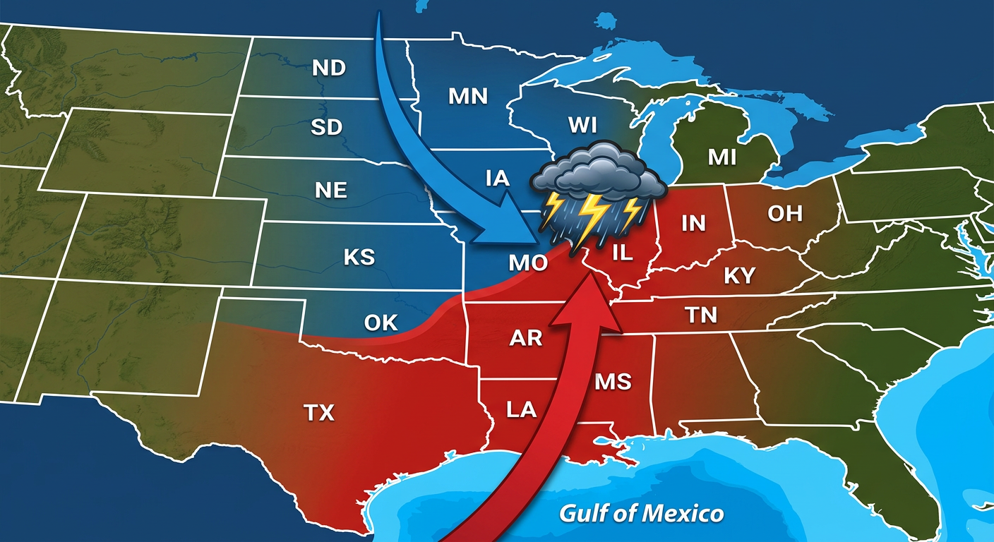
The Storm Prediction Center has issued a Level 4 out of 5 Moderate Risk for severe weather across northern Illinois. This includes Joliet, Peoria, and Bloomington. We are talking about a very volatile environment. The local National Weather Service office in Lincoln, Illinois is watching a sharp warm front. Where that front sets up, we could see multiple strong to intense tornadoes and very large hail.
Broadening out, there is a Level 3 Enhanced Risk stretching from Chicago all the way down through Kansas City, Oklahoma City, and Fort Worth.
If you are in these zones, do not go to sleep without a way to get warnings. Have your weather radio on. Have your phone volume up. This is a nocturnal threat, and those are always the most dangerous.
The Science: Blame the Polar Vortex Split
So why is the weather acting so crazy? Why are we seeing record warmth followed by violent storms, and then a brutal cold snap?
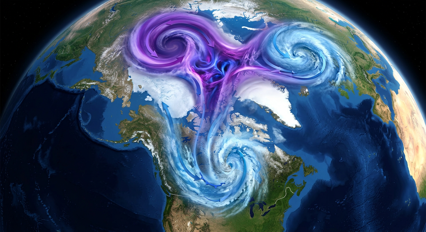
Here is the thing. It all comes down to a rare Polar Vortex split.
Usually, the Polar Vortex acts like a tight bowl of freezing air spinning up in the Arctic. But right now, that bowl has cracked. The vortex is splitting, and that allows all that brutally cold arctic air to spill southward into the United States.
When you have record-breaking warm, moist Gulf air sitting over the Midwest, and a massive arctic front comes crashing into it, the atmosphere essentially explodes. That is exactly why we are seeing these severe tornado outbreaks.
But the story does not end with the storms. Behind this cold front, temperatures are going to fall off a cliff. We are looking at a potential 60-degree temperature crash in under 24 hours in some spots. By later this week, parts of the Northeast and Mid-Atlantic will be 15 to 25 degrees below normal.
Winter is Still Kicking
While the Midwest deals with tornadoes, that same wild pattern is dumping heavy snow elsewhere.
Up in the Upper Peninsula of Michigan, Marquette is looking at 6 to 9 inches of fresh snow starting tonight. Meanwhile, over on the West Coast, an atmospheric river is slamming into the Pacific Northwest. The National Weather Service in Seattle has highlighted an Enhanced Risk for heavy snow and literal blizzard conditions in the Cascades. We are talking 1 to 3 feet of snow up in the higher elevations by Thursday.
The Big Takeaway
Y'all, the atmosphere is trying to find balance, and it is doing it in the most violent way possible.
The transition from La Niña to ENSO-neutral is underway, the Polar Vortex is fractured, and the results are playing out in our backyards.
Please take tonight's severe threat seriously. Check on your friends and family in Michigan who are dealing with the aftermath of yesterday's storms. And if you have packed away your winter coats, you might want to dig them back out before the weekend.
Stay safe out there, and keep your eyes on the skies.