Blog Article
Severe Weather Shift: Giant Hail Targets Kansas Thursday
A severe weather setup is targeting Kansas and Missouri on Thursday with a threat for 2-inch hail. Learn how the dryline will impact the Central Plains.
Why the Central Plains Needs to Prepare for Giant Hail Tomorrow
As we talked about yesterday, the West has been dealing with some intense heat and wind. That wind threat is peaking today across the Northern Rockies. But as we look ahead to Thursday, the severe weather focus is shifting straight into the Central Plains.
High Winds and Fire Danger Today
For today, the Storm Prediction Center has a Slight Risk posted from northern Utah up through eastern Idaho, western Wyoming, and western Montana. The main hazard here is wind. We are talking about scattered severe thunderstorms capable of producing 75 mph gusts. If you are driving a high-profile vehicle on I-15 or I-80 today, you need to keep both hands on the wheel.
Plus, that same system is driving critical fire weather up in northeastern Montana and northwestern North Dakota. It is a volatile mix. Get this. While it is warm and dry enough for critical fire weather in the plains, we are actually looking at high-elevation snow in Glacier National Park.
The Kansas Dryline Wakes Up Tomorrow
Now, looking ahead to Thursday. A strong upper-level system is going to traverse the central United States. The warm sector ahead of it is looking ripe for severe storms. SPC has a Slight Risk out for central and eastern Kansas. This includes Wichita, Topeka, and the Kansas City metro. Normal high temperatures around Kansas City this time of year are near 75 degrees, but we will have plenty of heat and moisture pumping in from the south to fuel these storms.
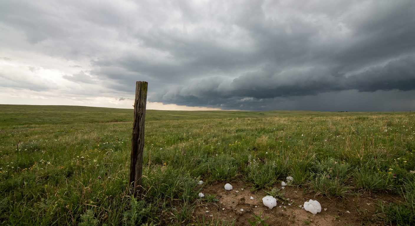
Moisture is going to surge northward, pushing dewpoints well into the 60s. When that dryline fires, the atmosphere will have plenty of energy to work with. The primary threat with these Thursday storms is going to be very large hail.
The SPC has a significant hatched area indicating the potential for hailstones 2 inches in diameter or larger. That is hen-egg size, folks. It is enough to do serious damage to roofs and vehicles. We also have a 15 percent risk for damaging wind gusts in that same area.
Bottom Line
For today, the primary hazards are severe wind gusts and fire danger across the Northern Rockies and High Plains. Tomorrow, the threat shifts to large hail and damaging winds in Kansas and western Missouri. If you live in the Slight Risk area for Thursday, park your car in the garage or under a carport tonight. Make sure you have a reliable way to get warnings, especially if you have evening commutes or outdoor sports practices.
https://ryanhallyall.com/blog/why-the-central-plains-needs-to-prepare-for-giant-hail-tomorrow