Blog Article
Polar Vortex Collapse Sparks First 2026 Tornado Threat
The polar vortex collapse is causing a massive clash of air masses, triggering 2026's first major severe weather and tornado threat for the Southern Plains.
Why The Polar Vortex Collapse Is Triggering 2026's First Big Tornado Threat
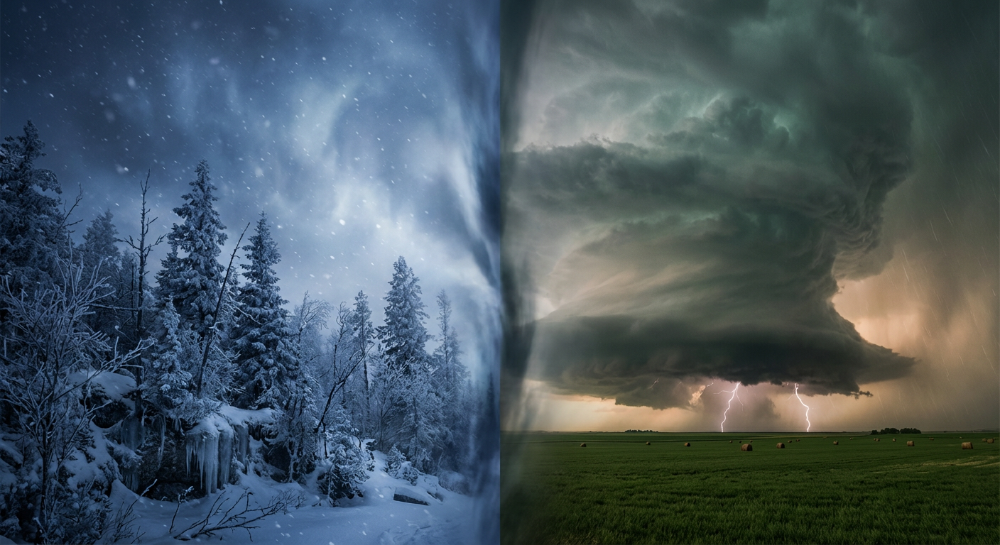
Alright folks, let's talk about what is blowing up all over your feeds right now. If you have opened TikTok or Twitter today, you have probably seen a million videos about the "polar vortex collapse" or a "sudden stratospheric warming event." People are still posting drone footage from that massive Northeast blizzard and wondering if March is about to deliver a sequel.
Here is the thing. The science behind this is fascinating, but what it actually means for your backyard is a little different than the doom and gloom you might be seeing online. We are not just looking at a simple cold snap. We are looking at a full blown battle of the seasons, and it is going to kick off the 2026 severe weather season in a major way.
The Polar Vortex Explained
So what is actually happening way up there in the atmosphere? Get this. A sudden stratospheric warming event basically means temperatures way above the North Pole spiked rapidly. This disrupts the tight ring of winds that usually keeps the coldest Arctic air locked up north. When that ring breaks down or stretches out, pieces of the polar vortex spill southward into the United States.
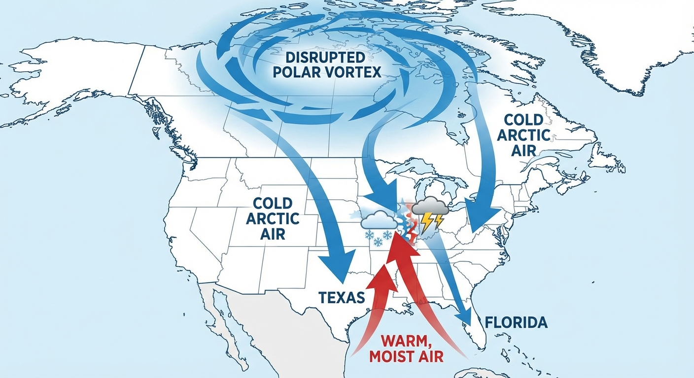
But we also have incredible heat building in the south. Just a couple of days ago, Laredo, Texas hit 103 degrees. That is a February record, y'all. When you have Arctic air diving south and record breaking heat pushing north, that creates an atmospheric war zone right over the central US.
The 2026 Tornado Season Starts Now
Newsweek and a bunch of other outlets have been dropping articles right and left about the 2026 tornado season, especially with La Nina fading out and ENSO neutral conditions taking over. Well, we do not have to wait long to see it in action. This clashing of air masses is setting the stage for our first real multi-day severe weather threat of the year.
Here is what we are looking at:
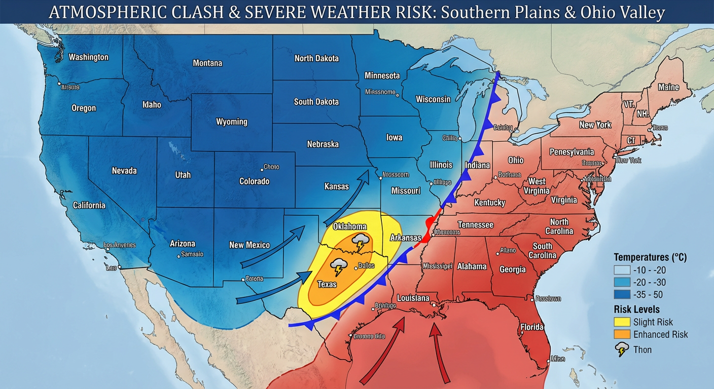
- Today and Tonight: We already have a Slight Risk for severe storms in central Oklahoma. Places like Norman and Shawnee need to be on the lookout for large hail this evening.
- Wednesday (Day 4): This is when things get really interesting. A cold front is going to sweep into a highly unstable, juicy airmass over the southern Plains. We have a 15% risk area covering over 9 million people, including Dallas, Fort Worth, and Arlington. We are talking about the potential for supercells, large hail, and damaging wind gusts.
- Thursday and Friday: That threat pushes east toward the mid-Mississippi Valley and the Ohio Valley. If you live in these areas, now is the time to brush off your severe weather safety plan.
The Cold Side of the Storm
Of course, you cannot have a massive storm system without a wintry side. While the South is dealing with severe storms, the northern and eastern sides of this system are going to be a mess.
If you live in the Mid-Atlantic, pay attention. We have a classic Cold Air Damming setup, or what meteorologists call a "CAD wedge." Sub-freezing air is going to get trapped right up against the eastern side of the Appalachian mountains. From the Shenandoah Valley up through Maryland and Pennsylvania, we are expecting freezing rain. Ice accretions of 0.10 to 0.20 inches might not sound like a lot, but it is plenty to turn roads into ice rinks and snap a few tree branches.
Meanwhile, a band of snow is going to drop 2 to 4 inches from northern Missouri into central Illinois. And out West? The mountains are getting absolutely dumped on, with 6 to 12 inches expected for the Snowy and Sierra Madre ranges.
The Bottom Line
Y'all, March is coming in like a lion. While folks down in Florida and Arizona are enjoying sunny skies for spring training baseball, the middle of the country is turning into a meteorological battleground. The polar vortex collapse is not just a buzzword. It is the trigger for a highly active, potentially dangerous week of weather.
Make sure you have multiple ways to get warnings, especially heading into Wednesday. I will be keeping a close eye on everything and bringing you updates as this system evolves. Stay safe out there!