Blog Article
Multi-Day Severe Weather Outbreak & Stuck Pattern Explained
Spring storm season is kicking off early with a multi-day severe weather outbreak. Find out why the weather pattern is stuck and what to expect this weekend.
Why This Weather Pattern Is Stuck (And What It Means For Your Weekend)
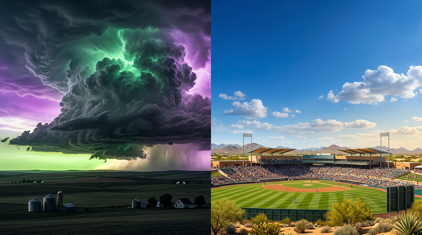
Alright folks, my timeline is absolutely flooded with two things right now. Half of y'all are sharing those wild videos of the downed transmission poles from the Oklahoma tornadoes, and the other half are getting hyped for the USA versus Brazil World Baseball Classic game tonight.
It feels like spring fever is in full swing. But get this, the atmosphere is also way ahead of schedule. The whole "early tornado season" narrative is trending everywhere for a very good reason. We are currently in the middle of a multi-day severe weather siege.
Why Is The Weather Pattern Stuck?
A lot of folks are asking why we are seeing day after day of severe storms. I know some other weather pages are just hyping up the big scary storm clouds, but here is the actual science behind what is happening.
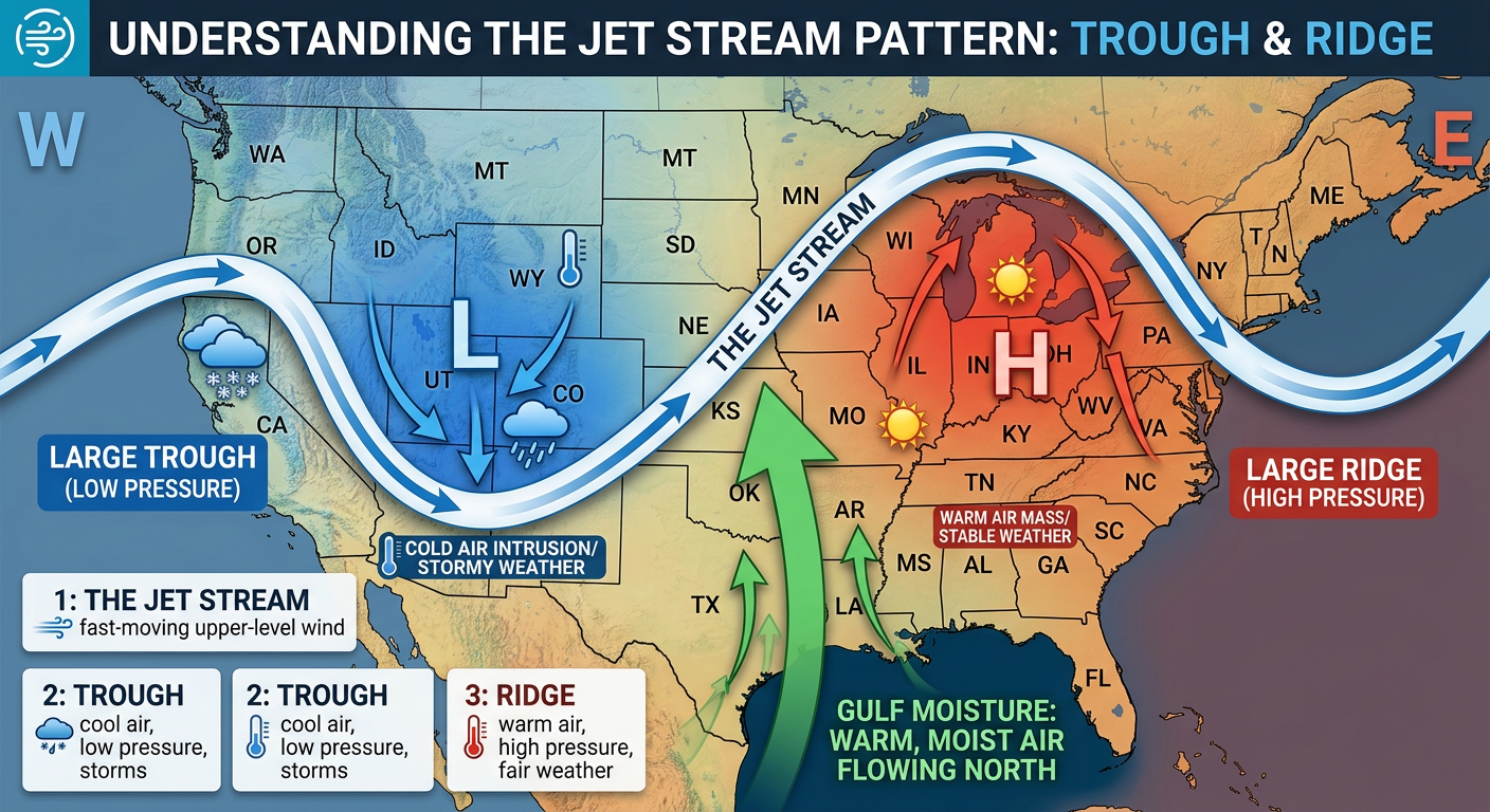
We have a massive traffic jam in the atmosphere. There is a stubborn trough of low pressure hanging out over the West, and a big ridge of high pressure over the East. Because neither of these systems wants to budge, the jet stream is locked right over the middle of the country.
This setup is acting like a giant vacuum. It is pulling rich, warm moisture straight off the Gulf of Mexico and slamming it into cold fronts coming off the Rockies. It is a textbook recipe for repeated days of severe weather, and it explains why the storms just keep coming.
What This Means For Your Weekend
If you are lucky enough to be out at Spring Training in Arizona or Florida this weekend, you are in great shape. But for the over 58 million of us living between Texas and the Great Lakes, we have to stay weather aware.
Tonight, we have an Enhanced Risk, which is a level 3 out of 5, for severe storms across the Central and Southern Plains. We are talking about places like Kansas City, Omaha, and Tulsa. The main threats are very large hail and tornadoes. If you are hosting a watch party for the WBC game tonight, make sure you have your phone off silent and a weather radio nearby.
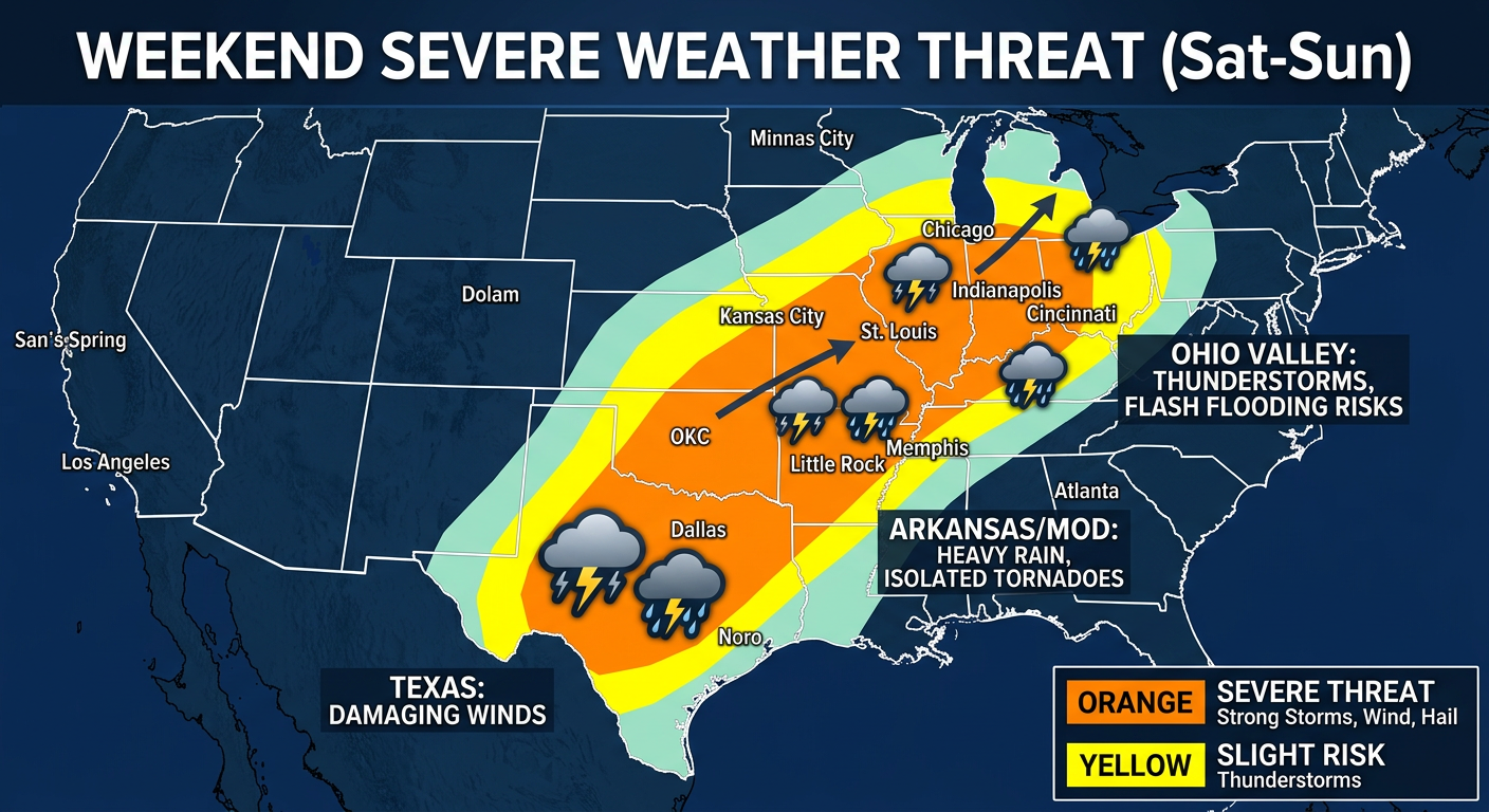
As we head into Saturday, that main cold front finally starts to push east. The Storm Prediction Center has highlighted a broad Slight Risk for severe weather stretching from Texas all the way up into the Ohio Valley and Lower Great Lakes.
This is going to impact a lot of weekend plans. If you are heading to the massive Rangotsav outdoor Holi festival near Austin on Saturday, you need to keep a very close eye on the radar. The Dallas, Austin, and Houston areas are all in that Slight Risk zone tomorrow. We are looking at scattered severe thunderstorms capable of producing large hail and damaging winds.
On top of that, there is a serious flood threat hanging over the ArkLaTex region into the Lower Mississippi Valley due to all the rain we have already had this week.
The Bottom Line
Spring storm season does not care what the calendar says. It is here, and it is making a statement. Do not let your guard down just because you survived yesterday's storms. This stuck pattern means we have to stay vigilant through the entire weekend.
The Y'all Squad will be tracking this live, so if things get bumpy in your neck of the woods, come hang out with us on the stream. Keep your devices charged, have multiple ways to get warnings, and please stay safe out there y'all!
https://ryanhallyall.com/blog/why-this-weather-pattern-is-stuck-and-what-it-means-for-your-weekend