Blog Article
Michigan Tornado Aftermath & Tuesday's Midwest Severe Threat
Discover why early March is producing rare EF3 tornadoes in Michigan, and get the latest forecast on Tuesday's Enhanced severe weather risk for the Midwest.
Why Those Viral Michigan Tornado Videos Are Just The Beginning
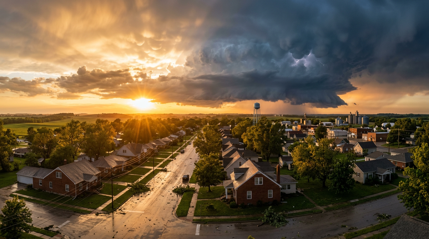
Alright folks, if you have been anywhere near social media today, you have probably seen it. That wild dashcam video out of Three Rivers, Michigan, showing a tornado completely tearing the roof off a business. Or maybe you saw that heartbreaking photo going around of 68-year-old Norma Tuttle. She was standing outside her house of 68 years on Tuttle Park Drive, just watching the cleanup crews work.
It is incredibly heavy stuff, y'all. Michigan's governor has declared a state of emergency for Branch, St. Joseph, and Cass counties. Entire communities are just beginning to pick up the pieces from Friday's deadly EF3 tornado.
But here is the thing so many of you are asking me in the comments today. Why in the world is Michigan getting hit with violent, EF3 tornadoes in the first week of March?
Let's talk about the science behind this weird weather, and more importantly, why we need to stay on high alert for Tuesday.
The Anatomy of an Early Season Outbreak
Typically, the Midwest does not see this kind of violent tornado activity until late April or May. Michigan only averages about 15 tornadoes a year, and they are rarely this strong, this early.
So what gives?
It all comes down to temperature whiplash. We are caught in a massive tug-of-war between seasons. Down south, we have record-breaking heat. Remember how Laredo, Texas hit 103 degrees just a few days ago? That extreme heat is pulling a massive amount of rich, tropical moisture straight out of the Gulf of Mexico.
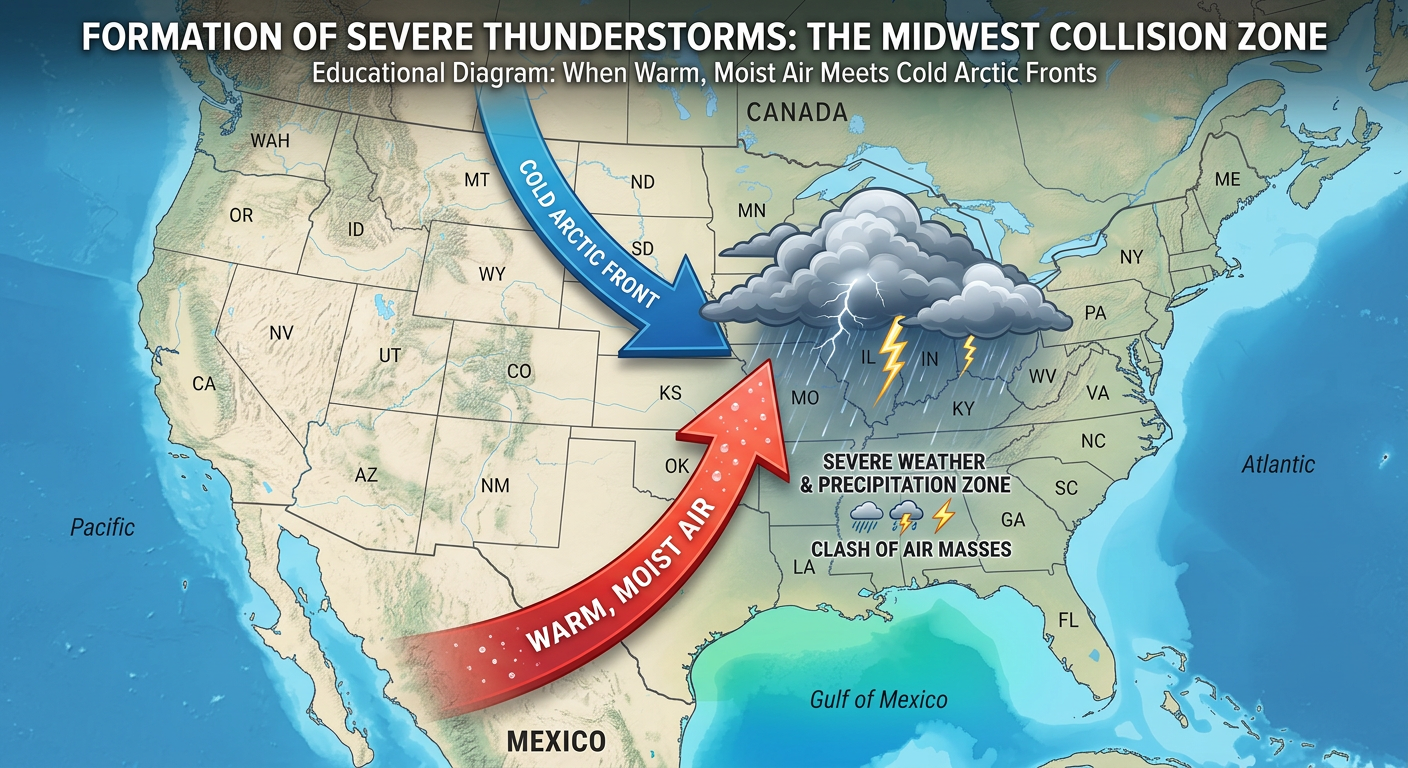
At the exact same time, we still have winter holding on strong up north. When that surging warm air slams into a stalled out cold front, the atmosphere basically explodes. The jet stream is screaming overhead right now, which provides the wind shear needed to take regular thunderstorms and turn them into rotating supercells.
That is exactly what happened in Union City and Three Rivers. The atmosphere did not care that the calendar said early March. The ingredients were fully stocked for a May-style outbreak.
Get Ready For Tuesday
I hate to be the bearer of bad news, especially for folks who are already exhausted from cleaning up. But the atmosphere is reloading for another round on Tuesday.
Get this. The Storm Prediction Center has already issued an Enhanced Risk (Level 3 out of 5) for severe weather on Tuesday. The bullseye is right over Central Illinois and Northwest Indiana.
Here is what you need to know for Tuesday:
- Tornado Threat: We have a hatched risk area, meaning strong, EF2 or greater tornadoes are absolutely possible in Illinois and Indiana.
- Giant Hail: We are talking about the potential for hail up to 2.5 inches in diameter. That will dent your car and bust your windshield.
- Texas Threat: There is a second Enhanced Risk area down south covering the Edwards Plateau into Central Texas for destructive winds and very large hail.
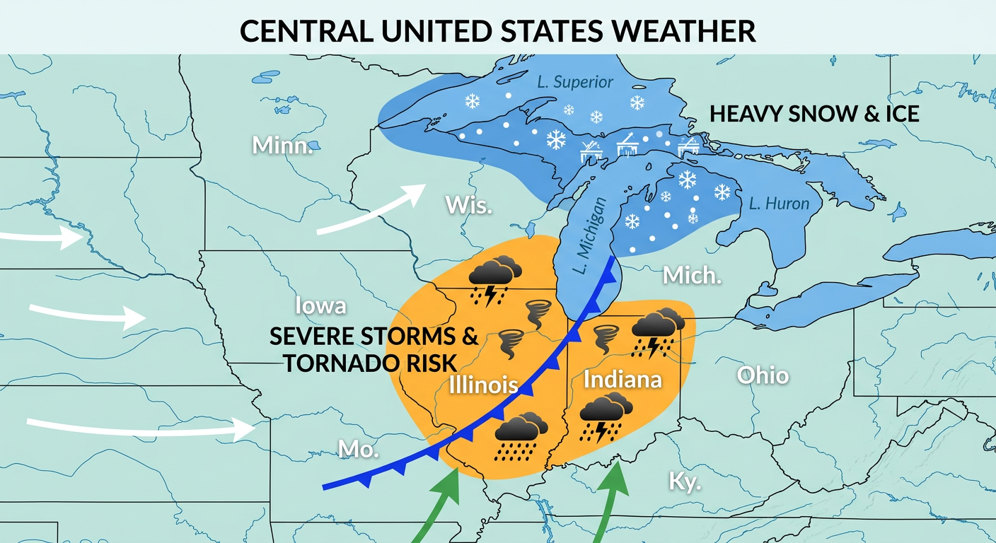
And just to prove how crazy this storm system is, while Illinois is dealing with tornadoes, the Upper Peninsula of Michigan is going to be buried in winter weather. We have a Winter Storm Watch for Marquette County where they could see 3 to 9 inches of heavy snow and significant icing on Tuesday into Wednesday.
The Bottom Line
We are in a very active, very dangerous weather pattern right now. If you live anywhere from Texas up into the Ohio Valley and Great Lakes, you cannot let your guard down.
For my friends in Michigan still recovering from Friday, please stay weather aware as this next system rolls through. Even if you just get rain and wind, that can cause major issues when roofs are already damaged and tarps are deployed.
If you are in that Enhanced Risk zone in Illinois or Indiana tomorrow, have a plan. Know where your safe room is. Make sure your weather radio has fresh batteries. Do not rely on outdoor sirens to wake you up if storms roll through your area.
Stay safe out there, y'all. I will be tracking this every step of the way.
https://ryanhallyall.com/blog/why-those-viral-michigan-tornado-videos-are-just-the-beginning