Blog Article
Anchor Lake Dam Failure & Gulf Coast Flash Flood Emergencies
A High Risk for excessive rainfall is causing life-threatening flash floods and dam failures across the Central Gulf Coast. Here is the science behind the storms.
Why Your Feed is Full of Flash Flood Emergencies Tonight
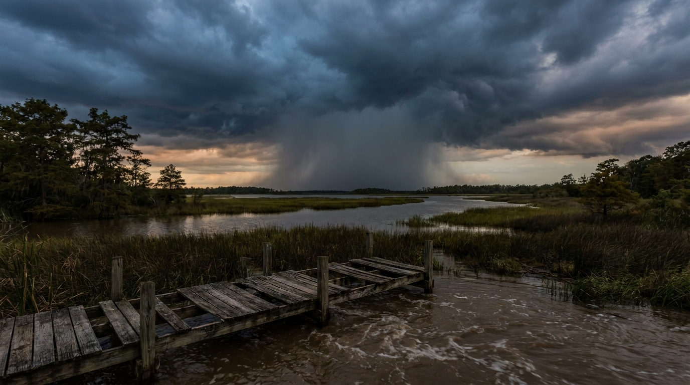
Y'all have probably seen the videos on your timeline by now. Anchor Lake Dam is failing. Phones are going off with flash flood emergencies across the Central Gulf Coast, and folks are sharing unbelievable footage of water rushing over roads. It is a dangerous mess down there right now.
Here is the thing. The Weather Prediction Center has a High Risk for excessive rainfall over the Central Gulf Coast today. That is their highest possible warning level. We are looking at the remnants of Tropical Storm Arthur pulling a firehose of moisture straight off the Gulf of Mexico.
The Science of Training Thunderstorms
Let me explain what is actually happening in the sky right now. These thunderstorms are doing something we call "training."
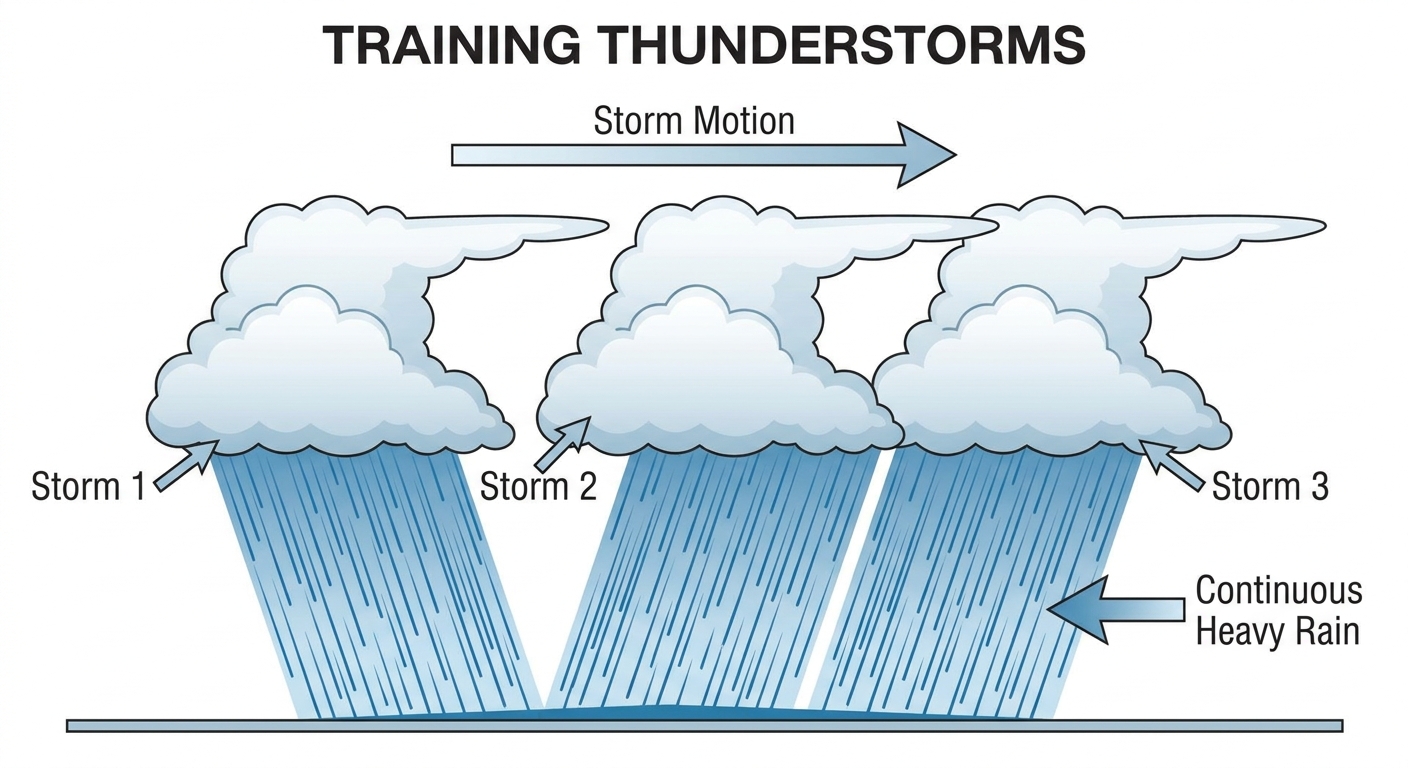
Think of it like a freight train. The tracks do not move, but train car after train car rolls over them. One storm drops a couple of inches of rain, and then another storm drives right over that exact same path. The ground is already saturated from earlier in the week, so the water has nowhere to go.
Normal highs in places like New Orleans and Mobile sit right around 90 degrees in late June. All that heat and humidity acts like a giant engine for these storms. When you combine that heat with a stalled weather boundary, the atmosphere just wrings itself out like a wet towel.
Infrastructure Under Pressure
That brings us back to Anchor Lake. When earth dams take on too much water too fast, they overtop and wash away. That is exactly what prompted the emergency alerts today.
The National Weather Service offices in Mobile and New Orleans are working overtime managing widespread, life-threatening flooding. The data shows some spots could see up to 20 inches of rain before this is all said and done. Our roads, drainage systems, and smaller dams simply were not built to handle that volume of water in a 24-hour window.
Ripples Up the East Coast
This system is also causing headaches further up the coast.
- U.S. Open Golf: The tournament is underway out in Southampton, New York. They are sitting in a Marginal risk for severe storms today.
- Evening Baseball: Boston has a Slight risk for severe weather tonight right around the time the Red Sox and Blue Jays take the field.
We are looking at isolated damaging winds and maybe a quick spin-up tornado for the Northeast. If you are watching sports on TV tonight, do not be surprised if you see the tarps come out on the field or lightning delays on the golf course.
Moving water is the most powerful force on earth. It does not care about your truck, your road, or your dam. If you live near a creek or a low-lying area in the Deep South tonight, keep your phone loud and listen to local officials.
https://ryanhallyall.com/blog/why-your-feed-is-full-of-flash-flood-emergencies-tonight