Blog Article
Winter Weather Update: Arctic Cold & Weekend Ice Storm Forecast
A Clipper hits the Midwest today while dangerous Arctic cold sets the stage for a major ice storm across the South this weekend. Get the latest forecast.
Winter's Reload: Arctic Blasts, Clippers, and a Southern Ice Update
Alright folks, grab your coffee. We need to talk. If you thought the last 24 hours were wild—with the Northern Lights showing up in Alabama and that historic snow burying parts of New York—I have some news. The atmosphere is reloading.
We are looking at a classic "one-two punch" scenario. We have a quick hitter moving through the North right now, but the main event is still brewing for the weekend. Let's break down exactly what the data is showing this morning.
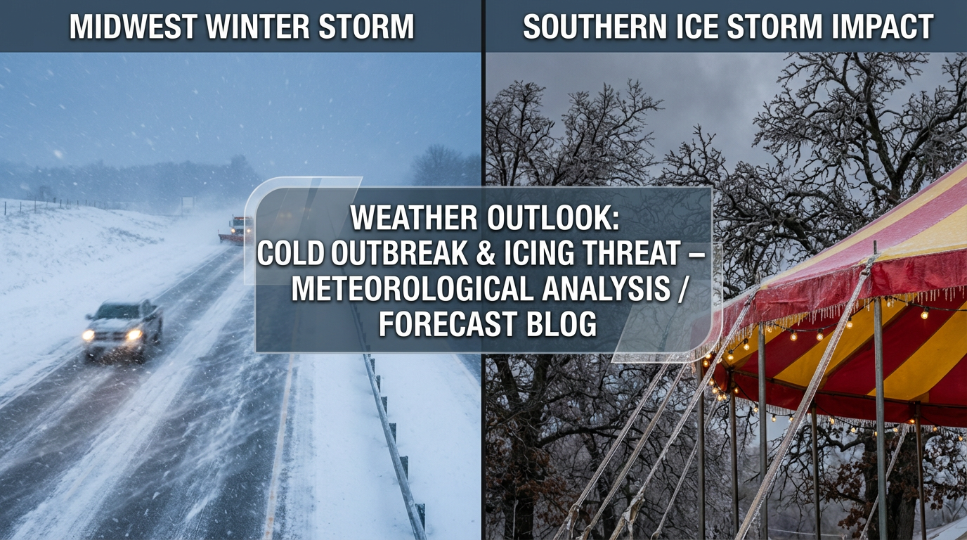
The Midwest Clipper: Sneaky and Slick
First things first. We have a Clipper system diving out of the Dakotas and heading for the Great Lakes today and Wednesday. If you are in Iowa, Southern Wisconsin, Northern Illinois, or Michigan, look alive.
This isn't going to be a blockbuster blizzard, but these systems are tricky. We are talking a general 2 to 5 inches of snow for places like the WI/IL border. But here is the kicker. As this system moves over Lake Michigan, it's going to squeeze out extra moisture. Southwest Michigan and Northern Indiana could see locally higher amounts up to 6 inches.
If you are commuting around Chicago or Grand Rapids tomorrow morning, leave early. We saw that nasty 100-car pileup on I-196 yesterday. Please do not let that happen again. The roads will be slicker than they look.
The Arctic Recharge
Here is the big picture. Behind this Clipper, the door to the freezer is being left wide open. A reinforcing shot of Arctic air is plunging south late Thursday into Friday.
Get this. The National Weather Service is talking about wind chills hitting -50°F in the Dakotas and Minnesota by Friday morning. That is life-threatening cold. Even if you are tough, you don't mess with that.
This cold air is going to sink all the way down to the Gulf Coast. If you are planning to hit the Boca Raton Beer, Wine, and Spirits Fest in Florida this Saturday, bring a jacket. It's going to be unseasonably chilly even down there.
Weekend Threat: The Ice Zone Solidifies
Now, let's circle back to that Southern threat we talked about yesterday. That fresh Arctic air I just mentioned? It's going to act like a shallow layer of cold air hugging the ground across Texas, Arkansas, Tennessee, and the Carolinas.
Starting Friday, moisture is going to ride over top of that cold dome. This is a textbook setup for freezing rain and sleet.
- Texas & Oklahoma: The mess starts Friday. Central Texas is still in the bullseye for significant icing.
- The Southeast: By Saturday, this moves into Tennessee and the Carolinas. I am particularly worried about Charlotte, NC. I know y'all have the Big Southern Classic Battle of the Bands on Saturday. You need to watch this forecast closely. Traveling to the event could be treacherous if the roads glaze over.
The WPC is now highlighting a "moderate to high confidence" risk of significant icing in the interior Southeast. This can snap tree limbs and knock out power. If you are in this corridor, today is the day to check your generator and make sure you have flashlights ready.
Bottom Line
- Midwest: Watch for slick roads through Wednesday morning from the Clipper. Don't underestimate a few inches of snow.
- Northern Plains: Prepare for extreme, dangerous cold Thursday and Friday. Limit time outside.
- The South: The weekend ice threat is becoming more likely. If you have travel plans Friday or Saturday from Dallas to Charlotte, have a backup plan.
- Florida: Freeze warnings are likely again late week. Protect those plants and pipes.
This pattern is active and it is dangerous. Stay safe, check on your neighbors, and keep it tuned right here for updates!
https://ryanhallyall.com/blog/winters-reload-arctic-blasts-clippers-and-a-southern-ice-update