Blog Article
Severe Storms Shift North This Weekend as Festivals Fill Up
While the World Cup and summer festivals dominate, the severe weather threat shifts to Montana and North Dakota Saturday with an Enhanced Risk for hail and wind.
World Cup Fans, Festivals, and a Front: Why the Northern Plains Steals the Severe Weather Spotlight Saturday
Alright, y'all. The whole world's watching soccer right now. World Cup group play has folks glued to their phones, and the trending searches are full of it, pink cleats, Cape Verde versus Saudi Arabia, the works. There's even a story going around about fans missing games because their resale tickets fell through. Brutal.
But here's the thing. While everybody's arguing about cleats and brackets, the weather map is doing something interesting and quiet, and it's worth understanding before you make weekend plans.
The big severe weather story this weekend isn't where it's been all month. It's moving north.
Where the Action Goes Saturday
For weeks now, the Southern Plains and the Ozarks have been getting hammered. Just yesterday we talked about that 101 mph gust near Boise City, Oklahoma, and the flash flooding that ran from Oklahoma into Missouri. Wichita had cars submerged downtown. That's been the rhythm of June 2026.
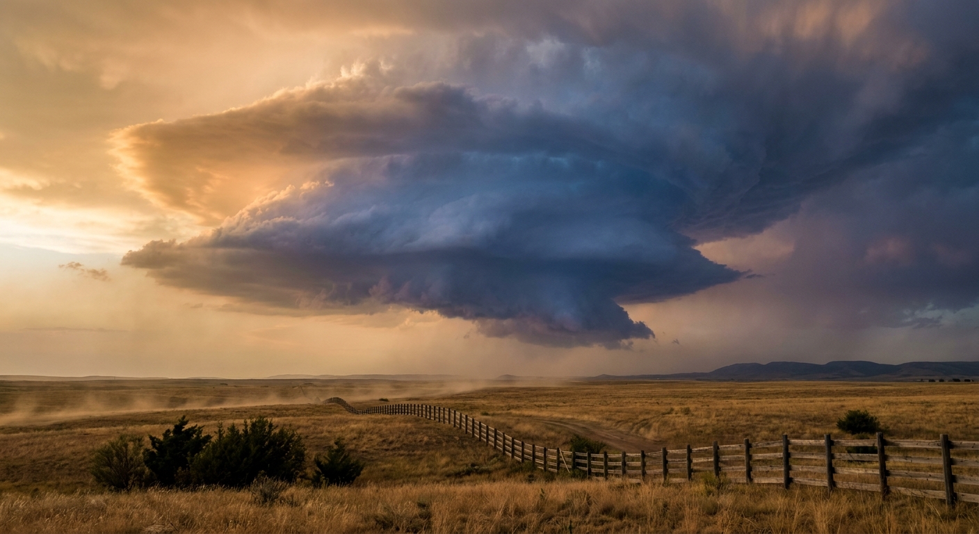
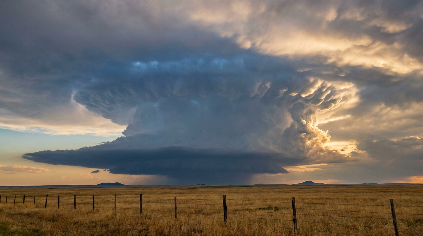
Saturday, the Storm Prediction Center has the highest threat way up north. We're talking an Enhanced Risk, that's level 3 out of 5, for eastern Montana into western and central North Dakota. Think Baker, Glendive, and Bismarck.
Here's what the data shows for that zone:
- A 30% wind probability with a hatched area for gusts of 75 mph or higher, affecting about 377,000 people
- A 30% hail probability with a hatched area for hail 2 inches or larger, hen-egg size, affecting about 864,000 people
- An isolated tornado threat where storms can organize
That hail number deserves a pause. Two inches across is big enough to crack windshields and dent metal. If you've got vehicles parked outside up there, this is your heads-up.
The Science: Why Montana, Why Now
So what's pulling the trouble north? A deepening surface low and strengthening southerly winds at low levels are going to pump mid-60s dewpoints up into the northern High Plains. That's the fuel. Above it, you've got 50 to 60 knot winds at the middle levels of the atmosphere, around 500 millibars. That's the wind shear, the change in wind speed and direction with height that lets storms organize and rotate instead of just popping up and dying.
Fuel plus shear plus a trigger equals supercells. The first storms are expected to fire near the Big Horns and the Beartooth and Absaroka ranges, then roll east. Late in the day, those discrete storms may clump together into one big complex, what meteorologists call an MCS, a mesoscale convective system. That's when the widespread damaging wind threat ramps up.
There's history here, too. Late June is one of the country's peak windows for severe weather on the northern Plains. Baker, Montana got hit by an EF3 tornado back on June 11, 2016. And North Dakota's most infamous tornado, the Fargo F5, happened on June 20, 1957. A late-June Enhanced Risk up there isn't out of left field. It fits the climatology.
Out East: Soccer, Jazz, and a Lower-Key Threat
Now, if you're at the Hampton Jazz and Music Festival in Virginia this weekend, or you're tracking the FIFA World Cup Final coming to East Rutherford, New Jersey on July 19, here's your local read.
Saturday brings a Slight Risk, that's level 2 out of 5, for severe storms across southeast Virginia into northeast North Carolina. Virginia Beach, Norfolk, and Richmond are in that zone. The main concern is organized damaging wind. Not a washout, but if you're outdoors at Hampton, keep one eye on the sky and know where you'd go if a storm rolls through. These tend to be afternoon and evening pop-up affairs.
For the baseball crowd, and there's a lot of you, the Yankees are at Boston for a weekend series, the Phillies are at the Mets in Queens, and there's a full slate across the Northeast. Most of that region sits under a marginal threat at worst Friday night, with the bigger organized stuff staying south and west. Boston's also got the Yo Quiero Bailar Fest going on. Late June normals for Boston run a high near 76. Comfortable enough.
The Quiet Star Nobody's Talking About
Here's my favorite under-the-radar story. The best weather in the entire country this weekend is sitting over Wisconsin and Michigan.
Saturday, that zone scores a 92 out of 100 on our nice-weather scale. Highs in the mid-to-upper 70s, dewpoints in the comfortable upper 50s, cloud cover around 14%, and almost no rain chance. If you happen to be at Summerfest in Milwaukee, or Electric Forest over in Rothbury, Michigan, you hit the jackpot. A broad area of high pressure parked near the Canadian border is keeping it calm, dry, and pleasant.
That's the flip side of the same pattern. The ridge that's giving Wisconsin a perfect festival weekend is the same feature steering storms around its northern edge into Montana and North Dakota.
One More Thing: The Fire Side
While the Plains deal with storms, the Four Corners is dealing with the opposite problem. Saturday brings an Extremely Critical fire weather setup for western Colorado and eastern Utah into the Four Corners, with relative humidity dropping below 10% around Grand Junction and Cortez. Bone dry, windy, and primed to burn. If you're out that way for the holiday week, be careful with anything that throws a spark.
The Takeaway
Weather doesn't care what's trending. The World Cup will keep folks talking, the festivals will go on, and the baseball will get played. But this weekend the map quietly rearranged itself. The severe threat that's been parked over the Southern Plains for weeks finally shifted north to Montana and North Dakota, the Northeast gets a manageable afternoon storm chance, and the upper Midwest gets the kind of weekend you tell people about later.
If you're up in the northern Plains, know where your safe spot is and keep your phone charged for warnings. Everybody else, enjoy the games and the music.