Winter weather
1 to 3 feet of snow for I-80 Donner Summit starting Tuesday night
By Ryan Hall, Y'all Weather Desk · Published
Written by our automated news desk from National Weather Service data.
Key points
- Where: The Sierra Nevada and southern Cascades above 4,000 feet, including I-80, Highway 50, and State Routes 4 and 108, plus the Greater Lake Tahoe Area.
- When: Warning starts 10 PM Tuesday, Nov. 17 (Tahoe area at 4 AM Wednesday) and runs to 4 AM Friday, Nov. 20. The heaviest snow comes Thursday into early Friday.
- What: 1 to 3 feet above 5,000 feet, up to 4 feet on the peaks. Around Lake Tahoe, 2 to 4 feet above 7,000 feet. Gusty winds will accompany the storm.
- What it means: Hazardous to impossible travel over the high passes. If you can get across before Tuesday night, do it.
A Winter Storm Warning for the Sierra Nevada and southern Cascades runs from 10 PM Tuesday, Nov. 17, to 4 AM Friday, Nov. 20, Pacific time. It calls for 1 to 3 feet of snow above 5,000 feet, with up to 4 feet on the highest peaks, and that includes I-80 over Donner Summit. Today's snow on the pass is just the opener.
Travel over the high passes may become hazardous to impossible, with the heaviest snowfall and worst conditions Thursday into early Friday.
Today on the pass is the warm-up
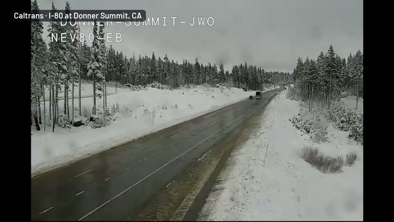
That's a Caltrans camera view of I-80 at Donner Summit from about 1:14 PM Pacific Monday (4:14 PM Eastern). There's snow on both sides of the road, the pavement is wet, and trucks are rolling. A Caltrans plow comes up the eastbound lanes toward the camera at the end of the clip. Credit goes to Caltrans.
That plow is working ahead of a bigger storm. A Winter Weather Advisory for the northern Sierra above 6,000 feet runs until 10 PM tonight. It calls for up to 6 more inches of snow and gusts as high as 40 mph. Around Lake Tahoe, above 7,000 feet, the advisory brings up to 3 more inches, with ridgetop gusts to 50 mph, until 7 PM.
The big snow starts Tuesday night
The warning for the northern Sierra and southern Cascades starts at 10 PM Tuesday for elevations above 4,000 feet. Totals of 1 to 3 feet are expected above 5,000 feet, and up to 4 feet on the highest peaks. The Lake Tahoe area warning starts a little later, at 4 AM Wednesday. It calls for 2 to 4 feet above 7,000 feet.
A strong low pressure system and a long plume of Pacific moisture (an atmospheric river) are lining up on the Sierra. The mountains force that wet air upward, and it dumps its moisture as snow. We have high confidence that Thursday into early Friday brings the heaviest snowfall and the worst conditions on the high passes. Exact totals will swing a lot with elevation, so a pass at 7,000 feet will see much more than a town at 4,500.
Wind and flooding come along with it
Gusty winds will accompany the storm. They can blow snow sideways and reduce visibility on the summits. Our flash flood outlook also has a Level 2 of 4 (Slight) risk over parts of California on Wednesday, Nov. 18. Low-elevation rain and high-elevation snow often come from the same storm, so check where you're headed.
After that, the storm moves east into the Rockies and Plains. Snow and gusty wind are possible from eastern Wyoming and Montana across the Dakotas from Friday into Saturday. Confidence there is moderate, because the exact track is still shifting.
What to do
- Cross early or wait. If you have to take I-80 over Donner Summit, aim to be across before Tuesday night. Otherwise plan on waiting until Friday.
- Check conditions before you go. Look at the Caltrans road conditions and our interstate driving outlook before you leave, not after you're in the snow.
- Carry chains and know how to put them on. Pack extra food, water, warm layers, a blanket and a full tank. Closures and long holds can happen with little warning.
- Don't count on cell service. Tell someone your route and your timing.
- Watch for changes. The winter storm outlook and the live warnings page update as the storm firms up. You can also sign up for free Y'all Alerts.
Bottom line
Monday's snow on I-80 is the small stuff. From Tuesday night through early Friday, 1 to 3 feet of snow and gusty winds will make Donner Summit and the other high Sierra passes hazardous to impossible. Get your trip done before the storm or push it to the weekend.
Explained: Winter Storm Watch vs. Warning vs. Winter Weather Advisory: What Each Means
More on West winter weather, November 2026
Places in this story: Soda Springs, CA
https://ryanhallyall.com/news/1-to-3-feet-of-snow-for-i-80-donner-summit-starting-tuesday-night