Weather news
158 of 159 weather radars are working Friday; the ground stop isn't a radar outage
By Ryan Hall, Y'all Weather Desk · Published
Written by our automated news desk from National Weather Service data.

Key points
- What: 158 of 159 weather radars were sending live data at 4:38 PM ET Friday.
- Where the gap is: Kadena Air Base in Okinawa, Japan. No lower 48 site was offline in that check.
- Why flights are stopped: The FAA said it has "communication issues impacting multiple Air Route Traffic Control Centers" (statement reported at 4:27 PM ET).
- What it means: The weather radar network is still sending data. Flight delays today are not a sign that weather radar is broken.
Weather radar is not down. At 4:38 PM ET Friday, Nov. 13, 158 of the country's 159 weather radars were sending live data, and the one that wasn't is the Kadena Air Base radar in Okinawa, Japan. The national flight ground stop is an air traffic control communications problem, not a radar problem. A viral post claiming "NWS confirms an ongoing radar outage nationwide" is wrong.
The radar network is sending data
The graphic below is our national radar picture for this story. We checked the federal list of weather radar stations at 4:38 PM ET and counted every site that had sent data in the last 20 minutes. That came to 158 of 159.
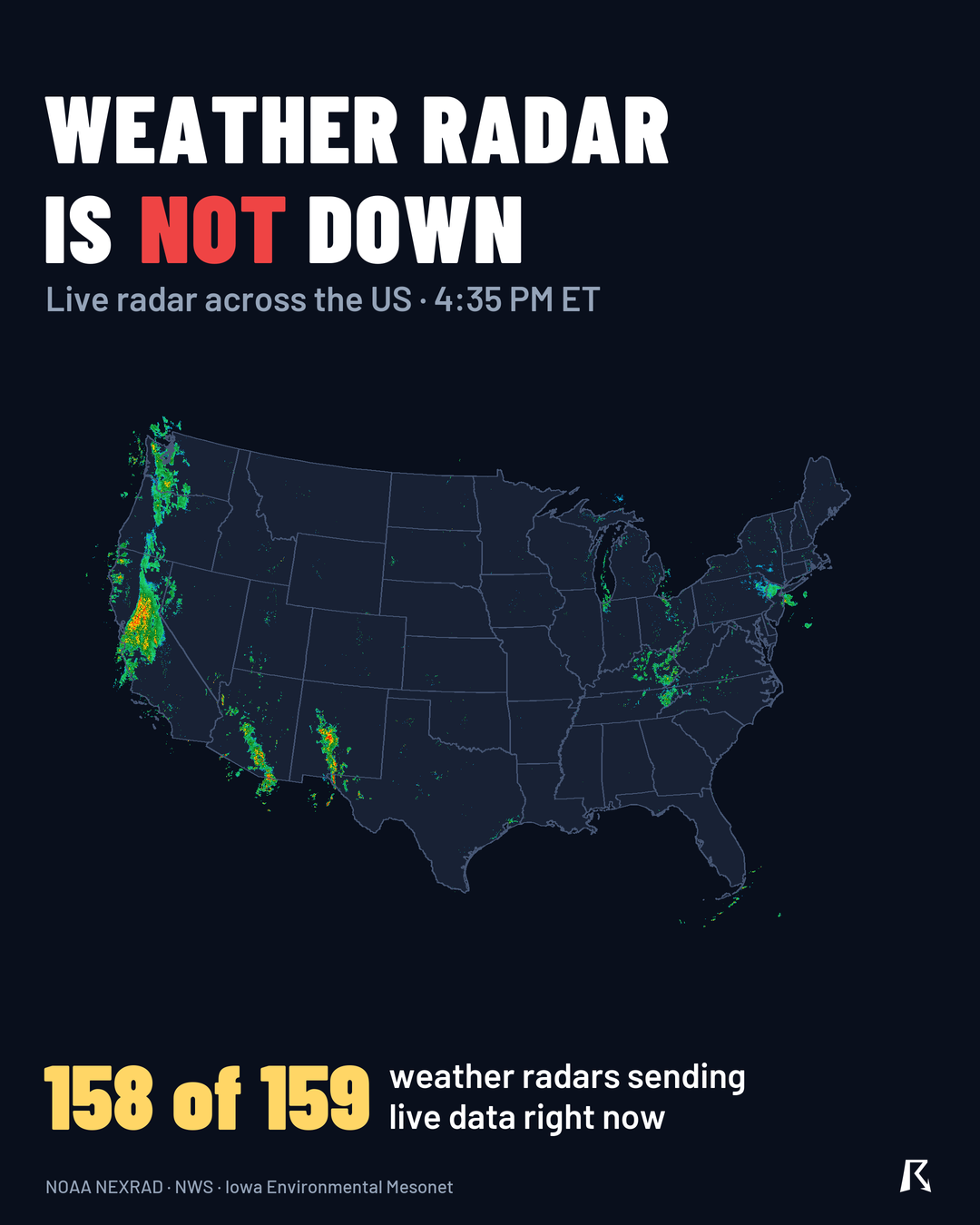
We also looked at the national radar mosaic valid at 4:35 PM ET. It was built from 144 of 147 lower 48 radar sites. Those numbers come from live data checks, not from a rumor or a screenshot.
Why flights are stopped
The FAA ground stop is a separate system from weather radar. The agency described the trouble as communication issues affecting multiple Air Route Traffic Control Centers, the facilities that guide planes between airports. That is about talking to aircraft and passing information between centers. It has nothing to do with the dishes that scan for rain and snow.
We don't have an end time for the ground stop. Check your airline's app for the latest on your flight. Our airport delay outlook covers weather-driven delays only, so it won't explain this one.
What radar is showing today
Radar is picking up real weather, mostly in the West.
- Northern and central California: A cold front is bringing scattered to organized thunderstorms this afternoon and evening. Flood advisories were up for Alameda County and southeastern San Mateo County, and a Coastal Flood Advisory covers the San Francisco Bay shoreline until 4 PM PST. The flash flood risk is Level 1 of 4 (Marginal), with isolated flash flooding possible, especially in urban areas like San Francisco and Sacramento. See the flash flood outlook.
- Lake Tahoe: A Winter Storm Warning runs until 10 AM PST Saturday. Expect near 12 inches of heavy wet snow above 7,000 feet, up to 20 inches along the crest west of the lake, and gusts of 70 to 90 mph over ridges.
- Northern Michigan: Lake effect snow could add 1 to 3 inches in Grand Traverse County through early Saturday morning.
- Severe storms: None expected today or Saturday. Sunday, Nov. 15, brings a Level 1 of 5 (Marginal) risk across Texas.
What to do
- If you saw the outage claim, don't share it. Send people to the radar itself, which is still updating nationally.
- If you're flying, check your airline's app and the FAA's own updates. Radar has nothing to do with the delay.
- If you're in the Bay Area, the Sierra or northern Michigan, trust your radar and warnings today. Active warnings are live on our site, and you can sign up for free Y'all Alerts.
Bottom line
At 4:38 PM ET, weather radar was working nationally, with 158 of 159 sites reporting and the only gap in Japan. The ground stop is the FAA's communications problem, and it doesn't touch the radar you use to watch the sky.
Explained: Flood Advisory, Watch, Warning and Flash Flood Warning explained
More on November 2026 weather
Sources
- Iowa Environmental Mesonet observations, Iowa Environmental Mesonet (Iowa State University)
- theres a weather radar outage now?'), National Weather Service