Forecasts
Heavy Sierra snow Friday into Saturday, up to 2 feet; wet Olympics Saturday
By Ryan Hall, Y'all Weather Desk · Published
Written by our automated news desk from National Weather Service data.
What's new: Leads with the Sierra heavy snow and I-80 travel threat, and adds the Sunday Gulf Coast flood risk and the next western snow rounds.

Key points
- Sierra Nevada, today through Saturday: Heavy, wet snow with the biggest totals up high. Pass closures and travel disruptions are possible, so check road conditions before traveling.
- Washington's Olympic Peninsula, Saturday, Nov. 14: Another 1 to 3 inches of rain, locally more. A Level 1 of 4 (Marginal) flash flood risk is up for northwest Washington.
- Poconos, Catskills, northern Pennsylvania and southern New York, today: The first accumulating snow of the season winds down by evening. Slick spots on higher roads linger through the day.
- Upper Peninsula of Michigan, today: Lake-effect snow in several bands can cut visibility fast.
- Texas and western Louisiana, Sunday, Nov. 15: A Level 1 of 5 (Marginal) storm risk covers Texas, while a Level 1 of 4 flood risk covers eastern Texas and western Louisiana.
Heavy, wet snow falls across the Sierra Nevada today, Friday, Nov. 13, and into Saturday, Nov. 14. There is a 50 to 90 percent chance of more than 12 inches, and locally up to 2 feet. That could be enough to close mountain passes around Lake Tahoe and slow the drive on I-80. No severe storms are expected anywhere in the lower 48 today, and no flash flood risk is outlined.
Sierra snow can close passes through Saturday
A strong Pacific storm is pushing into California, and the Sierra is where it hits hardest. Snow levels will bounce up and down. Warmer air runs ahead of the front and colder air follows it, so lower elevations may see rain mixed in before it flips back to snow. The heaviest, stickiest snow falls at pass level and above.
Our interstate outlook for Saturday rates I-80 as Hazardous Conditions for precipitation, the worst rating on the map. If you cross the Sierra on I-80 or another pass, check road conditions before you leave, carry chains, and fill the tank. Heavy snow is likely. The exact totals at any one pass depend on where the snow level sits hour to hour.
Olympic Peninsula gets a second soaking Saturday
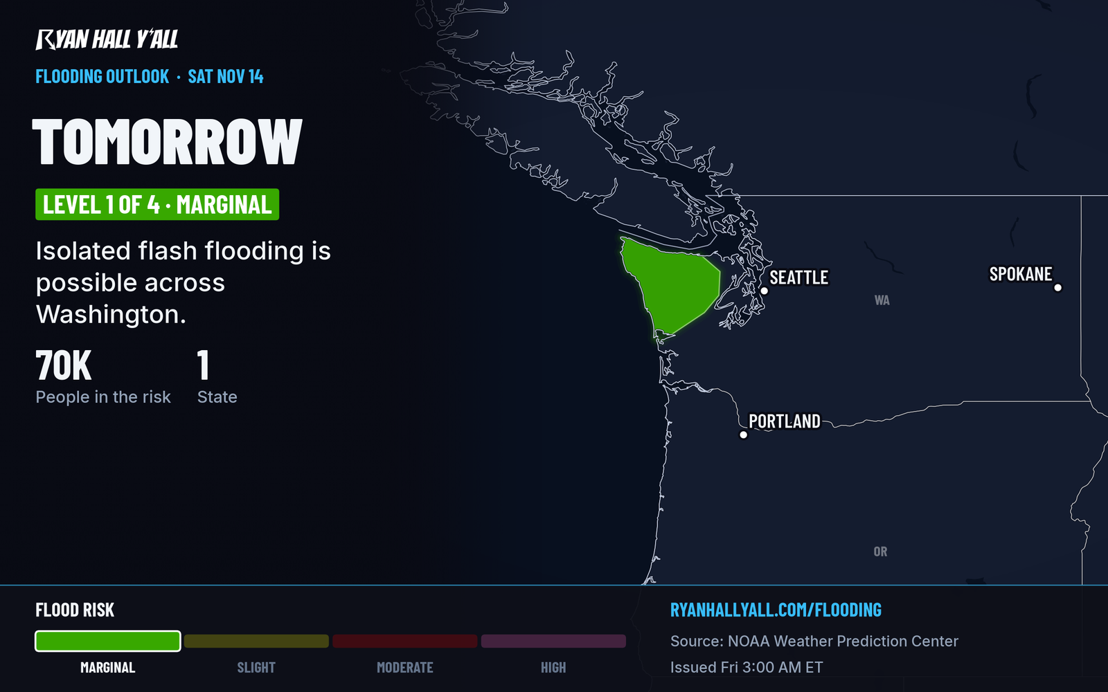
Another round of rain arrives Saturday, Nov. 14, and most of it falls in a window of about 12 hours. The Olympic Peninsula and northwest Washington could pick up 1 to 3 inches more, locally higher, on ground and rivers already wet from earlier rain. That could cause isolated flash flooding and river overflow. Don't drive through water over the road, and watch river levels if you live near one. Seattle ran record warm earlier this week, and our desk story on the Seattle record and the Olympic rain has that background. The flood risk is Level 1 of 4, so this is a localized problem, not a widespread one.
Northeast snow winds down tonight
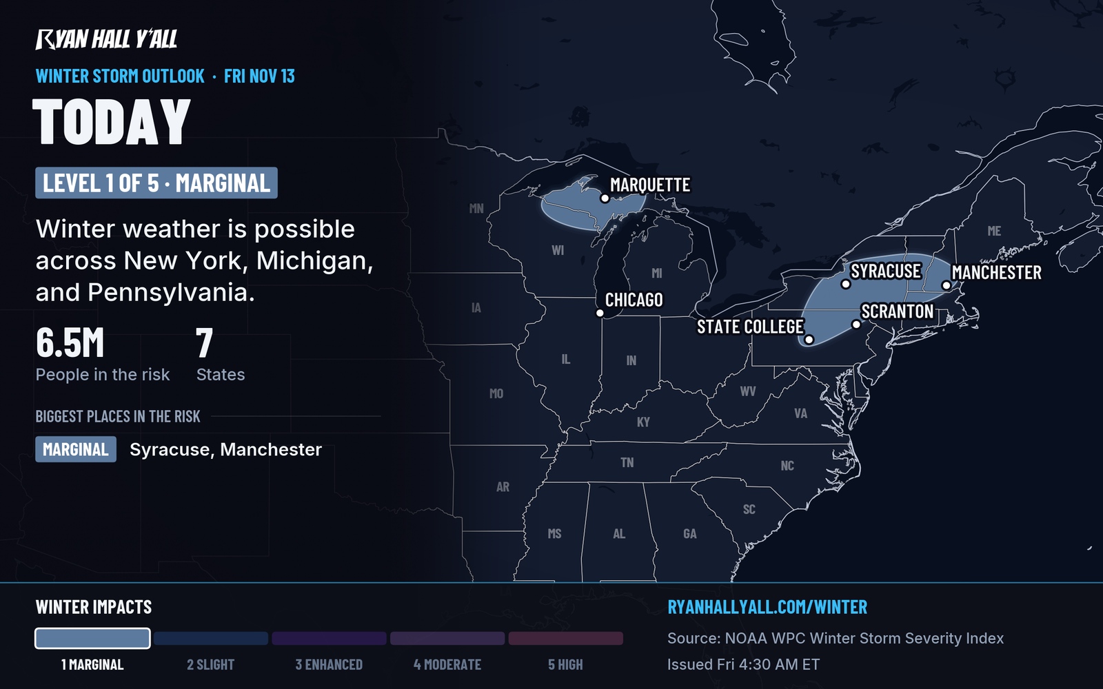
The coastal low that brought storms and a tornado to the Mid-Atlantic on Thursday is pulling away to the east. Snow keeps falling in the Poconos, the Catskills, northern Pennsylvania and southern New York through Friday evening, especially at higher elevations. Our winter storm outlook has a Marginal risk of winter weather impacts across the Northeast and the upper Great Lakes today. In Michigan's Upper Peninsula, including the Huron Mountains, lake-effect bands can abruptly reduce visibility and make travel difficult. No severe storms are expected in the East today.
Texas storm and flood risk builds Sunday
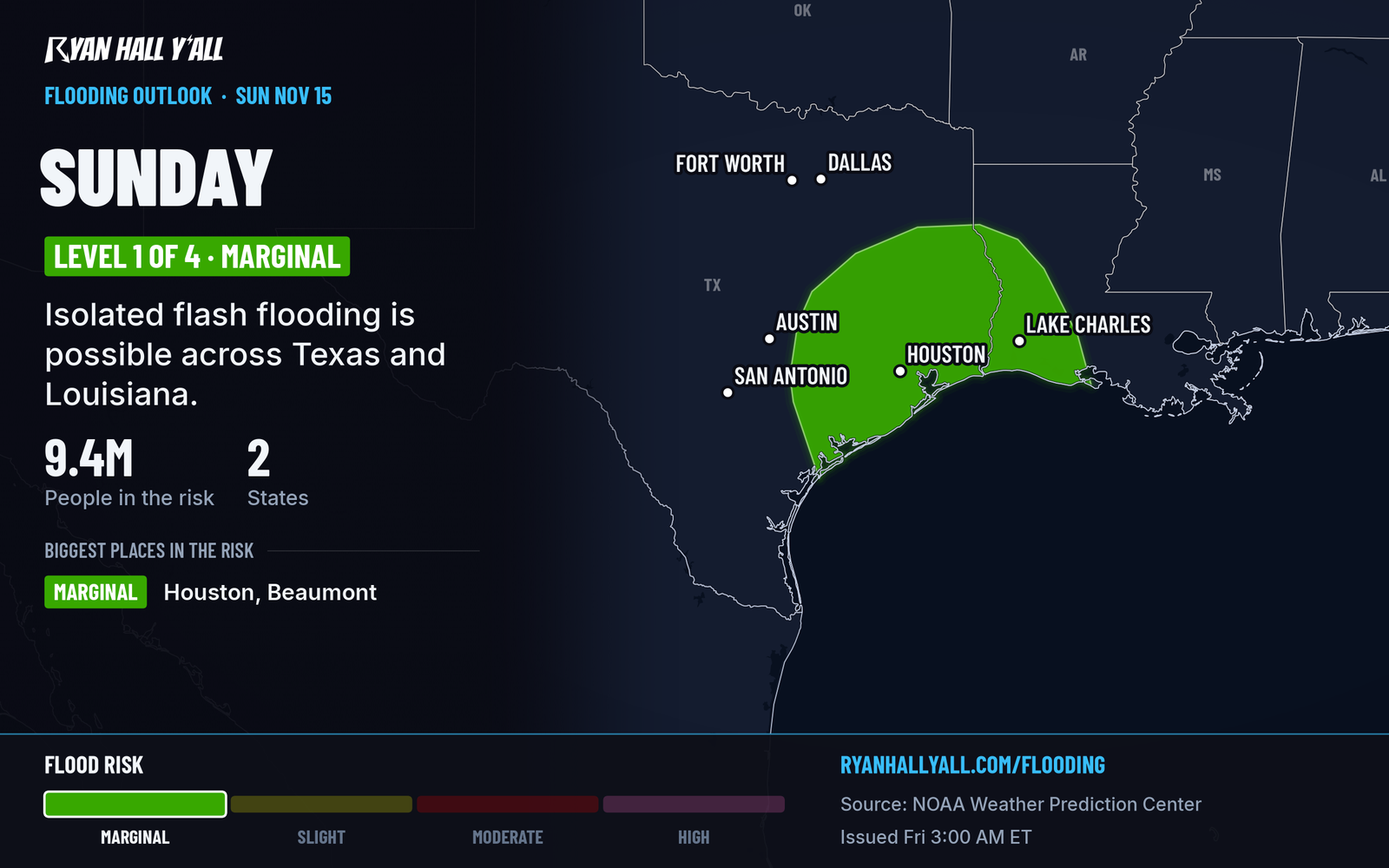
Scattered storms move across central and southern Texas Sunday, Nov. 15, while the flood concern centers near the upper Texas coast into southwest Louisiana. Texas is under a Level 1 of 5 storm risk, and eastern Texas and western Louisiana are under a Level 1 of 4 flood risk. The heaviest rain may stay just offshore or push inland, and that part is still uncertain. Our desk story on the Texas storm risk has the storm details. See the flash flood outlook for updates.
Looking ahead
More rounds of mountain snow roll from the Pacific Northwest and Sierra into the Great Basin and Rockies from Sunday through Wednesday. Our winter outlook shows the Cascades, Wasatch and Colorado ranges as likely targets. The Plains stay mild and dry under a ridge, and the cold in the East eases. A freeze reaches parts of the South this weekend. If you want sunshine, south Texas is the pick today, and the desert Southwest is the best bet Sunday. The Nice Weather outlook has the day-by-day rankings. A minor geomagnetic storm is possible Nov. 17 and 18 for aurora watchers.
Bottom line
If you're crossing the Sierra today or Saturday, check road conditions before leaving, carry chains, and be ready to turn around if a pass closes. No severe storms are expected Friday, and no flash flood risk is outlined.
More on Texas winter weather, November 2026
Sources
- WPC Day 2 Excessive Rainfall Outlook, NOAA Weather Prediction Center, issued
- WPC Day 3 Excessive Rainfall Outlook, NOAA Weather Prediction Center, issued
- Ryan Hall, Y'all winter storm outlook, day 1 (our own outlook), Ryan Hall, Y'all, issued
- WPC Winter Storm Severity Index (WSSI), NOAA Weather Prediction Center
- Ryan Hall, Y'all interstate travel outlook (our own outlook), Ryan Hall, Y'all, issued