Weather news
LA burn scars under evacuation warning as 3 to 5 inches of rain could fall Thursday
By Ryan Hall, Y'all Weather Desk · Published
Written by our automated news desk from National Weather Service data.

Key points
- Where: Below the Palisades burn scar (including Mandeville Canyon), the Hurst scar above Sylmar and the Sunset scar in the Hollywood Hills.
- When: The warning runs from 6 PM PST Wednesday to 8 AM PST Friday. The heaviest rain arrives around mid-morning Thursday.
- What: Debris flows, meaning fast-moving mud and rock, off burned slopes. Rain rates could reach 1 inch per hour.
- What it means: A warning means be ready to go. An order means leave right away.
Los Angeles has put an evacuation warning on the Palisades, Hurst and Sunset burn scars from 6 PM PST Wednesday until 8 AM PST Friday, Nov. 20. The reason is rain: 3 to 5 inches could fall on the coastal slopes and foothills Thursday, Nov. 19, with the heaviest coming around mid-morning. Burned hillsides can't soak that up, so mud, rocks and debris can come down into the neighborhoods below.
There is no evacuation order yet. If you live below one of these scars, now is the time to get ready.
What the warning covers
The Los Angeles Fire Department issued the warning for the Palisades, Hurst and Sunset burn scars. The LAPD will visit the highest-risk homes in person.
The warning is mapped by evacuation zone. The Palisades scar covers zones LFD-1081, 1083, 1085, 1087, 1089, 1091, 1092, 1093, 1095, 1096 and 1097, plus Mandeville in zone 0891. Hurst is zone 0001-B and Sunset is zone 0835. You can look up your address on the city's evacuation map to see if you're in one.
How much rain and when
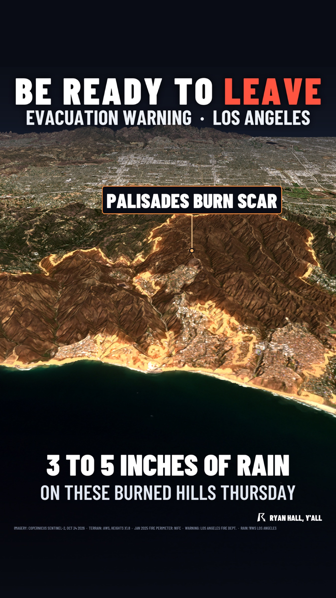
Coastal slopes and foothills are in line for 3 to 5 inches. Coastal areas and valleys should see 1 to 2 inches, locally up to 3. A Flood Watch covers Los Angeles County from 6 AM to 6 PM PST Thursday, and the heaviest rain should reach the county around mid-morning.
Our flash flood outlook has Level 2 of 4 (Slight Risk) across the Los Angeles Basin on Thursday. The strongest rain will hit the mountains just north of the city, and much of it should fall in a 3 to 6 hour stretch. That short window is what makes burn scars so touchy. Burned ground sheds water like a parking lot, and a short burst can start a debris flow even when the rain total looks ordinary.
How sure are we? The warning is in place and the rain is expected. The heaviest rain is expected around mid-morning Thursday, and burn scars could worsen localized flooding.
What to do
- Know your zone. Look up your address on the city's evacuation map tonight, before the rain starts.
- Get ready now. Pack a bag with medications, documents, chargers and pet supplies. Park the car facing out and fill the tank.
- Pick two ways out. Mud and water can close a street fast.
- If an order is issued, leave right away. Don't wait for the rain to peak, and don't wait to see the debris.
- Don't drive through water or mud on the road. Debris flows can cover pavement quickly, and you can't tell how deep it is.
- Keep alerts on. Check active warnings as the rain moves in, and sign up for free Y'all Alerts.
Bottom line
Heavy rain Thursday on the Palisades, Hurst and Sunset burn scars could send mud, rocks and debris into neighborhoods below, so the warning is worth taking seriously tonight. Get packed, know your zone, and be ready to leave the moment an order comes.
More on West flooding, November 2026
Places in this story: Los Angeles, CA