Winter weather
Only 2 falls in 142 years waited longer for Minneapolis' first snowflake
By Ryan Hall, Y'all Weather Desk · Published · Updated
Written by our automated news desk from National Weather Service data.
What's new: Record context corrected: only 2 falls went later than Nov. 14, and the ranking thresholds were fixed
Key points
- Where: Minneapolis and the Twin Cities. The snow depth picture also shows bare ground in Fargo and Denver.
- What: No snow of any amount since July 1. Airport observations from Thursday evening through early Saturday show none.
- When: Dry and sunny or clear through Monday, Nov. 16.
- What it means: Only 1931 (Nov. 18) and 1953 (Nov. 21, the record) started later. 1902's first flake came Nov. 14.
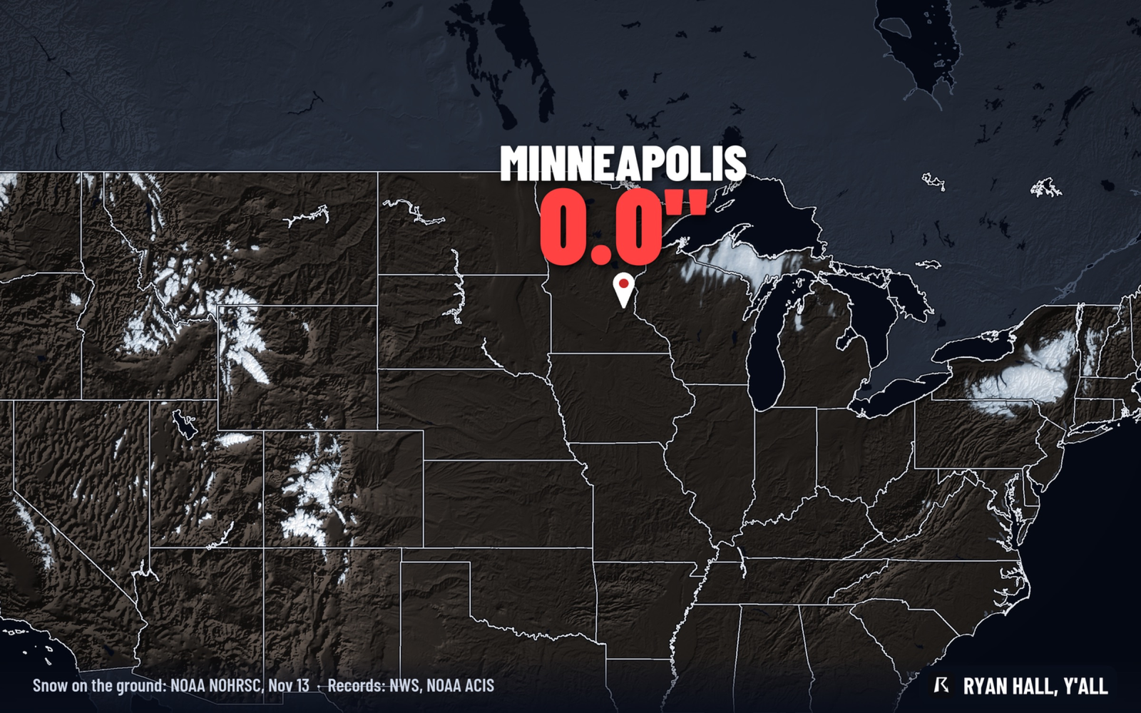
Minneapolis has not recorded a single snowflake, not even a trace, since July 1, and the forecast stays dry through Monday, Nov. 16. Only 2 of the 142 complete falls on record, 1931 and 1953, waited longer for a first flake. If the dry stretch holds, this fall moves into third place on that list.
Where this fall sits in the record book
The record goes back to 1884, and a trace counts as snow in it. Even so, 140 of those 142 falls had a first flake by Nov. 14. The year 1902 got its first one on Nov. 14 itself, so it sits right on the edge of the list.
A correction on the count: earlier versions of this story said only 3 other falls had gone this late. That was right only through Nov. 13. Now that Nov. 14 is here, only 2 falls went later.
Today is not over, and a flake before midnight would only tie 1902. A first flake from Nov. 15 through Nov. 17 would make 2026 the third latest on record. Waiting past Nov. 18 would pass 1931, and waiting past Nov. 21 would take the record from 1953.
The ground is bare in Minneapolis, Fargo and Denver
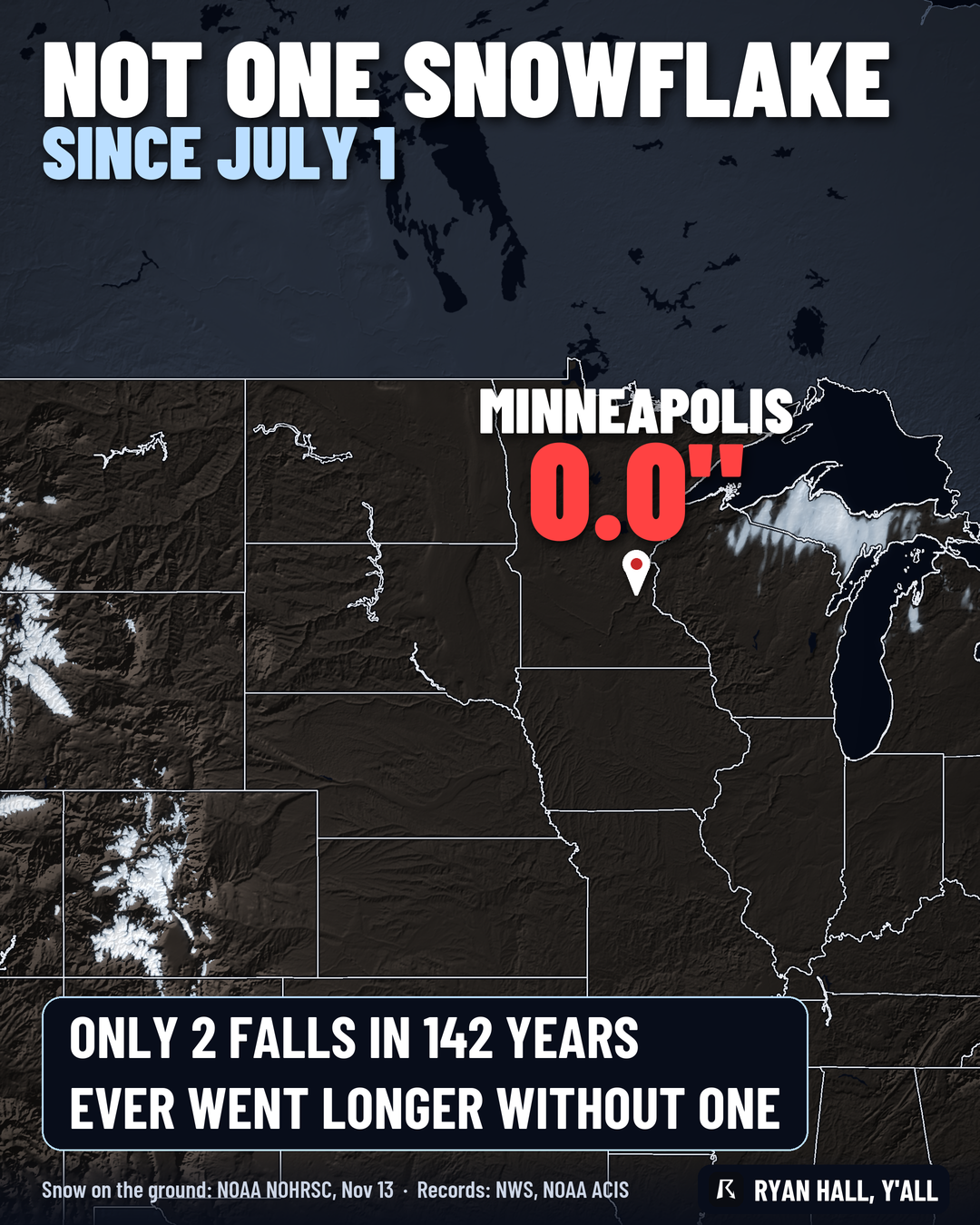
Our snow depth picture from early Friday shows nothing on the ground at Minneapolis, Fargo or Denver.
The snow is headed for the West instead. A cold front sweeps the Northwest and northern Rockies on Tuesday, Nov. 17. It brings accumulating snow to the higher parts of Idaho, western Montana, Wyoming and northern Utah, with locally significant amounts exceeding 6 to 12 inches across the highest peaks. A stronger disturbance follows Wednesday, with another round of moderate to heavy snow in the Cascades and Sierra Nevada. Confidence is fairly high on that progression through Wednesday.
By late next week, the pattern may push snow into the central Rockies and the adjacent High Plains, including the Denver area. The details that far out are still shaky. Our winter storm outlook has the latest.
What the forecast says for the Twin Cities
Saturday stays dry and sunny, and the forecast is dry and mostly clear through Monday. Our winter outlook for the next few days outlines no winter weather risk in Minnesota.
Past Monday, the streak is not guaranteed. A single flurry would end it, and our forecast for that stretch is not locked in.
What to do
Use the quiet time. Get the snow tires on, check the shovel and the snowblower, and finish outdoor jobs like gutters, hoses and the last yard cleanup. When the first snow does show up, you can follow our snow forecasts and sign up for free Y'all Alerts.
Bottom line
Minneapolis is snowless into mid-November, a pace only 1931 and 1953 beat in 142 years of records. Dry weather through Monday keeps this fall on track for third place.
| Fall | First flake | Note |
|---|---|---|
| 1953 | Nov. 21 | The record |
| 1931 | Nov. 18 | Second latest |
| 1902 | Nov. 14 | Sits right on the edge of this list |
More on Plains winter weather, November 2026
Places in this story: Minneapolis, MN; Denver, CO; Fargo, ND
Sources
- NOAA Regional Climate Centers ACIS station records, NOAA Regional Climate Centers (ACIS)
- Iowa Environmental Mesonet observations, Iowa Environmental Mesonet (Iowa State University)