Tropics
Weekend coastal low may hit East Coast Sunday into Monday; track still uncertain
By Ryan Hall, Y'all Weather Desk · Published · Updated
Written by our automated news desk from National Weather Service data.
What's new: Updated ensembles now slightly favor the coastal track, 43 to 38

Key points
- Where: The low forms near the Bahamas. The track after that decides who gets hit, anywhere from the Carolinas to New England.
- When: It develops this weekend. East Coast impacts, if they happen, come Sunday into Monday.
- What: Up the coast means wind, heavy rain and coastal flooding. Out to sea means rain mostly near the Southeast coast.
- How sure: Not very. The split is 43 to 38, so the exact track is still up in the air.
- What it means: Keep Sunday and Monday travel flexible along the coast, but don't cancel anything yet.
A low-pressure system forming near the Bahamas this weekend could bring rain, wind and coastal flooding from the Carolinas to New England on Sunday, Nov. 22, into Monday, Nov. 23. The newest computer model runs lean slightly that way, with 43 of 81 sending it up the East Coast and 38 keeping it out to sea. That is an edge, not a call, and we don't have rain or wind numbers yet because they depend on the track.
Why the forecast is still split
We looked at the American (GFS) and European ensembles from the overnight run. An ensemble is a group of forecasts started from slightly different conditions, so the spread shows how much the answer can wobble. Here, 81 runs followed the low from Saturday through Monday. They sort into two nearly even camps: 43 up the coast, 38 out to sea.
The National Hurricane Center gives the area a 20% chance of becoming a subtropical storm over the next 7 days. No named storms are active in the Atlantic today. A low doesn't need a name to bring rain, wind and high water, so that 20% is not the number to watch. The track is.
If the low comes up the coast
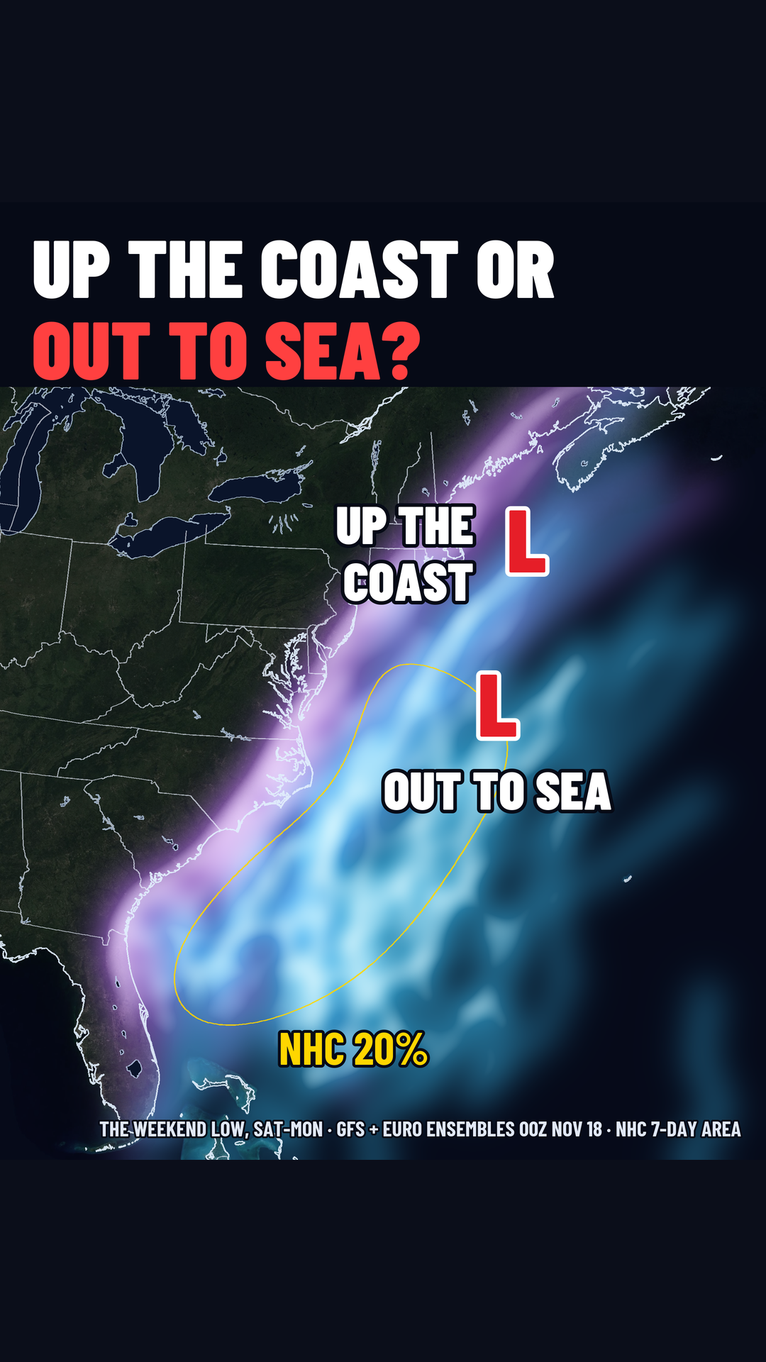
This is the path that matters for the most people. A low running up the coast Sunday into Monday would bring wind, heavy rain and coastal flooding from the Carolinas to New England. The timing lands right as Thanksgiving week starts, with Thanksgiving itself on Thursday, Nov. 26. Monday travel on I-95 and at coastal airports is the part to watch.
We don't have rain totals or gust numbers for this path yet. Pinning those down takes a track first, and we won't guess.
If it goes out to sea
The rain stays near the Southeast coast. Even then, that coast is not dry. A flood watch is up through Thursday evening for southeast Florida, including Miami-Dade, Broward and Palm Beach counties. Florida also has a Level 3 of 4 (Moderate) flash flood risk each day through Friday. That setup is separate from this weekend's low. You can follow it on our flash flood outlook.
What to do
- Along the East Coast, Carolinas to New England: Treat Sunday and Monday as uncertain. If you can, hold off on non-refundable travel or tight schedules for those days.
- If you're flying or driving Monday: Check back Thursday and Friday. Our airport delay outlook and interstate driving outlook will carry any changes.
- If you live where water comes up near the shore: Know your route out and where your car can sit on higher ground. You don't need to act yet. It's just easier to sort out before a track is set.
- Stay current: Sign up for free Y'all Alerts so you hear when the odds shift.
Bottom line
The overnight runs split 43 to 38 on whether this weekend's low rides up the coast or heads out to sea, so Sunday and Monday call for flexible plans, not canceled ones. We'll update as the numbers move.
More on 2026 hurricane season
Sources
- GFS, NOAA National Centers for Environmental Prediction
- NHC advisories, NOAA National Hurricane Center
https://ryanhallyall.com/news/43-of-81-model-runs-send-weekend-coastal-low-up-the-east-coast