Weather news
8 inches of rain in Daytona Beach since Tuesday, flood risk Level 3 of 4 again
By Ryan Hall, Y'all Weather Desk · Published
Written by our automated news desk from National Weather Service data.

Key points
- Where: Florida's east coast and the east-central part of the state, Daytona Beach down to Stuart, with Orlando and Sanford included Friday.
- When: Thursday into Friday morning, then again from Friday into early Saturday, with the heaviest rain on the coast.
- What: Training bands of heavy rain, meaning storms that keep passing over the same neighborhoods. Hourly rain amounts up to 4 inches are theoretically possible in this environment.
- What it means: Flash flooding in city streets, underpasses and low spots, on top of rain that has already fallen.
Daytona Beach has picked up 8.29 inches of rain since Tuesday, Nov. 17, and a Level 3 of 4 (Moderate) flash flood risk covers Florida's east coast from Daytona Beach to Stuart today, Thursday. The same Level 3 risk returns Friday, Nov. 20, from New Smyrna Beach to Vero Beach and inland to Orlando and Sanford.
The ground is already saturated, so more heavy rain could quickly overwhelm urban areas. The Weather Prediction Center added a higher end of Level 3 for Cocoa Beach, Melbourne and Fort Pierce this morning.
What has already fallen
Daytona Beach got 2.19 inches on Tuesday and 5.77 inches on Wednesday. Another 0.33 inch has fallen early Thursday, for a total of 8.29 inches. Both days were daily records. Tuesday beat 1.51 inches from 2023. Wednesday crushed the old record of 0.55 inch from 2021.
The Space Coast was hit hard too. Cape Canaveral has 6.90 inches since Tuesday. Melbourne has 3.29 inches, and its 2.61 inches on Wednesday broke a record from 1959 of 0.71 inch. Orlando has 1.62 inches, so the heaviest rain has stayed close to the coast.
These are measured totals from official climate stations, so they are the numbers to trust.
Why more rain is a bigger deal this time
This is not the first soaking. Parts of east-central Florida had very heavy rain 16 to 19 days ago, and a flood wave from that event is still working north along the St. Johns River. Recent rains of 3 to 6 inches also left east-central Florida and the Royal Palm Beach area saturated. Between Hollywood and Pembroke Pines in Broward County, totals of 12 to 17 inches have made that area more sensitive too.
The Weather Prediction Center says the rain so far is already close to the size of the mid-November 2023 event in eastern Florida. Its main worry is a repeat of the heavy rain from two to three weeks ago.
Timing for Thursday and Friday
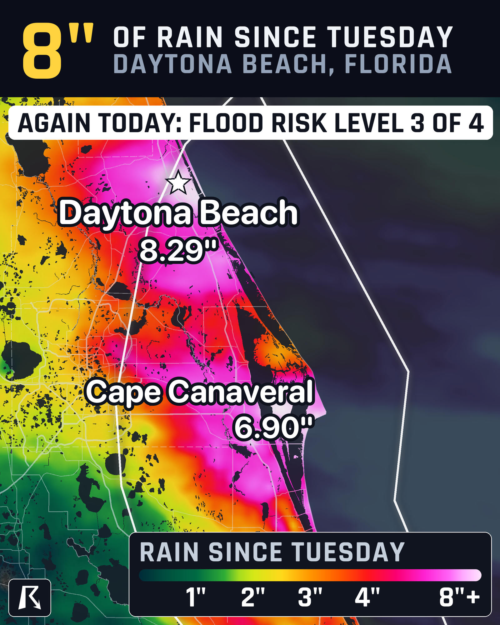
Thursday's Level 3 risk runs from 7 AM Eastern today to 7 AM Friday. The air is carrying about 1.75 to 2 inches of precipitable water, which means far more moisture than normal. There is also enough storm fuel and wind shear for bands of rain to sit over one area for an hour or two before reorganizing somewhere else. Those bands could quickly overwhelm urban areas where they persist.
Friday's Level 3 covers New Smyrna Beach to Vero Beach and inland to Orlando and Sanford. Daytona Beach drops to Level 2 of 4 (Slight) that day. More disturbances and a low pressure area forming near the Bahamas keep the rain going. The low-level winds may shift late Friday night and early Saturday morning, which should slowly ease the heavy rain concern.
By Saturday, Nov. 21, a low may form off the Southeast coast, with a Level 2 risk for Florida, Georgia and South Carolina. The National Hurricane Center puts the odds of that low becoming a subtropical or tropical storm at 50%. No named storms are active right now, and the track is still uncertain.
What to do
- Don't drive into water over the road.
- Avoid underpasses and low-lying streets, especially near Daytona Beach, Cocoa Beach, Melbourne and Fort Pierce.
- If you live near the St. Johns River or in a spot that flooded two or three weeks ago, move cars and valuables up now.
- Clear storm drains and gutters near your home while the rain is light.
- Keep the flash flood outlook and active warnings open, and sign up for free Y'all Alerts so a warning reaches your phone overnight.
Bottom line
Daytona Beach is already past 8 inches since Tuesday, and Level 3 of 4 flood risk covers both Thursday and Friday. Treat any new heavy rain on the Florida east coast as a flash flood threat, because the ground can't soak up much more.
| Value | Note | |
|---|---|---|
| Daytona Beach | 8.29 in | Daily records Tuesday and Wednesday |
| Cape Canaveral | 6.9 in | |
| Melbourne | 3.29 in | Daily record Wednesday |
| Orlando | 1.62 in | Mostly Tuesday and Wednesday |
More on Florida flooding, November 2026
Places in this story: Orlando, FL; Daytona Beach, FL; Melbourne, FL; Cocoa Beach, FL; Fort Pierce, FL
Sources
- Iowa Environmental Mesonet observations, Iowa Environmental Mesonet (Iowa State University)
- WPC Excessive Rainfall Outlook, NOAA Weather Prediction Center