Forecasts
Coastal flooding and big surf threaten parts of California around Tuesday morning's high tide
By Ryan Hall, Y'all Weather Desk · Published
Written by our automated news desk from National Weather Service data.
What's new: The focus shifts to California's Tuesday morning coastal flooding and surf hazards, while South Texas rain eases toward a quieter Tuesday.
Key points
- Parts of the California coast, mostly through noon Tuesday PST: Minor to moderate flooding of low-lying shoreline areas at high tide, plus dangerous rip currents. Stay off beaches, jetties and rocks.
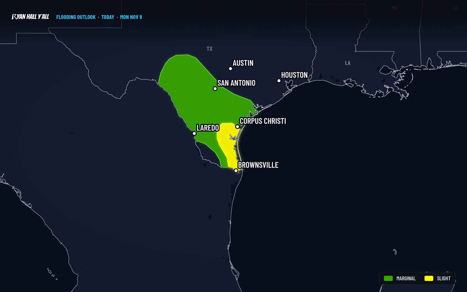
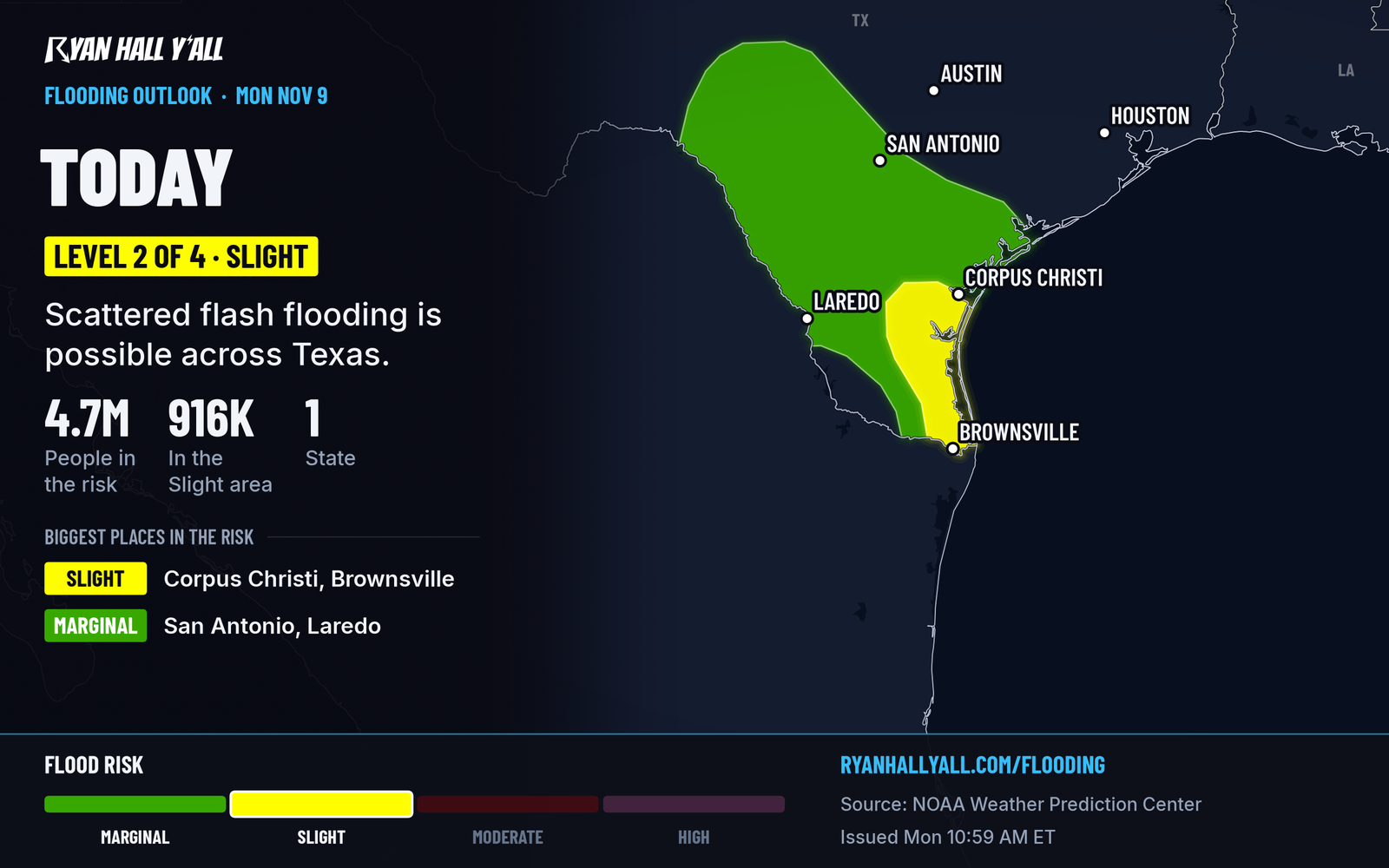
- South Texas, until early Tuesday: Heavy rain is fading, but soaked ground keeps a flash flood risk alive from Brownsville to Corpus Christi. Minor coastal flooding is also in effect near Corpus Christi until 3 AM CST.
- Pacific Northwest, tonight: The heaviest rain of the next couple of days arrives tonight, with snow in the Cascades and Olympics.
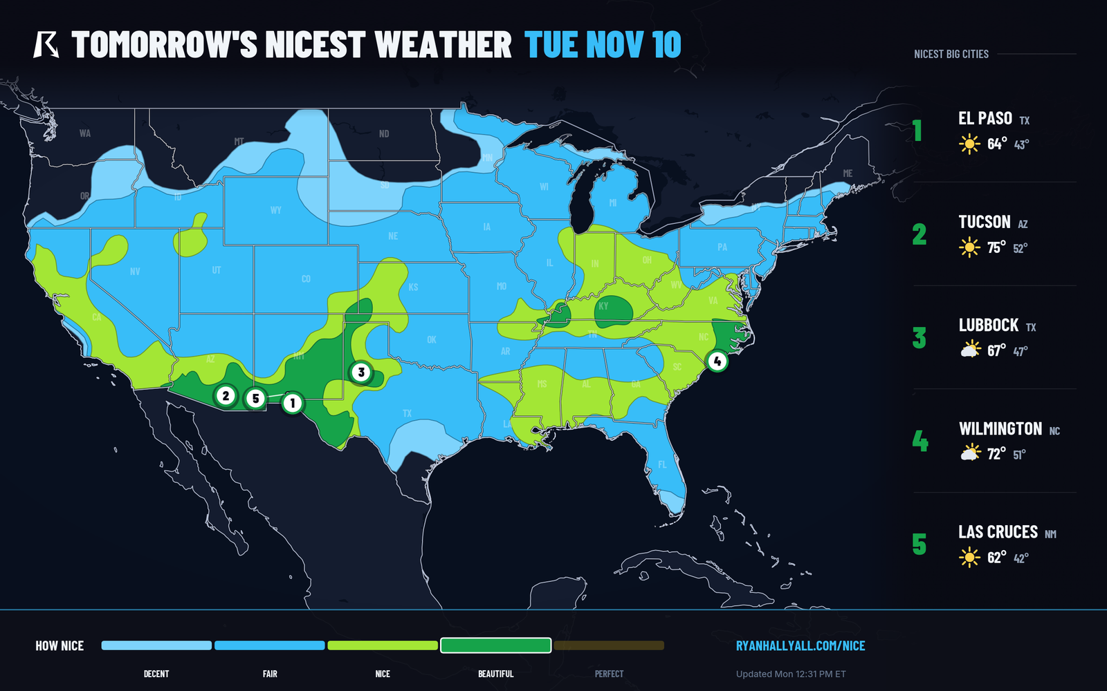
- Tuesday, much of the Southeast and Mid-South: Chilly start, then a dry, comfortable afternoon with highs in the mid 60s to low 70s.
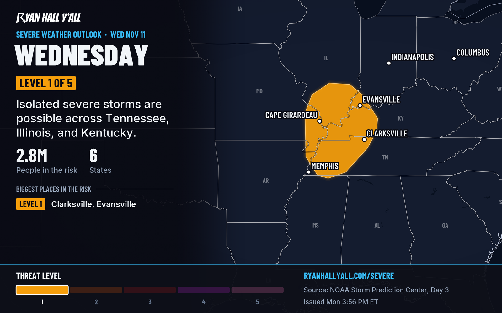
- Wednesday, Mid-Mississippi Valley: A Level 1 of 5 (Marginal Risk) for a few stronger storms ahead of a cold front.
Parts of the California coast from the San Francisco area to San Diego are under coastal flood advisories, most until noon Tuesday PST, and flooding is expected around morning high tide. Some San Francisco bayshore advisories last through Friday afternoon. Surf is 12 to 16 feet near San Francisco and 9 to 14 feet on the Central Coast. Most of the rest of the country is quiet tonight, with a chilly night in the Southeast and a fading flood risk in South Texas.
California coast: flooding at high tide, and surf you should respect
Advisories cover several stretches of the coast. Around San Francisco, breaking waves of 12 to 16 feet bring a risk of sneaker waves, which are surges that run far up the beach with no warning. The Bay Area flood advisory allows up to 1.6 feet of water over low-lying ground near the shoreline and the bay, and it lasts through Friday afternoon.
Farther south, the San Luis Obispo and Santa Barbara County beaches have the strongest wording: moderate coastal flooding and waves of 9 to 14 feet. Los Angeles and Ventura County beaches can see minor to locally moderate flooding, with surf of 5 to 8 feet. San Diego County has 3 to 6 foot surf on west-facing beaches, and its Beach Hazards Statement runs through Tuesday evening.
If you live or park near the water, move cars out of low beachfront lots before bed. Check Tuesday morning's route for coastal roads that may have water on them. Don't turn your back on the surf, and keep kids and dogs off jetties. You can see every alert on our live warnings page.
South Texas: the flood risk is fading, but the ground is still soaked
Rain is easing, but a Level 2 of 4 (Slight) flash flood risk stays in place over far southeastern Texas until early Tuesday morning. Soil moisture is above the 95th percentile across the region, so a slow storm can still flood roads. Tuesday has no flash flood risk outlined. A few morning showers are possible around Brownsville and the Coastal Bend before drying out after midday. Don't drive through water over the road tonight. Our earlier story has the rain record, and the flash flood outlook has the latest.
Pacific Northwest rain, then a cold front for the Mid-Mississippi Valley
Washington and Oregon get steady rain and gusty wind tonight, with higher-elevation snow possible in the Cascades and Olympics. Allow extra time in the morning. More rounds follow over the next few days. Our jet stream story has the bigger picture.
Wednesday is the next real storm chance east of the Rockies. Late in the afternoon and early evening, scattered storms could form along a cold front from around Clarksville, TN, to Evansville, IN, and Cape Girardeau, MO. A few could produce damaging gusts. The Level 1 reflects an isolated severe storm threat. See the severe outlook and our Wednesday story.
Tuesday is a nice day for a big stretch of the middle of the country
Frost advisories are up for parts of the Southeast tonight, so cover tender plants. Tuesday afternoon then turns dry, light-wind and pleasant from southern Missouri and Illinois through Kentucky and Tennessee into eastern North Carolina and southeastern Virginia. Southeastern Arizona, southern New Mexico and the Oklahoma Panhandle get the same. Highs run mid 60s to low 70s. The Nice Weather outlook has more.
Bottom line
A key hazard tonight is the California shoreline around Tuesday morning's high tide, with waves large enough to knock people off rocks and jetties. South Texas should get quieter by morning, and Wednesday brings only a Level 1 storm risk.
More on West flooding, November 2026
Places in this story: San Francisco, CA; San Diego, CA; Brownsville, TX; Corpus Christi, TX
Sources
- SPC Day 3 Convective Outlook, NOAA Storm Prediction Center, issued
- WPC Day 1 Excessive Rainfall Outlook, NOAA Weather Prediction Center, issued
- Ryan Hall, Y'all Nice Weather outlook (our own outlook), Ryan Hall, Y'all, issued