Flooding
Level 2 flash flood risk for the Texas coast Sunday, Nov. 15
By Ryan Hall, Y'all Weather Desk · Published · Updated
Written by our automated news desk from National Weather Service data.
What's new: Sunday's Level 2 narrowed to the Texas coast, Monday's flood risk removed

Key points
- Where: The upper and central Texas coast, with Level 1 of 4 (Marginal) areas around it.
- When: 6 AM Sunday, Nov. 15, to 6 AM Monday Central.
- What: Heavy rain, with particular concern in cities and areas that received 1.5 to 4 inches of rain in the past week.
- What it means: Sunday drives along the coast need extra time and a plan around water over the road.
- After that: No flash flood risk is outlined for Monday, Nov. 16.
Parts of the upper and central Texas coast have a Level 2 of 4 (Slight) flash flood risk on Sunday, Nov. 15, from 6 AM Sunday to 6 AM Monday Central time. Gulf moisture is streaming in, and areas that received 1.5 to 4 inches of rain in the past week may be more vulnerable to heavy rain, especially in cities.
The heaviest rain may stay offshore, so how far inland the trouble reaches is still unsettled. Level 2 is a Slight risk, but it's worth planning around if you're traveling the Gulf Coast side of Texas.
Sunday: Level 2 flash flood risk on the Texas coast
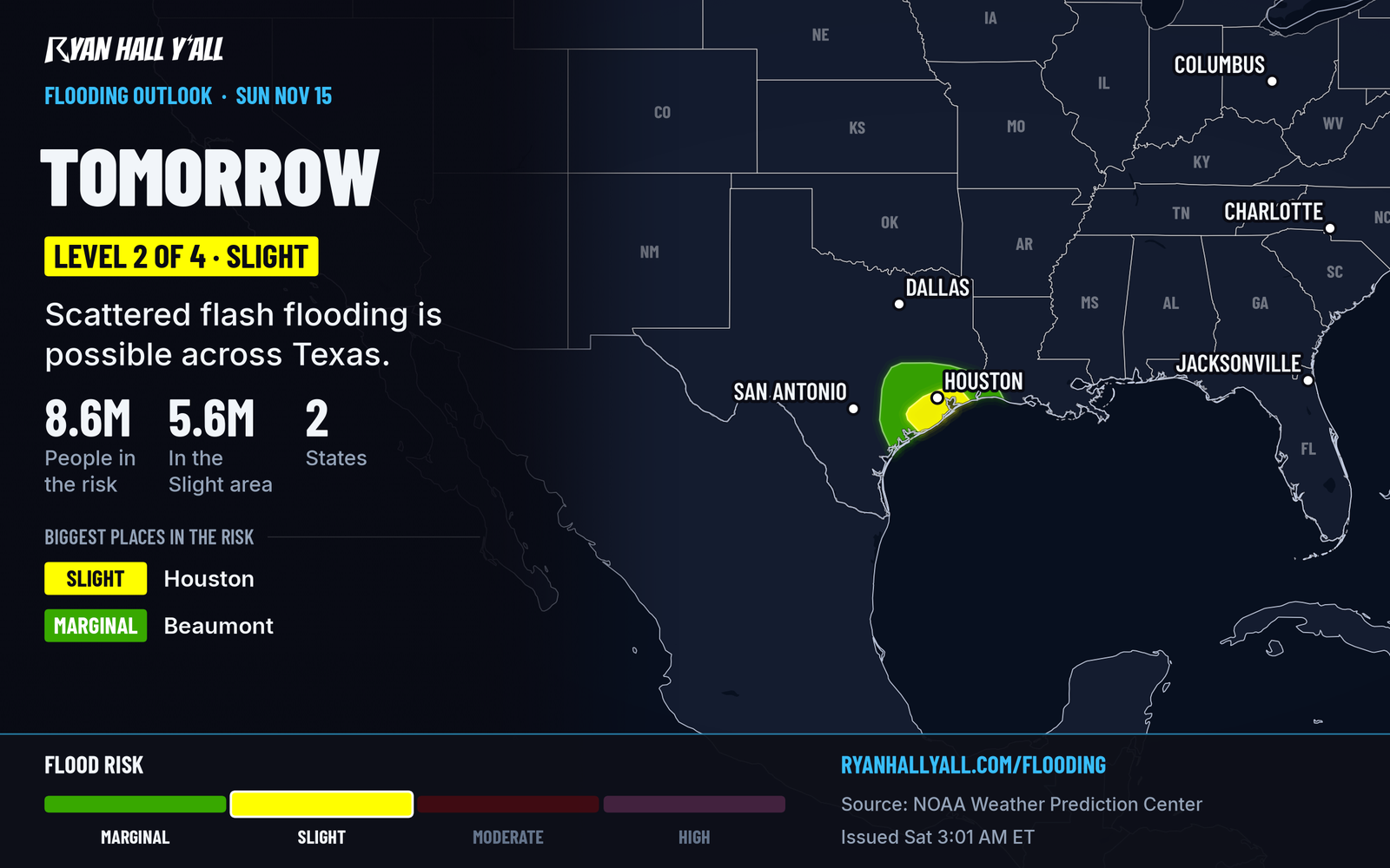
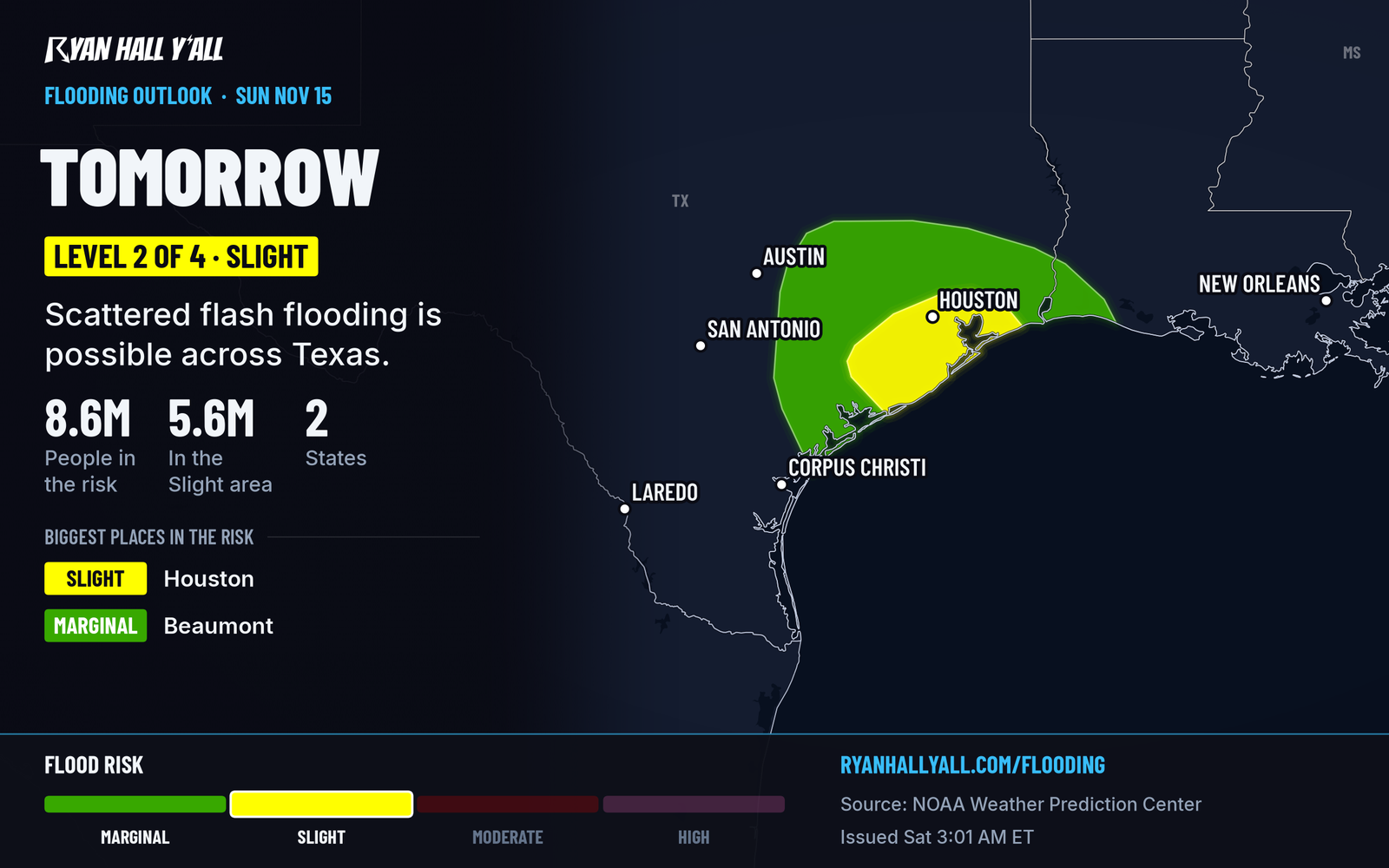
A disturbance moves in from the northwest early Sunday while winds off the Gulf carry moist air northward across the coast. The air is carrying about 1.5 inches of water vapor, roughly 1.5 to 2 standard deviations above normal for mid-November. That is plenty of fuel for storms that can drop rain fast.
Areas that received 1.5 to 4 inches of rain in the past week may be more vulnerable to additional heavy rain. Urbanized areas are also a particular concern.
Here is what we know and what we don't:
- Fairly sure: The ingredients for heavy rain are lining up along the coast.
- Still up in the air: The disturbance may push the heaviest totals offshore as the day goes on. There is also some doubt about how much storm fuel will be available, which is why parts of the area stay at Level 1.
A small severe storm chance, Level 1 of 5 (Marginal), also covers Texas on Sunday.
Saturday: storms arrive overnight across North Texas
Saturday has a Level 1 of 4 (Marginal) flash flood risk over Texas, and no severe storms are expected. Storms form overnight Saturday into Sunday morning and move from the eastern Texas Panhandle into north-central Texas. They have modest storm fuel but a lot of moisture, so some spots could see quick, heavy downpours.
Soils there are fairly dry, so much of that rain will help more than hurt. Level 1 risks also cover Oklahoma and northwest Washington, including the Olympic Peninsula, on Saturday.
What to do
- Don't drive into water over the road. It can be deeper and faster than it looks, and it can hide washed-out pavement.
- Leave extra time Sunday on coastal Texas roads, and know a way around underpasses and low spots.
- Move your car if you park where water collects in heavy rain.
- Check active warnings Sunday morning and again around midday.
- Sign up for Y'all Alerts so a warning reaches your phone if you're asleep or on the road.
Our flash flood outlook will show any changes to the risk area.
Bottom line
The upper and central Texas coast has a Level 2 of 4 flash flood risk from 6 AM Sunday to 6 AM Monday Central, with no risk outlined after 6 AM Monday. Turn around if you meet water over the road.
Explained: What the flash flood risk levels mean, from Level 1 to Level 4
More on Texas flooding, November 2026
Sources
- WPC Day 2 Excessive Rainfall Outlook, NOAA Weather Prediction Center, issued