Forecasts
Saturday night storms in north-central Texas; 1 to 3 inches of rain in Washington
By Ryan Hall, Y'all Weather Desk · Published
Written by our automated news desk from National Weather Service data.
What's new: New since this morning: a Level 1 flood risk for north-central Texas Saturday night, Level 1 severe and flood risks for the Texas coast Sunday, and flood advisories around the California Bay Area and Sacramento.

Key points
- North-central Texas, Saturday night (Central time): Storms with heavy downpours and a Level 1 of 4 flood risk. Rain rates can get high, so avoid flooded roads on the drive home.
- Texas coast, Sunday, Nov. 15: A Level 1 of 5 (Marginal) severe storm risk from Houston to Corpus Christi. Isolated strong storms are possible. Check the radar before outdoor plans.
- Olympic Peninsula and northwest Washington, Saturday: 1 to 3 inches of rain, locally more, with a Level 1 of 4 flood risk. Small streams can rise quickly.
- Lake Tahoe and the Sierra, through 10 AM PST Saturday: Near 12 inches of snow above 7,000 feet and up to 20 inches along the crest. Ridge gusts hit 70 to 90 mph.
- Southeast and Mid-Atlantic, Saturday night: Frost and freeze conditions in spots. Cover tender plants and bring pets in.
Storms and heavy rain move through north-central Texas Saturday night, Nov. 14, with a Level 1 of 4 (Marginal) flash flood risk over north-central Texas. Northwest Washington and the Olympic Peninsula get 1 to 3 inches of rain on Saturday, and the heavy snow around Lake Tahoe keeps going until 10 AM PST Saturday. Parts of the Southeast and Mid-Atlantic turn cold and clear, with frost and freeze conditions possible Saturday night.
Storms and heavy rain across north-central Texas Saturday night
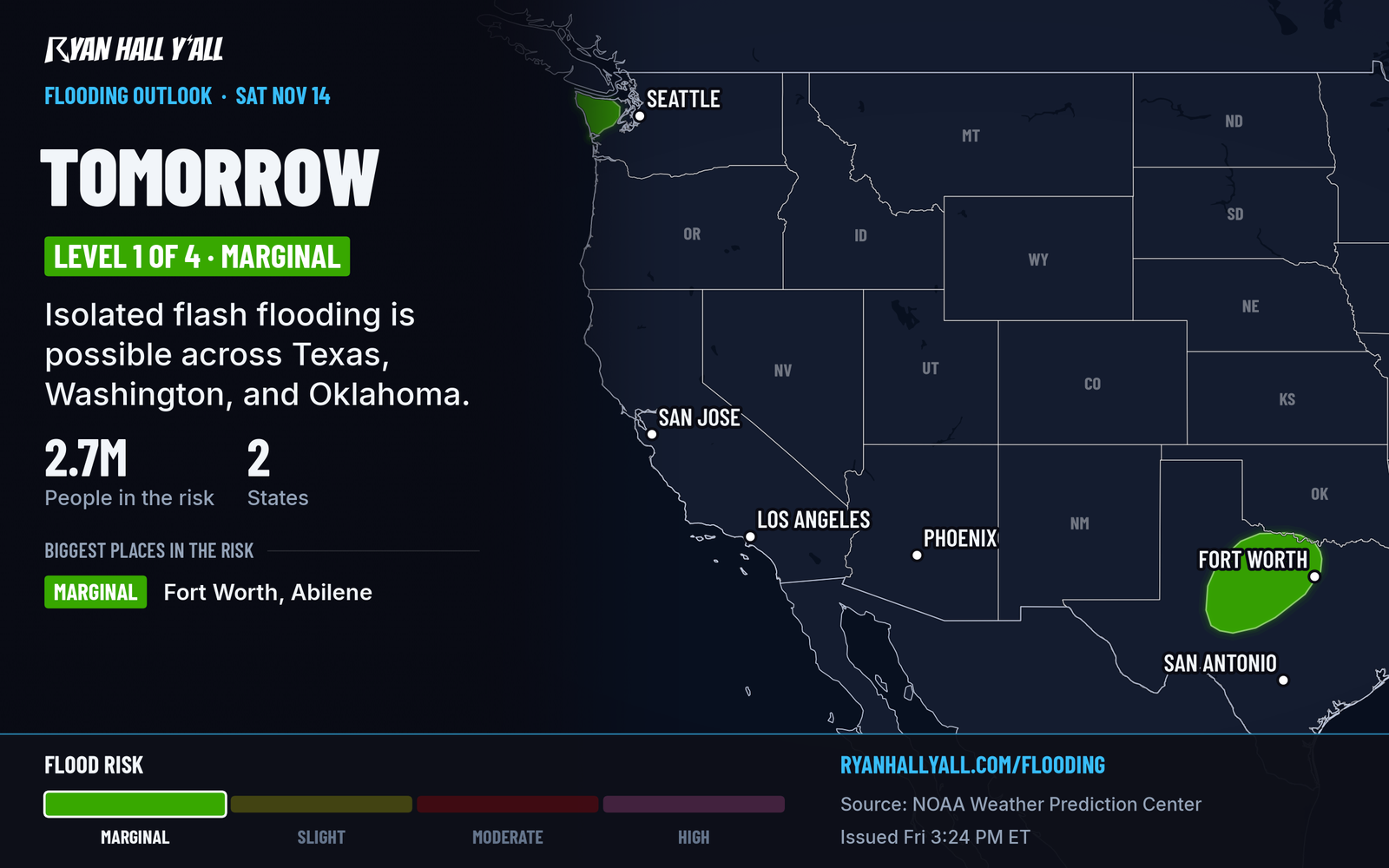
A disturbance crossing the Rockies links up with a southern disturbance tonight. A low-pressure center forms on Saturday, and storms then develop and move from the eastern Texas Panhandle through north-central Texas on Saturday night. The air will hold only modest storm fuel, but it carries enough moisture for efficient rain, meaning a lot of water in a short time. Soils are fairly dry, so some of this rain may help. The risk is isolated flash flooding where the heaviest rain falls, and we also have a Level 1 of 4 over parts of Oklahoma.
By early Sunday, leftover showers and storms sit over central Texas and southwest Oklahoma, and small hail is possible. Later Sunday, storms sink south toward the Gulf Coast.
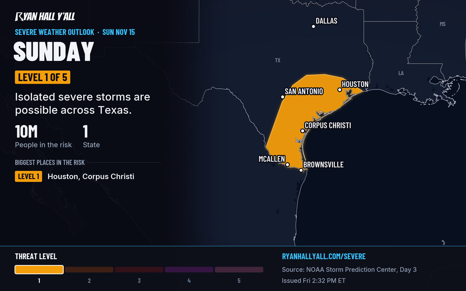
The Storm Prediction Center has a Level 1 of 5 (Marginal) risk up for the Texas coastal plain Sunday, including the Houston, Corpus Christi and Brownsville areas. That is a keep-an-eye-on-the-sky day, not a big one. A Level 1 of 4 flood risk also covers coastal Texas and Louisiana. The heaviest rain may stay just offshore, and that part is still uncertain. Check our severe outlook and flash flood outlook Saturday for updates.
Washington gets another soaking Saturday
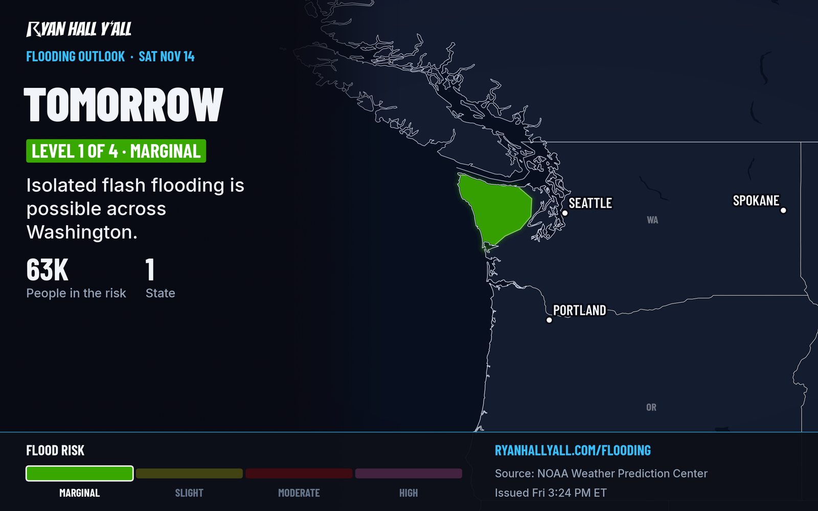
Another round of rain arrives Saturday across northwest Washington and the Olympic Peninsula. The heaviest falls in roughly a 12-hour stretch ahead of a cold front. Streams and drainage areas are already wet, so flooding on small creeks and rivers is possible, along with gusty coastal and mountain winds. If you drive near the Olympics, don't cross water over the road.
Breakers of 30 to 35 feet pound the Clatsop and Tillamook coast in Oregon until noon PST Saturday. Stay well back from the beaches and jetties.
Tahoe snow and California rain, then another round Sunday
Flood advisories were out this afternoon for parts of the Bay Area and the Sacramento Valley as the front moved through. Those end by the evening, and the rain eases overnight. A Winter Storm Warning stays up for the Greater Lake Tahoe area until 10 AM PST Saturday. If you must cross the Sierra tonight, carry chains and expect rapid changes on the road. Our desk story on Mt. Rose Highway has the details.
Another atmospheric river, a long plume of Pacific moisture, reaches the West Coast Sunday with more rain and mountain snow. Our winter outlook shows mountain snow continuing across the West through next week.
Cold and clear in the East, with frost Saturday night
Frost and freeze conditions are possible Saturday night across parts of the Southeast and Mid-Atlantic. Lake-effect snow is limited because the air is warming a little, but a Winter Weather Advisory continues for Grand Traverse County in Michigan, with 1 to 3 more inches until 7 AM EST Saturday. Higher elevations in the northern Adirondacks and Green Mountains could see more than 4 inches Saturday into Saturday night, and the highest Smokies could get accumulating snow tonight. Coastal flood advisories for the Delaware beaches run until 4 AM EST Saturday, with up to half a foot of water in low spots.
Saturday's nicest weather is in the Carolinas, south-central Virginia and the desert Southwest.
Flights tonight
A nationwide FAA ground stop was issued Friday evening. Check your flight before leaving for the airport. Our desk story has the latest on the ground stop.
Bottom line
The storms in north-central Texas are the main change, with the heaviest rain Saturday night and a Level 1 flood risk. Washington's rain is the better-locked part of the forecast. Texas storm placement can still shift a bit.
More on South Texas flooding, November 2026
Places in this story: Houston, TX; Corpus Christi, TX
Sources
- SPC Day 3 Convective Outlook, NOAA Storm Prediction Center, issued
- WPC Day 2 Excessive Rainfall Outlook, NOAA Weather Prediction Center, issued