Recaps
Florida storms and tornado warnings, Puerto Rico floods, Saturday, Nov. 21
By Ryan Hall, Y'all Weather Desk · Published
Written by our automated news desk from National Weather Service data.
Key points
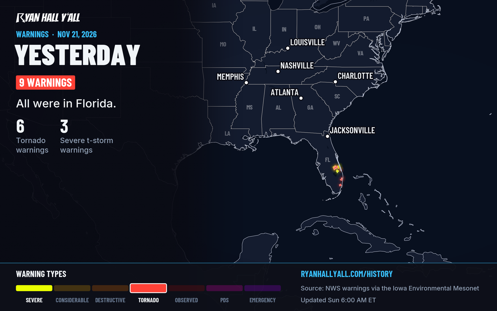
- Tornado Watch 706 covered east-central and southeast Florida, and multiple tornado warnings were issued for radar-indicated rotation. A warning means rotation showed up on radar. It does not mean a tornado touched down.
- Wind damage was reported in Boca Raton and western Delray Beach around 6 PM Eastern, mostly downed branches, palm fronds and a dead traffic light. One homeowner reported damage to a house.
- A weather station southwest of Trenton, Florida, measured 9.68 inches of rain. Deep Creek at Spuds reached 4.24 feet, and the St. Johns River above Lake Harney hit 12.5 feet, both at major flood levels.
- Puerto Rico had flash flooding after 2 to 4 inches of rain, with roads closed and vehicles stranded.
- Savannah/Hilton Head International Airport in Georgia set a daily rainfall record of 2.04 inches.
Tornado-warned storms crossed east-central and southeast Florida on Saturday, Nov. 21, under Tornado Watch 706, and left wind damage in Boca Raton and Delray Beach. No tornado touchdown is confirmed in the reports we have; separately, a station southwest of Trenton measured 9.68 inches of rain, major flooding was observed along the St. Johns River, and 2 to 4 inches of rain led to flash flooding that trapped drivers in western Puerto Rico.
How the day unfolded
Our count for the day shows 6 tornado warnings and 3 severe thunderstorm warnings issued nationwide. Those are warnings, not tornadoes. Heavy rain soaked Florida, including the 9.68-inch total southwest of Trenton. Major flood levels were observed in the St. Johns basin.
In Puerto Rico, the trouble started around midday. Local time, a stranded-vehicle flood report came in from the Puerto Nuevo area of San Juan around 1:15 PM. Near Juncal, around 1:45 PM, emergency crews rescued two adults and a child from a vehicle stuck in floodwater on PR-119. Creeks overflowed in Moca and San Sebastian during the afternoon. Radar estimates put the rain at 2 to 4 inches around Moca, and a Flash Flood Warning covered Aguada, Aguadilla and Moca. The 911 center reported vehicles trapped by sudden surges of water.
By evening the rivers were the problem. The Rio Blanco reached minor flood stage at 8.51 feet around 6:30 PM, and PR-31 and PR-973 were closed. The Rio Culebrinas hit minor flood stage at 16.66 feet around 6:45 PM, and PR-110 was closed. Flood advisories were upgraded to Flood Warnings for the nearby municipalities. Downed trees and power lines also blocked roads in Moca and near Luyando in western Puerto Rico, and near Daguao in eastern Puerto Rico.
Back in Florida, a trained observer reported a waterspout east of Miami Beach around 11:20 AM Eastern. The tornado-warned storms followed later. Wind damage came in from Boca Raton and Delray Beach around 6:20 PM. By late evening the storms were moving offshore into the Atlantic.
Farther west, snow fell across the Northern and Central Rockies. Shower Falls SNOTEL in Montana picked up 11.0 inches, and a site near Victor, Idaho, measured 6.1 inches.
What we forecast vs. what happened
Yesterday morning's briefing called for heavy rain along the coast from Savannah, Georgia, to Wilmington, North Carolina, under a Level 2 of 4 (Slight) flash flood risk. Savannah backed that up with its record 2.04 inches, beating the old mark of 1.93 inches from 2005.
The briefing did not lead with the Florida storms, the Puerto Rico flooding or the Rockies snow, and those became the bigger impact stories. It also mentioned isolated storms in Kansas and Oklahoma. So the coastal rain call held up in Savannah, and the tornado-warned storms in Florida were a miss in our headline.
What's next
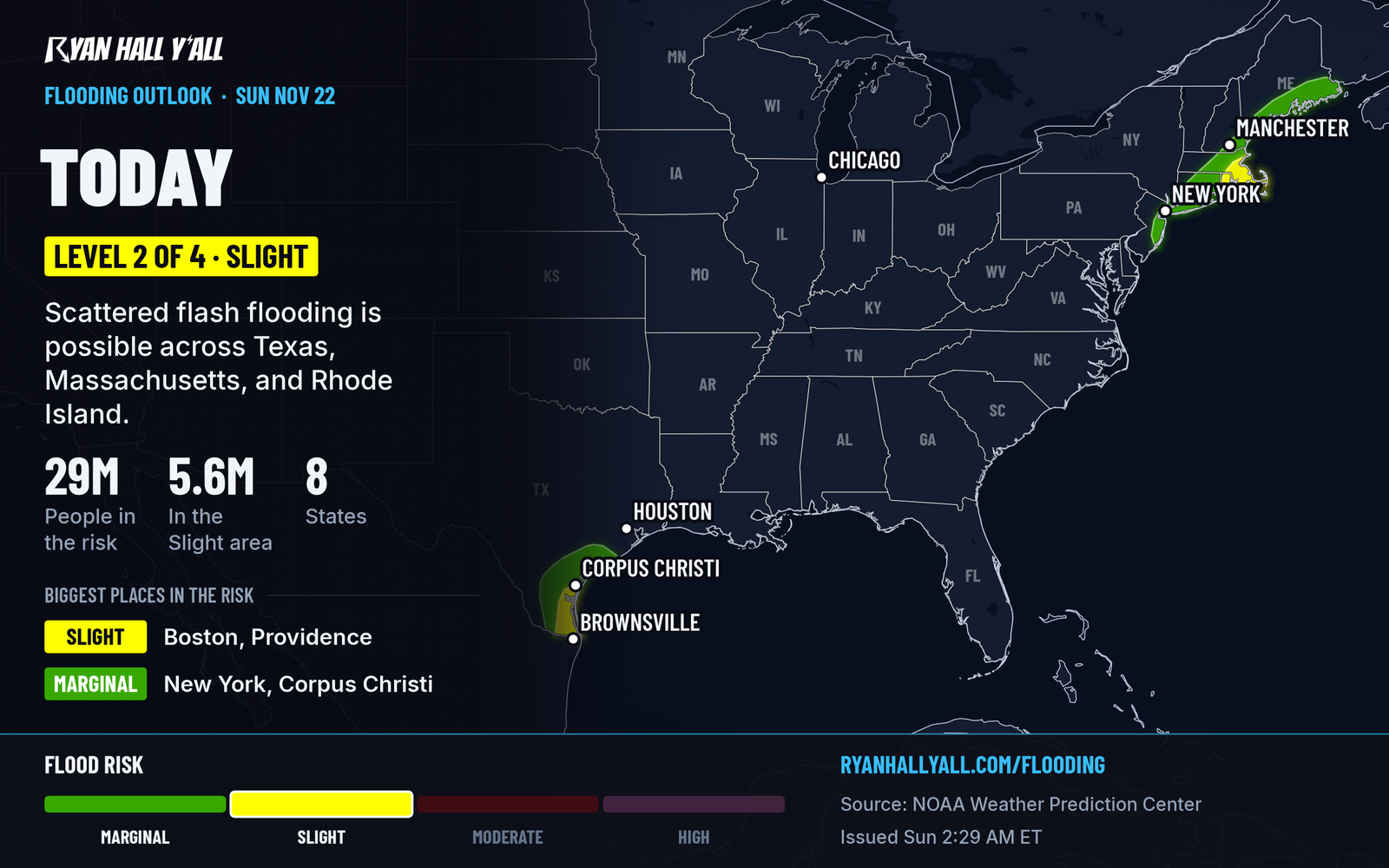
Today, Sunday, Nov. 22, the Storm Prediction Center has a Level 1 of 5 (Marginal) severe risk across Texas. Flash flooding is the bigger concern, with a Level 2 of 4 risk over Texas and over Massachusetts and Rhode Island. Our flash flood outlook has the maps. Our Monday winter weather outlook shows a Marginal risk across the upper Great Lakes, Pacific Northwest, and central and southern Rockies. Check live warnings if you are in any of those areas, and sign up for Y'all Alerts if you want a text when something changes.
Bottom line
Florida had tornado-warned storms and wind damage on Saturday but no confirmed tornado in the data we have. The heavier, more widespread impacts were river flooding in Florida and flash flooding in Puerto Rico. See live storm reports for updates as surveys and new reports come in.
More on Florida severe weather, November 2026
Places in this story: Savannah, GA; Trenton, FL
Sources
- WPC Day 1 Excessive Rainfall Outlook, NOAA Weather Prediction Center, issued