Winter weather
Up to 4 feet of snow around Lake Tahoe and 1 to 2 inches of LA rain Thursday
By Ryan Hall, Y'all Weather Desk · Published
Written by our automated news desk from National Weather Service data.
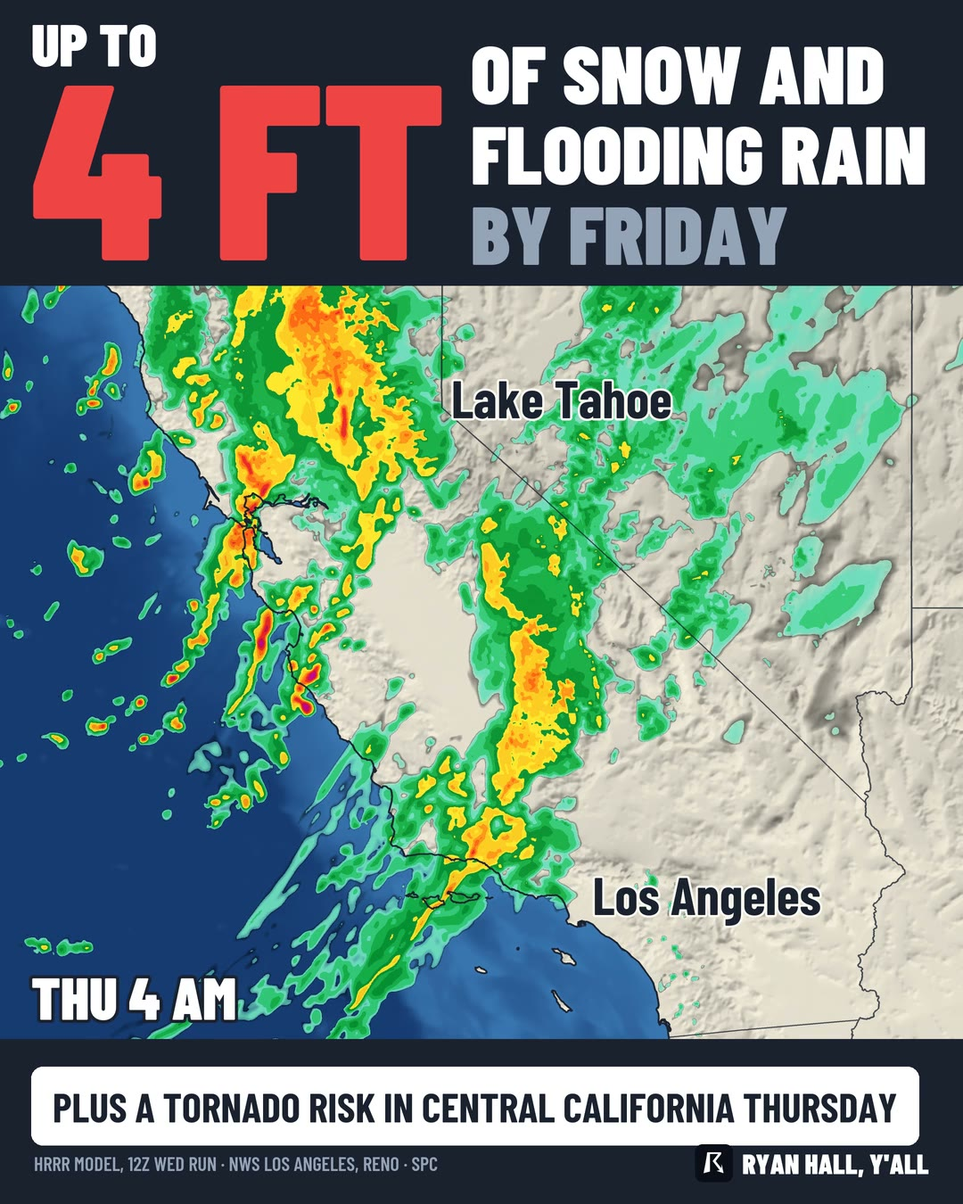
Key points
- Los Angeles County: A flood watch runs Thursday morning into the afternoon. Rain can fall at up to 1 inch per hour.
- Sierra Nevada and Lake Tahoe: A Winter Storm Warning runs until 4 AM PST Friday. Expect 2 to 4 feet above 7,000 feet and 1 to 2 feet at lake level.
- San Joaquin Valley: The Storm Prediction Center has a Level 1 of 5 (Marginal Risk) for Thursday afternoon. That means a brief tornado or two and isolated damaging gusts are possible.
- What it means: Plan on slow, wet drives in Los Angeles County and a mountain crossing that may not be possible at times.
California gets the whole storm on Thursday, Nov. 19, with flooding rain in Los Angeles County, heavy snow in the Sierra Nevada and a small chance of a brief tornado in the San Joaquin Valley. Los Angeles County coasts and valleys pick up 1 to 2 inches of rain, locally 3, while the Sierra gets 2 to 4 feet of snow above 7,000 feet through 4 AM PST Friday. The rain in Los Angeles is heaviest mid-morning, and the tornado risk is mostly an afternoon concern.
Los Angeles gets flooding rain Thursday morning
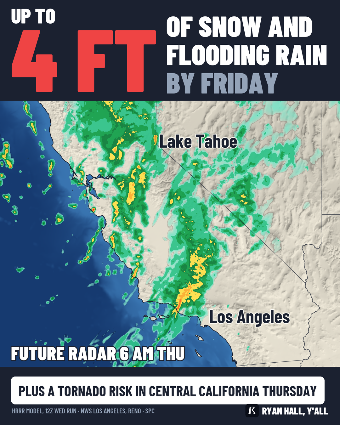
Rain moves into Los Angeles County Thursday, and the heaviest comes mid-morning. Coastal areas and valleys should see 1 to 2 inches, with some spots reaching 3. The foothills and coastal slopes catch more, around 3 to 5 inches.
Rain rates can reach 1 inch per hour.
Sierra snow: 2 to 4 feet, with winds to match
The mountain snow is already underway Wednesday and keeps going through Thursday. Above 7,000 feet around Lake Tahoe, the warning calls for 2 to 4 feet. Lake level gets 1 to 2 feet. Farther west on the northern Sierra, Interstate 80 and US-50 passes should see 18 inches or more, and the highest peaks can reach 5 feet.
The heaviest snowfall comes Thursday from about 10 AM to 7 PM PST, at 1 to 3 inches per hour. Winds gust 30 to 40 mph in Truckee and the Tahoe communities, and ridgetops can gust to 100 mph. That combination means whiteout conditions on the passes. Snow levels fall toward 3,500 feet behind the cold front. Reno, Carson City and Minden can see at least an inch of slushy snow on the valley floors, which affects both the morning and evening commutes.
A low-end tornado chance in the San Joaquin Valley
The storm's cold front can spin up a brief tornado or two and isolated damaging gusts in the San Joaquin Valley on Thursday afternoon. This is a Level 1 of 5 day, the lowest rung on the scale. Most of the valley will not see anything like it, but a storm that does turn can cause trouble in a hurry. Keep an eye on active warnings and the severe outlook Thursday afternoon.
Snow spreads east Thursday
Snow moves into Nevada, Utah and Idaho Thursday afternoon and night. Northern Utah mountains can pick up 6 to 12 inches, and the upper Cottonwoods locally up to 24. Our snow forecasts have the totals by area.
What to do
- Los Angeles area: Leave extra time Thursday morning and never drive into water over the road. If you live below a slope or in a flood-prone spot, check on it before the rain starts.
- Sierra travelers: If you can move your trip off Thursday, do. If you can't, carry chains, food, water and a full tank, and expect dangerous to impossible travel on I-80 and US-50.
- San Joaquin Valley: Know where you would shelter Thursday afternoon, and heed any warning at once.
- All of California: Sign up for free Y'all Alerts so warnings reach your phone.
Bottom line
Thursday brings flooding rain to Los Angeles, a heavy, wind-driven snowstorm to the Sierra and a small tornado chance to the San Joaquin Valley. The tornado piece is the low-odds part.
More on West winter weather, November 2026
Places in this story: Los Angeles, CA
Sources
- SPC Day 2 Convective Outlook, NOAA Storm Prediction Center