Severe weather
Isolated Severe Storms Possible Thursday Afternoon From Philadelphia to New York City
By Ryan Hall, Y'all Weather Desk · Published
Written by our automated news desk from National Weather Service data.

Key points
- Timing: Storms should fire up Thursday afternoon, Eastern time, as a cold front sweeps across the Mid-Atlantic. Behind the front, calmer and more stable air moves in.
- What could happen: A strong storm could bring gusts of 60 mph or more and quarter-sized hail. No tornado risk is outlined.
- Why it stays low-end: The air is cool, around 60 degrees at the surface, so there isn't much storm fuel. Winds higher up are strong, though, which is why a stray storm can still get gusty.
- What to do: Most folks just need to keep an eye on the sky. Move the patio furniture and cars if you're near a stronger cell, and sign up for Y'all Alerts so a warning reaches your phone.
A few thunderstorms on Thursday afternoon, Nov. 12, could turn severe from Philadelphia through New Jersey to New York City, with gusts up to 60 mph and quarter-sized hail possible. It's a Level 1 of 5 (Marginal Risk), the lowest step on the scale, so only one or two storms may turn severe.
What to know
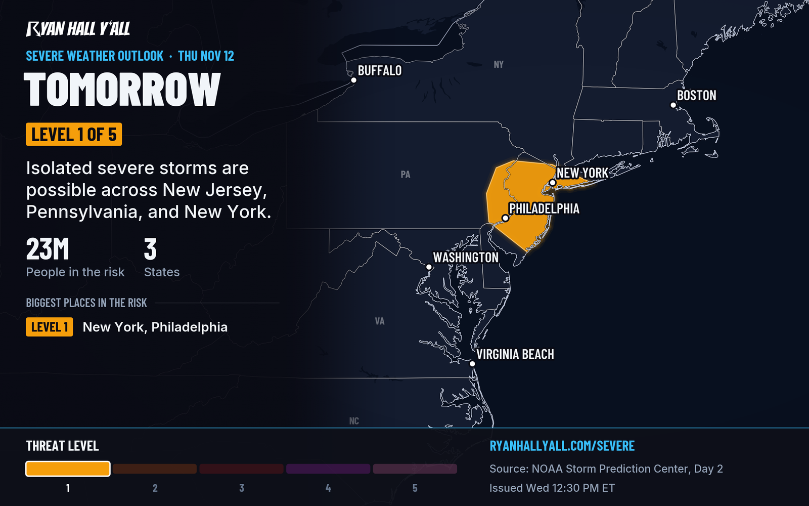
- Timing: Storms should fire up Thursday afternoon, Eastern time, as a cold front sweeps across the Mid-Atlantic. Behind the front, calmer and more stable air moves in.
- What could happen: A strong storm could bring gusts of 60 mph or more and quarter-sized hail. No tornado risk is outlined.
- Why it stays low-end: The air is cool, around 60 degrees at the surface, so there isn't much storm fuel. Winds higher up are strong, though, which is why a stray storm can still get gusty.
- What to do: Most folks just need to keep an eye on the sky. Move the patio furniture and cars if you're near a stronger cell, and sign up for Y'all Alerts so a warning reaches your phone.
A front and scattered storms are expected, but only one or two may turn severe.
Track the latest outlooks on our severe storm page.
Explained: What the severe storm risk levels mean, Level 1 to Level 5
More on Mid-Atlantic severe weather, November 2026
Places in this story: Philadelphia, PA; New York City, NY; Newark, NJ; Newark, NY
Sources
- SPC Day 2 Convective Outlook, NOAA Storm Prediction Center, issued