Recaps
Tornado, hail and flash floods hit Delaware, New Jersey Thursday, Nov. 12
By Ryan Hall, Y'all Weather Desk · Published
Written by our automated news desk from National Weather Service data.
What's new: Adds an expanded tally of hail, wind damage and flooding reports to our earlier Delaware tornado post.

Key points
- A tornado touched down near Christiana Hospital in Delaware, based on radar analysis and video. Spotters reported damage there, including a helicopter that lost a rotor.
- A radar-confirmed tornado tracked over Crosswicks, New Jersey. A fire department reported a barn and garage collapse in nearby Chesterfield.
- Hail reached 1.75 inches in Ocean County, NJ, and 1.50 inches in both New Castle County, DE, and Burlington County, NJ.
- Flash flooding led to water rescues in Delaware County, Pennsylvania, and closed roads in Monmouth County, New Jersey.
- Warnings issued Thursday totaled 4 tornado warnings and 14 severe thunderstorm warnings. That counts warnings, not tornadoes that touched down.
A tornado touched down near Christiana Hospital, west of Wilmington, Delaware, around 1:15 PM ET Thursday, Nov. 12. The storms that followed dropped hail up to 1.75 inches (golf ball size) in Ocean County, New Jersey, put a radar-confirmed tornado over Crosswicks, New Jersey, and flooded roads from the Philadelphia suburbs to the Jersey Shore. Early reports show wind damage and water rescues, but our data has no confirmed injury counts.
How the day unfolded
The day started with localized frontal convection in the Ohio Valley before the focus shifted to the Mid-Atlantic.
The trouble began in the Mid-Atlantic around midday. Flooding closed all lanes of NJ 35 northbound in Middletown Township, New Jersey, near 12:25 PM ET. Just after 1 PM, trained spotters reported trees and wires down and minor house damage in the Woodshade area of Delaware. They also reported damage around Christiana Hospital, where a tornado touched down about 1:15 PM.
By early afternoon the focus turned to water. Around 2:30 PM, emergency managers reported a water rescue on Concord Road in Chester Township, Pennsylvania. Rescues followed on Commerce Drive in Aston. About 2:45 PM, flooding closed lanes on I-95 near Trainer, Pennsylvania. Around 3:35 PM, spotters said Haines Street in Tullytown was impassable. NJ DOT and other agencies also reported lane closures on I-76 and I-476 in Pennsylvania and on I-678 in Queens, New York.
Around 4 PM the storms reached central New Jersey. A tornado tracked over Crosswicks. Emergency managers reported wires down along Old York Road in Chesterfield and White Pine Road in Mansfield Township. A trained spotter sent pictures of trees uprooted or snapped near Chesterfield. The fire department reported the collapsed barn and garage, and they called it a probable tornado. A damage survey can determine the tornado's path and rating, and we have no survey results to share yet.
The flooding moved to the Jersey Shore into the evening. Hance Avenue in Tinton Falls flooded in multiple spots about 6:15 PM. Around 6:30 PM, NJ DOT closed all lanes of NJ 35 in both directions at NJ 71 in Belmar. NJ 36 and NJ 71 in Monmouth County also had closures.
Farther north and inland, the same system turned to snow. Higher elevations of Otsego County, New York, measured 6 to 10 inches, and a Winter Storm Warning was issued. In the Florida Keys, a member of the public reported a pair of brief waterspouts near Big Pine Key around 2:30 PM EST.
Elsewhere, Tropical Depression Pena fell apart into an open trough over the central Pacific. A magnitude 4.5 earthquake was recorded off the Oregon coast.
What we forecast vs. what happened
We have no morning briefing on file for Thursday, so we can't grade a forecast against what happened. We can say it was a late-season event for this part of the country, with a Tornado Watch (705) and several tornado-warned storms. We covered the Delaware tornado in a post Thursday evening. What has changed since then is the expanded list of reports: hail, wind damage in New Jersey and the extent of the flooding.
What's next
Friday, Nov. 13, has no severe storms or flash flood risk outlined. Our winter outlook has a Marginal risk of winter weather impacts across parts of the Northeast, northern Mid-Atlantic and upper Great Lakes. Saturday, Nov. 14, brings Level 1 of 4 (Marginal) flash flood risk to Washington's Olympic Peninsula.
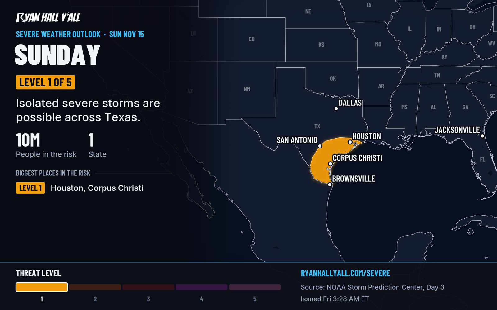
Sunday, Nov. 15, is the next day with a severe risk: Level 1 of 5 (Marginal) across Texas. Texas and Louisiana also have a Level 1 of 4 flood risk that day. Check the severe outlook and flash flood outlook for updates, and see live storm reports for anything new.
Bottom line
Thursday's storms brought a tornado near Wilmington, hail up to 1.75 inches in New Jersey and flash flooding across Pennsylvania and New Jersey. The Mid-Atlantic is quiet for severe weather Friday and Saturday. If your road was flooded or your property was damaged, expect more detail as additional information becomes available.
| Value | Note | |
|---|---|---|
| Ocean County, NJ | 1.75 inches | Golf ball size |
| New Castle County, DE | 1.5 inches | |
| Burlington County, NJ | 1.5 inches |
More on Mid-Atlantic severe weather, November 2026
Places in this story: Ocean County, NJ; New Castle County, DE; Burlington County, NJ; Wilmington, DE
Sources
- SPC Day 3 Convective Outlook, NOAA Storm Prediction Center, issued